MyTopo
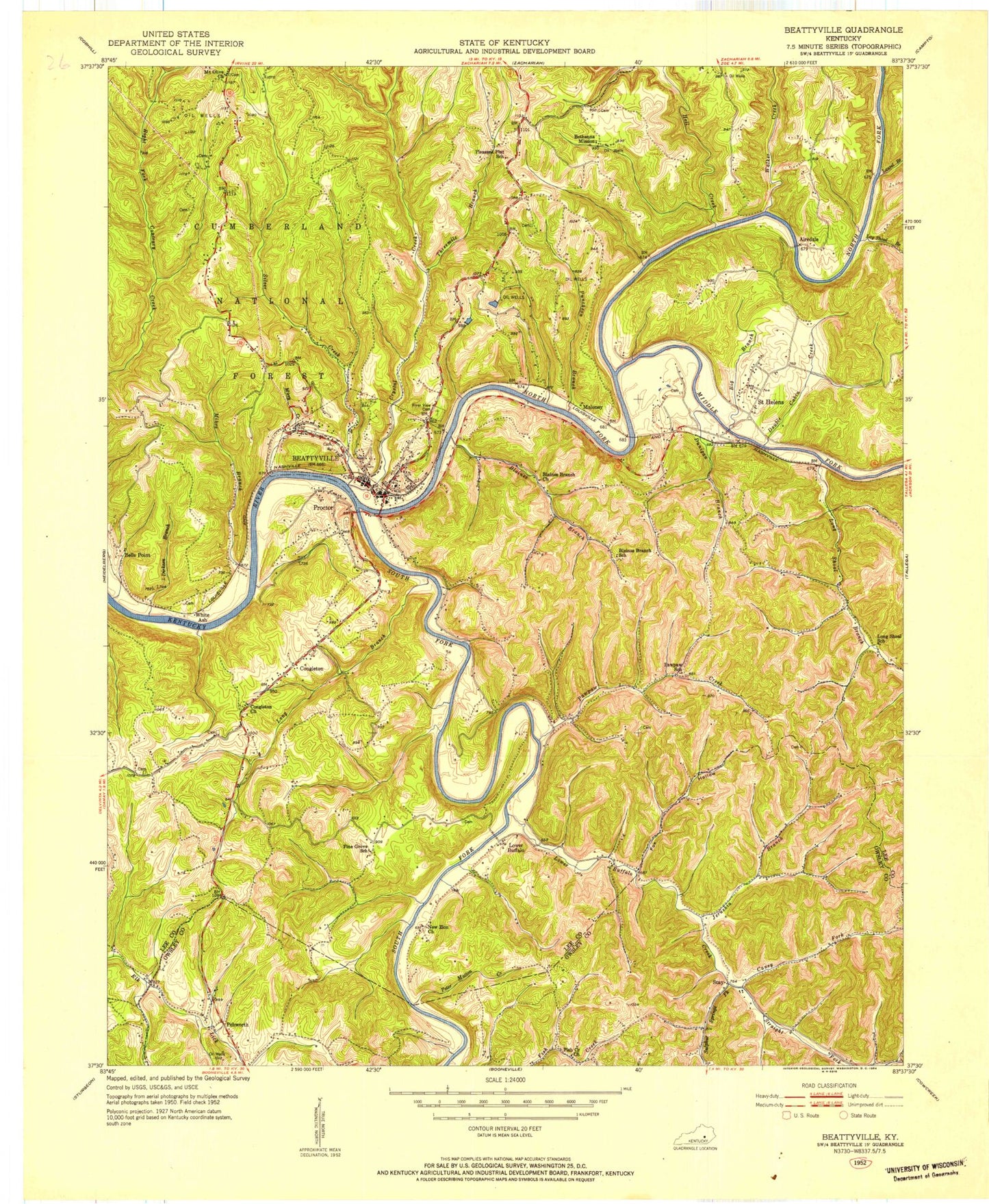
Classic USGS Beattyville Kentucky 7.5'x7.5' Topo Map
Couldn't load pickup availability
Historical USGS topographic quad map of Beattyville in the state of Kentucky. Typical map scale is 1:24,000, but may vary for certain years, if available. Print size: 24" x 27"
This quadrangle is in the following counties: Lee, Owsley.
The map contains contour lines, roads, rivers, towns, and lakes. Printed on high-quality waterproof paper with UV fade-resistant inks, and shipped rolled.
Contains the following named places: Airedale, Beattyville, Belle Point, Big Branch, Blaines Branch, Blaines Branch Church, Caney Fork, Congleton, Congleton Church, Crystal Creek, Dirksen Branch, Double Cabin Creek, Dunigan Branch, Enoch, Fish Creek Church, Fox Hollow, Hell Creek, Jerushia Branch, Laurel Branch, Log Shoal Branch, Long Branch, Long Shoal Branch, Lower Buffalo, Lower Buffalo Creek, Maloney, Matton Creek, Middle Fork Kentucky River, Mikes Branch, Mirey Creek, Mount Olive, Mount Olive Christian Church, New Zion Church, North Fork Kentucky River, Pawpaw Creek, Pebworth, Pleasant Flat School, Proctor, Puncheon Branch, Riverview Cemetery, Saint Helens, Silver Creek, South Fork Kentucky River, South Side Elementary School, Stay, Straight Fork, Sulphur Springs Fork, Threemile Branch, Walker Creek, White Ash, Lee County, WLJC-FM (Beattyville), WLJC-TV (Beattyville), Mulberry Hollow Valley, City of Beattyville, Stacey Neighborhood (historical), Hawk Post Office (historical), Stacey Post Office (historical), Fish Creek Neighborhood (historical), Pebworth Post Office, Lee County Board of Education, Beattyville and Lee County Fire Department, Lee County Ambulance Service, Beattyville Police Department, Lee County Sheriff's Office, Beattyville Post Office, Saint Helens Post Office