MyTopo
Classic USGS Beatys Butte Oregon 7.5'x7.5' Topo Map
Regular price
$16.95
Regular price
Sale price
$16.95
Unit price
per
Couldn't load pickup availability
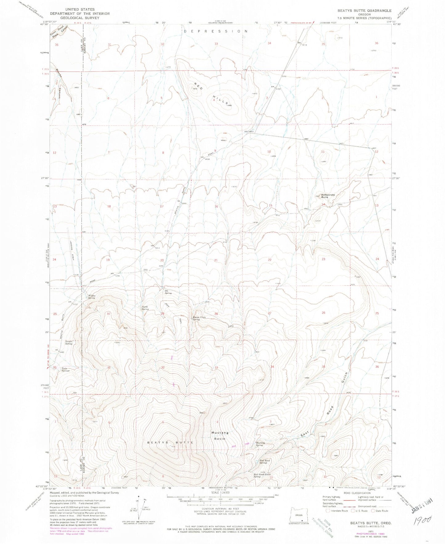
Historical USGS topographic quad map of Beatys Butte in the state of Oregon. Map scale may vary for some years, but is generally around 1:24,000. Print size is approximately 24" x 27"
This quadrangle is in the following counties: Harney, Lake.
The map contains contour lines, roads, rivers, towns, and lakes. Printed on high-quality waterproof paper with UV fade-resistant inks, and shipped rolled.
Contains the following named places: Beatys Butte, BLM Field Camp, Buena Vista Spring, D L Spring, East Road Gulch, East Road Gulch Spring, East Road Springs, Mustang Basin, Mustang Spring, North Spring, Rattlesnake Butte, Red Hills, Sunset Spring, Twin Springs, Willow Spring