MyTopo
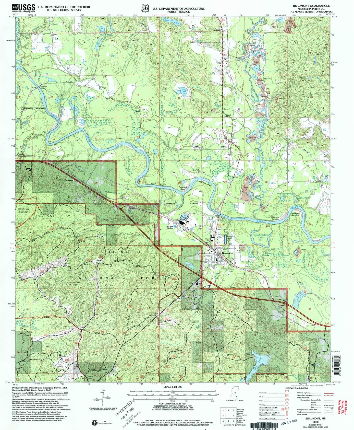
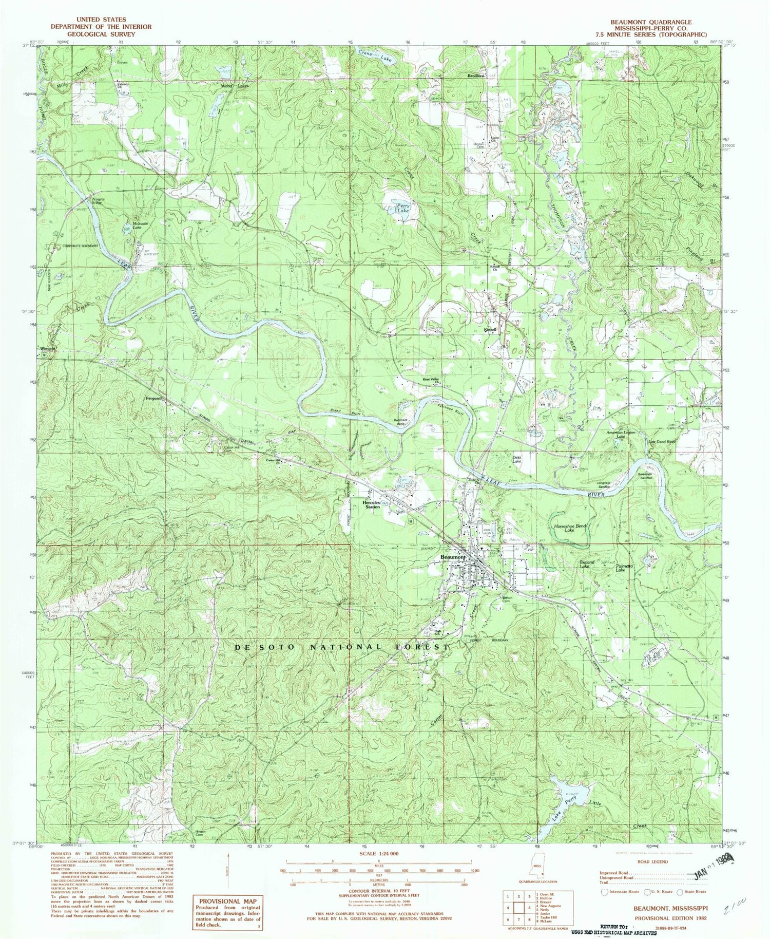
Classic USGS Beaumont Mississippi 7.5'x7.5' Topo Map
Couldn't load pickup availability
Historical USGS topographic quad map of Beaumont in the state of Mississippi. Map scale may vary for some years, but is generally around 1:24,000. Print size is approximately 24" x 27"
This quadrangle is in the following counties: Perry.
The map contains contour lines, roads, rivers, towns, and lakes. Printed on high-quality waterproof paper with UV fade-resistant inks, and shipped rolled.
Contains the following named places: American Legion Lake, Beaumont, Beaumont Church of God, Beaumont Elementary School, Beaumont Fire Tower, Beaumont High School, Beaumont Police Department, Beaumont Post Office, Beaumont Town Fire Department, Beaumont Volunteer Fire Department, Belton Cemetery, Benmore, Bland Bluff, Bogue Homo, Bolton Chapel United Methodist Church, Breakover Sandbar, Breland Lake, Calvary Church, Carter Creek, Carter Hill Cemetery, Carter Hill Church, Coleman Creek, Crane Creek, Crane Lake, Crane Lake Dam, Deitz Lake, Fairhope Bluff, Ferguson, First Baptist Church, Gum Dip Creek, Hercules Station, Hinton Cemetery, Horseshoe Bend Lake, Inland Lakes, Kittrell, Kittrell Church, Lake Perry, Lake Perry Dam, Leaf River Boat Ramp, Longfield Sandbar, Lott Cemetery, Lott Dead River, McSwain Lake, Mill Creek, Moffett Lake, Palmetto Lake, Perry County, Perry Lake, Perry Lake Dam, Racetrack Bend, Reeds Bluff, River Valley Church, Thompson Creek, Thompson Creek Church, Town of Beaumont, Tucker Bay School, Union Church, US Highway 98 Roadside Park, Wingate Bridge, ZIP Code: 39423