MyTopo
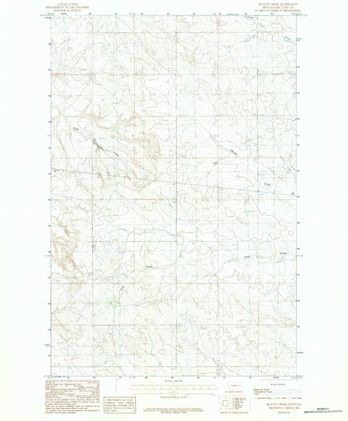
Classic USGS Beauty Creek Montana 7.5'x7.5' Topo Map
Couldn't load pickup availability
Historical USGS topographic quad map of Beauty Creek in the state of Montana. Map scale may vary for some years, but is generally around 1:24,000. Print size is approximately 24" x 27"
This quadrangle is in the following counties: McCone.
The map contains contour lines, roads, rivers, towns, and lakes. Printed on high-quality waterproof paper with UV fade-resistant inks, and shipped rolled.
Contains the following named places: 17N45E01DCAA01 Well, 17N45E04BDBB01 Well, 18N45E10CCBB01 Well, 18N45E10CCBB02 Well, 18N45E24CDDC01 Well, 18N45E25BAAC01 Well, 18N45E27DADD01 Well, 18N45E34ACCD01 Well, 18N45E34DBBB01 Well, 18N45E34DBBB02 Well, 18N46E08CBBC01 Well, 18N46E17ADBB01 Well, 18N46E18ADCA01 Well, 18N46E18ADCA02 Well, 18N46E19ABBC01 Well, 18N46E30ADAC01 Well, 19N45E35DBCA01 Well, 19N46E32CCCD01 Well, 19N46E32DCDD01 Well