MyTopo
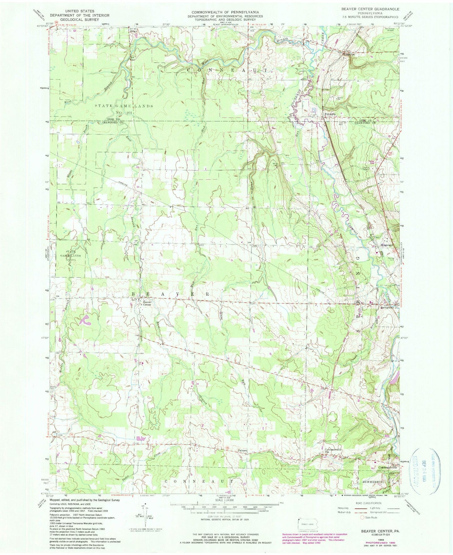
Classic USGS Beaver Center Pennsylvania 7.5'x7.5' Topo Map
Couldn't load pickup availability
Historical USGS topographic quad map of Beaver Center in the state of Pennsylvania. Map scale may vary for some years, but is generally around 1:24,000. Print size is approximately 24" x 27"
This quadrangle is in the following counties: Crawford, Erie.
The map contains contour lines, roads, rivers, towns, and lakes. Printed on high-quality waterproof paper with UV fade-resistant inks, and shipped rolled.
Contains the following named places: Beaver Center, Beaver Center Cemetery, Brooks Cemetery, Conneautville Station, Crazy Run, East Branch Conneaut Creek, Keepville, Keepville Cemetery, Keepville Wesleyan Methodist Church, Marther Field, Middle Branch Conneaut Creek, Misty Hollow Farm, Mud Run, Palmer, Pennside, Pontius Airport, Rausch Farm, Saint Peters Cemetery, Saint Sava Cemetery, Seldom Home Farm, Shadeland, Shadeland Station, Spring Cemetery, Springboro Station, State Game Lands Number 101, Stone Run, Township of Beaver, Tracy, West Branch Conneaut Creek, White Cemetery, Wing, ZIP Code: 16435