
MyTopo
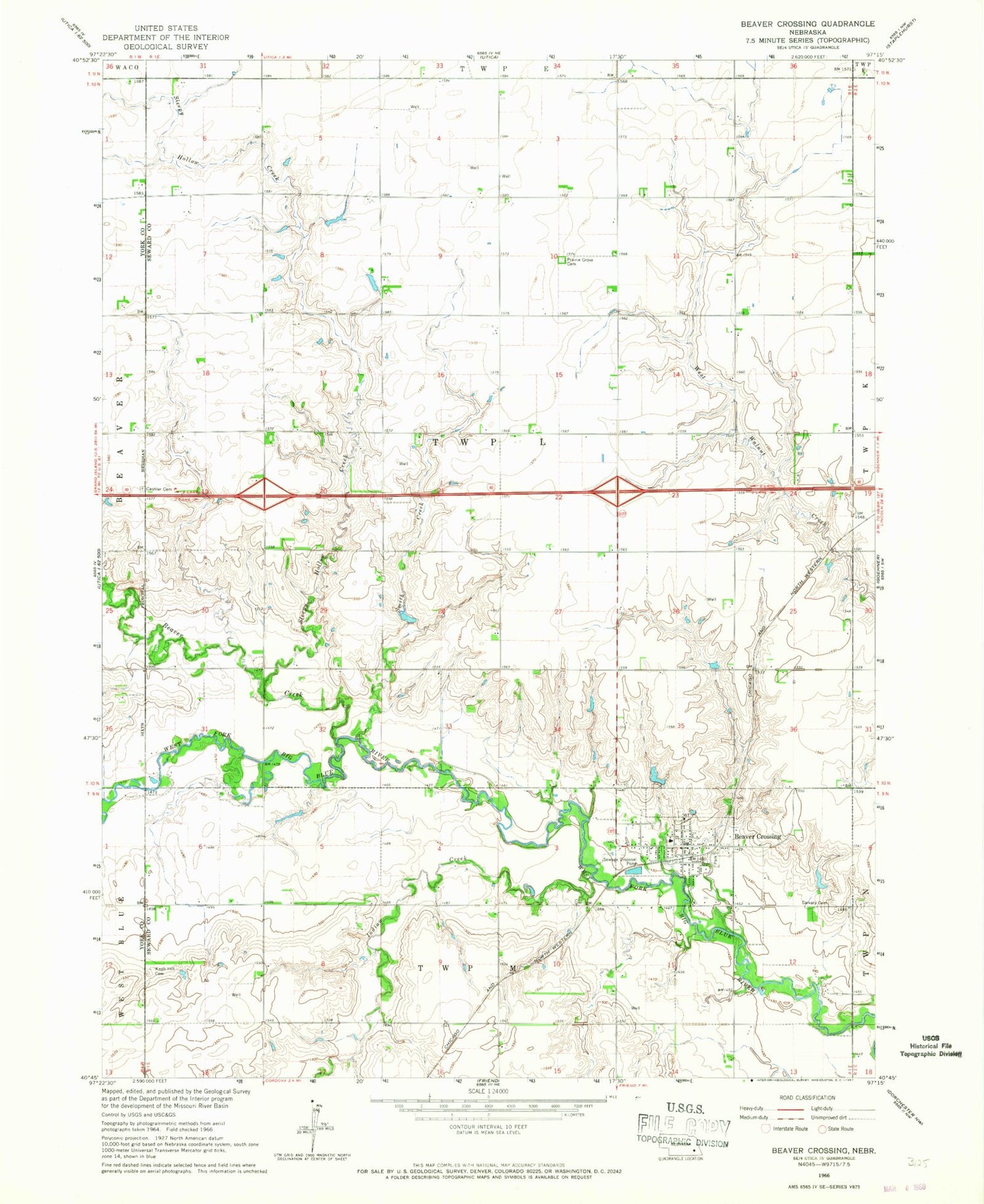
Classic USGS Beaver Crossing Nebraska 7.5'x7.5' Topo Map
Couldn't load pickup availability
Historical USGS topographic quad map of Beaver Crossing in the state of Nebraska. Map scale may vary for some years, but is generally around 1:24,000. Print size is approximately 24" x 27"
This quadrangle is in the following counties: Seward, York.
The map contains contour lines, roads, rivers, towns, and lakes. Printed on high-quality waterproof paper with UV fade-resistant inks, and shipped rolled.
Contains the following named places: Beaver Creek, Beaver Crossing, Beaver Crossing City Park, Beaver Crossing City Park Campground, Beaver Crossing Community Library, Beaver Crossing Mill Historical Marker, Beaver Crossing Nebraska Historical Marker, Beaver Crossing Police Department, Beaver Crossing Post Office, Beaver Crossing Volunteer Fire Department, Blue Valley Cooperative Elevator, Brackhan Reservoir, Brackhan-Marquardt Road Dam, Calvary Cemetery, Cashler Union Cemetery, Election Precinct L, Faith Christian School, Flying V Airport, Indian Creek, Knob Hill Cemetery, Langworthy Dam, Langworthy Reservoir, Miller Dam, Miller Reservoir, Miller-Flowerday Reservoir, Miller-Flowerday Road Dam, Phillips Airport, Prairie Grove Cemetery, Precinct M Beaver Crossing Election Precinct, Sacred Heart Catholic Church, Sleepy Hollow Creek, Smith Creek, Township L, Village of Beaver Crossing, ZIP Code: 68313


