MyTopo
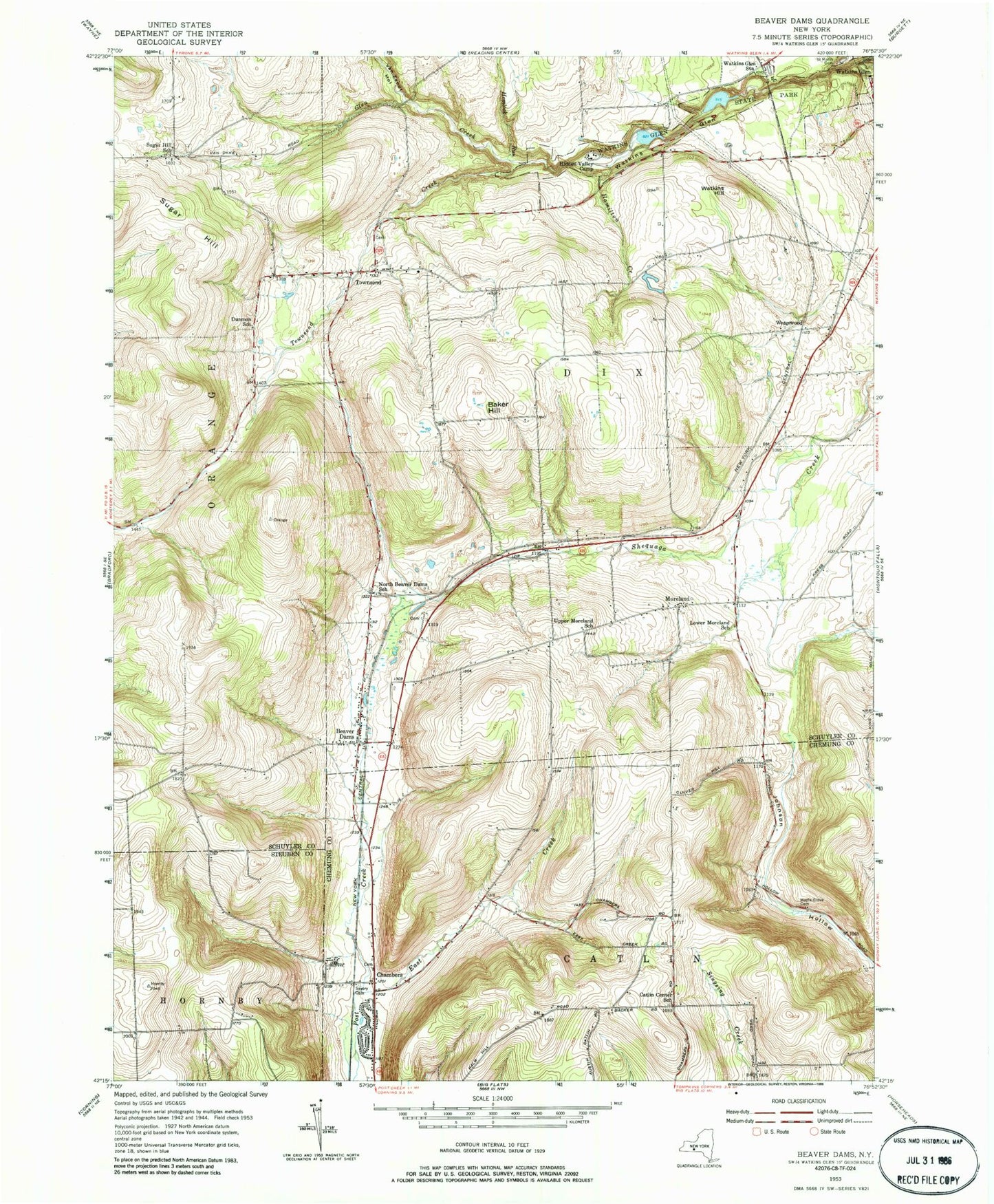
Classic USGS Beaver Dams New York 7.5'x7.5' Topo Map
Couldn't load pickup availability
Historical USGS topographic quad map of Beaver Dams in the state of New York. Map scale may vary for some years, but is generally around 1:24,000. Print size is approximately 24" x 27"
This quadrangle is in the following counties: Chemung, Schuyler, Steuben.
The map contains contour lines, roads, rivers, towns, and lakes. Printed on high-quality waterproof paper with UV fade-resistant inks, and shipped rolled.
Contains the following named places: Baker Hill, Beaver Dams, Beaver Dams Cemetery, Beaver Dams Post Office, Beaver Dams Volunteer Fire Department, Catlin Center School, Chambers, Cherry Lane, Cooley Cemetery, Dunmon School, East Creek, Full Gospel Church, Hamilton Creek, Hemlock Run, Hemlock Run Airport, Hidden Valley Camp, Lower Moreland School, Maple Grove Cemetery, Moreland, North Beaver Dams School, Quigley Cemetery, Saint Marys Cemetery, Savory Cemetery, Sugar Hill, Sugar Hill Cemetery, Sugar Hill School, Tilden Airport, Town of Dix, Townsend, Townsend Cemetery, Townsend Creek, Upper Moreland School, Van Zandt Hollow, Watkins Glen International, Watkins Glen State Park, Watkins Glen Station, Watkins Glen Yacht Club, Watkins Hill, Wedgewood, White Hollow Road Bridge, WNGZ-FM (Montour Falls), Woolsey Brook