MyTopo
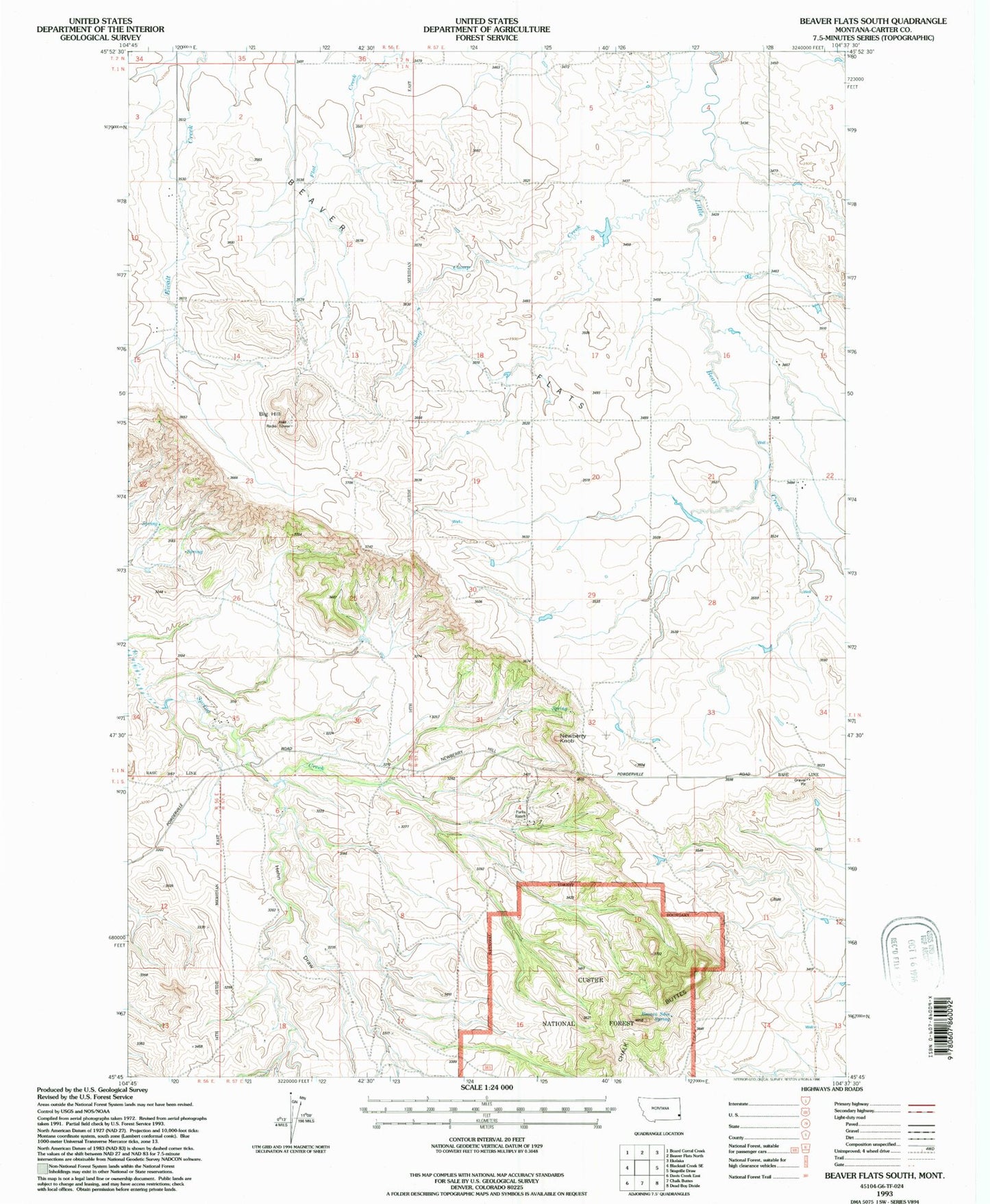
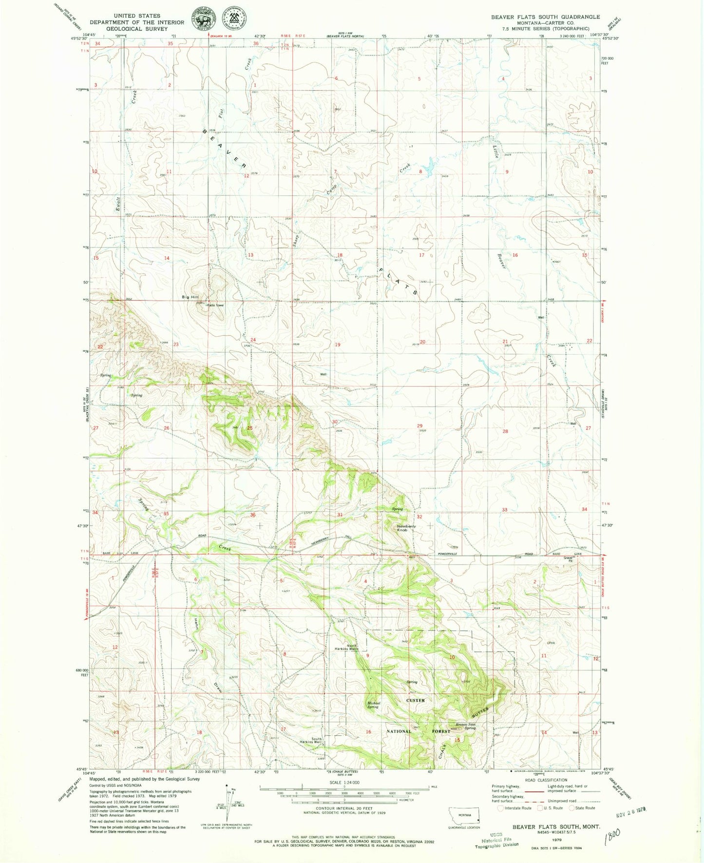
Classic USGS Beaver Flats South Montana 7.5'x7.5' Topo Map
Couldn't load pickup availability
Historical USGS topographic quad map of Beaver Flats South in the state of Montana. Map scale may vary for some years, but is generally around 1:24,000. Print size is approximately 24" x 27"
This quadrangle is in the following counties: Carter.
The map contains contour lines, roads, rivers, towns, and lakes. Printed on high-quality waterproof paper with UV fade-resistant inks, and shipped rolled.
Contains the following named places: 01N56E24BDDA01 Well, 01N57E19AABB01 Well, 01N57E19CDB_01 Well, 01S47E17DAA_01 Well, 01S57E16AC__01 Well, 01S57E17CDA_01 Well, 02N57E15ABAC01 Well, Beaver Flats, Big Hill, Bronco Sam Spring, Hehn Draw, Michael Spring, Newberry Knob, North Harkins Well, Sheep Camp Creek, South Harkins Well