MyTopo
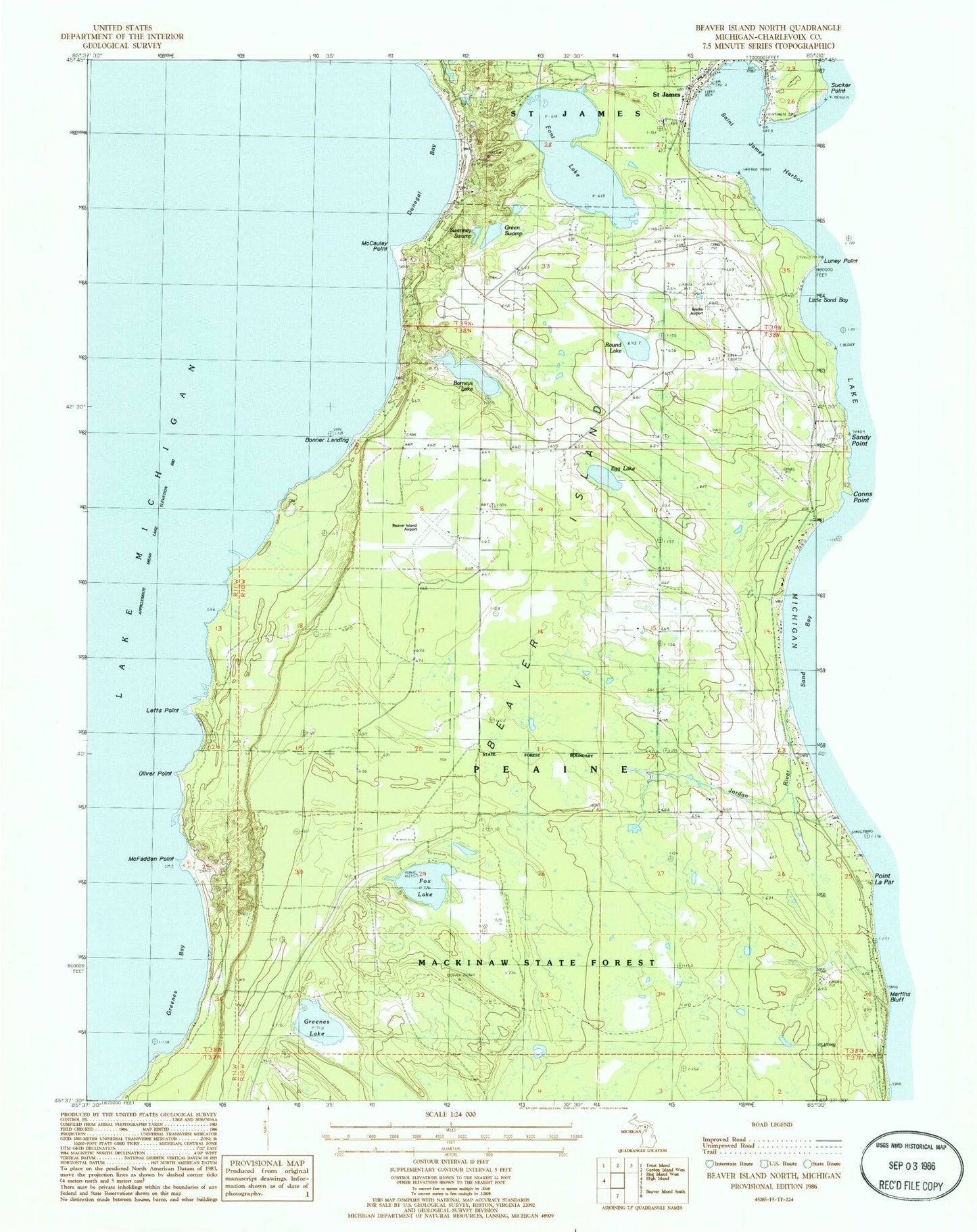
Classic USGS Beaver Island North Michigan 7.5'x7.5' Topo Map
Couldn't load pickup availability
Historical USGS topographic quad map of Beaver Island North in the state of Michigan. Map scale is 1:24000. Print size is approximately 24" x 27"
This quadrangle is in the following counties: Charlevoix.
The map contains contour lines, roads, rivers, towns, and lakes. Printed on high-quality waterproof paper with UV fade-resistant inks, and shipped rolled.
Contains the following named places: Barneys Lake, Beaver Harbor Lighthouse, Beaver Harbor Marina, Beaver Island, Beaver Island Airport, Beaver Island Campground, Beaver Island Emergency Medical Services, Beaver Island Fire Department Station 1, Beaver Island Harbor Lighthouse, Beaver Island Lookout Tower, Beaver Island Marine Museum, Beaver Island Post Office, Beaver Island Yacht Dock, Bonner Landing, Charlevoix County Sheriff's Office, Donegal Bay, Egg Lake, Font Lake, Fox Lake, Green Swamp, Greenes Bay, Greenes Lake, Holy Cross Cemetery, Holy Cross Church, Jordan River, Lefts Point, Little Sand Bay, Luney Point, McCauley Point, McFadden Point, Mormon Print Shop Historical Marker, Oliver Point, Roseville School, Round Lake, Saint James Census Designated Place, Saint James Harbor, Saint James Light, Sand Bay, Sunnyside School, Swenney Swamp, Township of Peaine, Welke Airport