MyTopo
Classic USGS Beaver Jack Mountain Idaho 7.5'x7.5' Topo Map
Couldn't load pickup availability
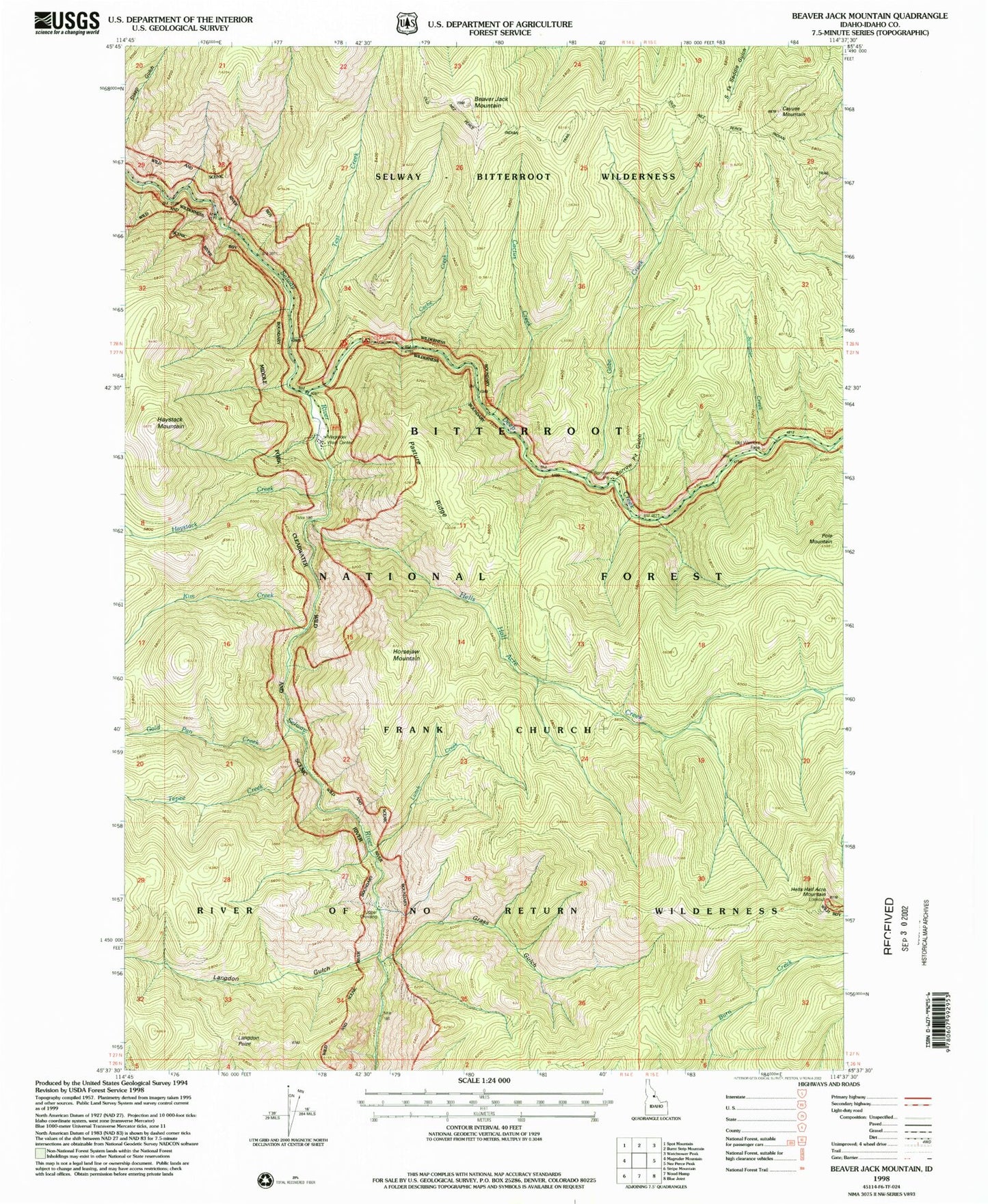
Historical USGS topographic quad map of Beaver Jack Mountain in the state of Idaho. Typical map scale is 1:24,000, but may vary for certain years, if available. Print size: 24" x 27"
This quadrangle is in the following counties: Idaho.
The map contains contour lines, roads, rivers, towns, and lakes. Printed on high-quality waterproof paper with UV fade-resistant inks, and shipped rolled.
Contains the following named places: Scimitar Creek, Beaver Jack Mountain, Borrow Pit Gulch, Cache Creek, Cactus Creek, Cayuse Mountain, Deep Creek, Deep Creek Campground, Gabe Creek, Gold Pan Creek, Grass Gulch, Haystack Creek, Haystack Mountain, Hells Half Acre Creek, Hells Half Acre Mountain, Horsejaw Mountain, Kim Creek, Langdon Gulch, Langdon Point, Lunch Creek, Magruder Ranger Station, Old Warriors Face, Pasture Ridge, Pole Mountain, Tepee Creek, Test Creek, Upper Crossing