MyTopo
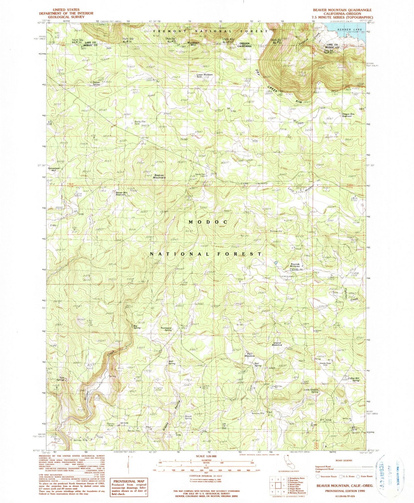
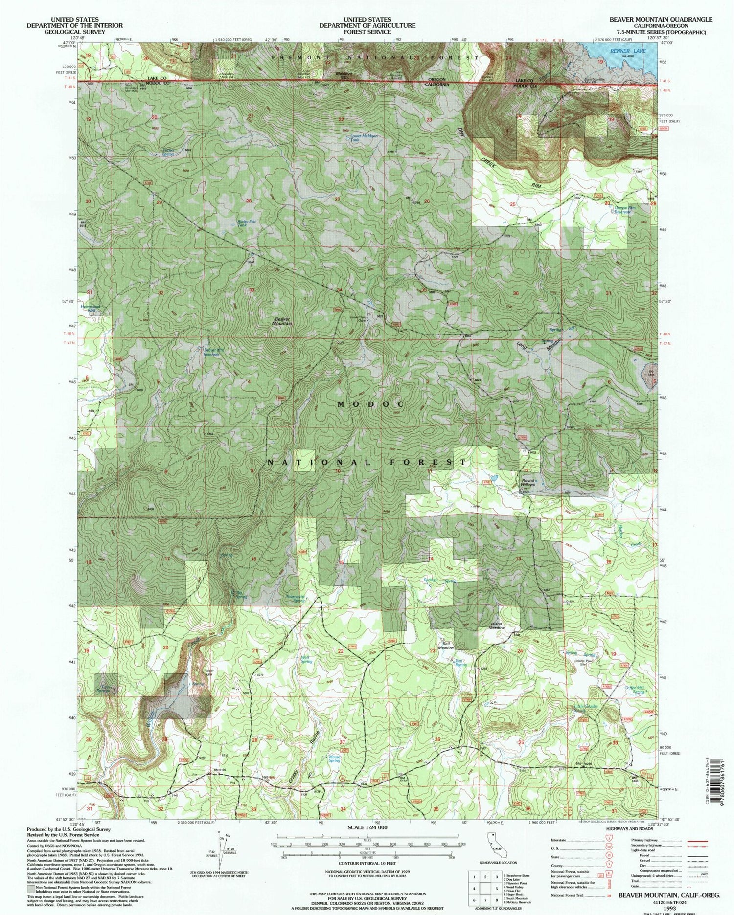
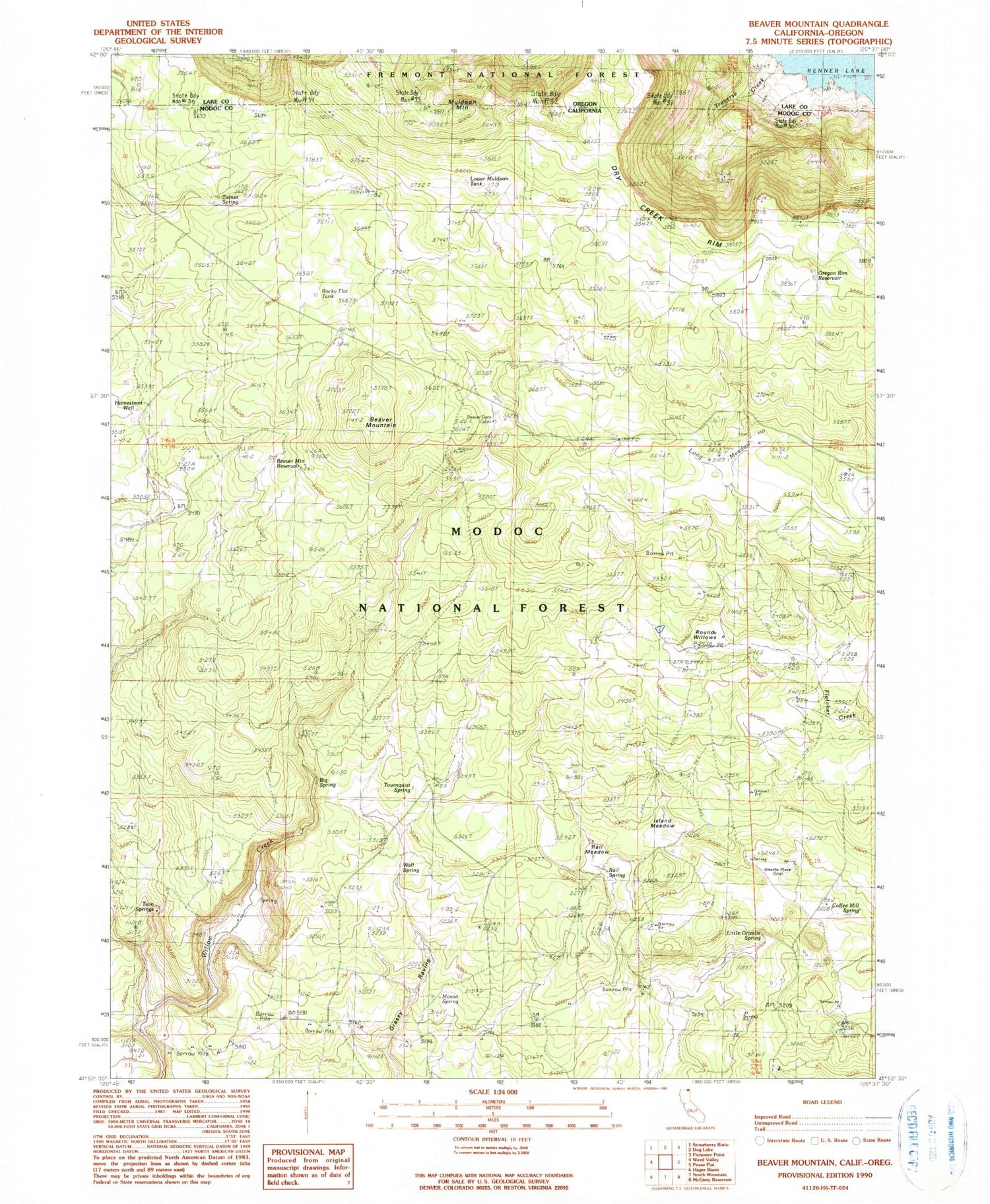
Classic USGS Beaver Mountain California 7.5'x7.5' Topo Map
Couldn't load pickup availability
Historical USGS topographic quad map of Beaver Mountain in the states of California, Oregon. Map scale may vary for some years, but is generally around 1:24,000. Print size is approximately 24" x 27"
This quadrangle is in the following counties: Lake, Modoc.
The map contains contour lines, roads, rivers, towns, and lakes. Printed on high-quality waterproof paper with UV fade-resistant inks, and shipped rolled.
Contains the following named places: Barrington Creek, Beaver Dam Cabin, Beaver Mountain, Beaver Mountain Reservoir, Big Spring, Coffee Mill Spring, Grizzlie Place, Homestead Well, Island Meadow, Little Grizzlie Spring, Long Meadow, Lower Muldoon Tank, Mouse Spring, Muldoon Mountain, Oregon Rim Reservoir, Rail Meadow, Rail Spring, Renner Lake, Rocky Flat Tank, Round Willows, Tournquist Spring, Traverse Creek, Turner Spring, Twin Springs, Upper Muldoon Tank, Wall Spring