MyTopo
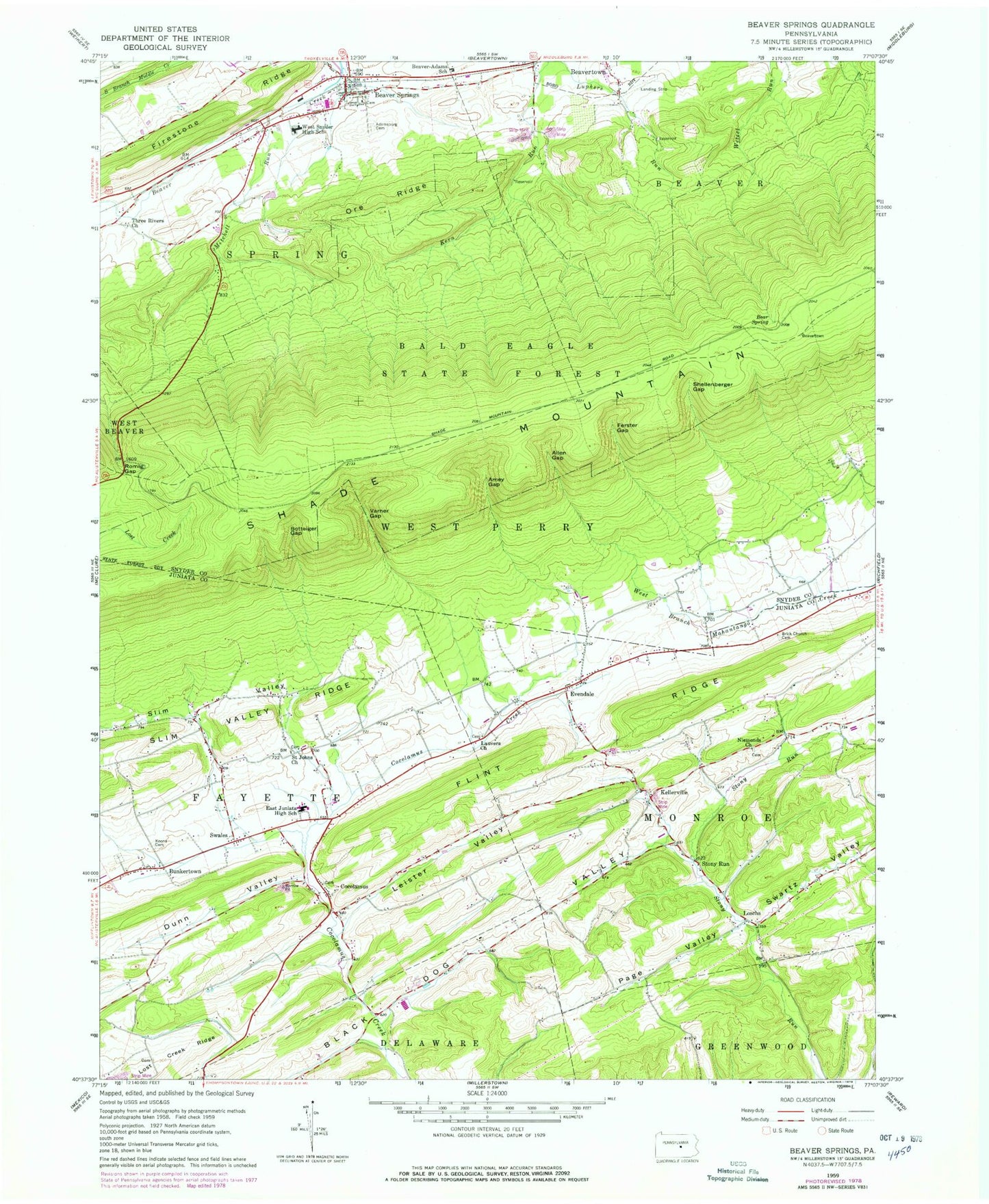
Classic USGS Beaver Springs Pennsylvania 7.5'x7.5' Topo Map
Couldn't load pickup availability
Historical USGS topographic quad map of Beaver Springs in the state of Pennsylvania. Typical map scale is 1:24,000, but may vary for certain years, if available. Print size: 24" x 27"
This quadrangle is in the following counties: Juniata, Snyder.
The map contains contour lines, roads, rivers, towns, and lakes. Printed on high-quality waterproof paper with UV fade-resistant inks, and shipped rolled.
Contains the following named places: Adamsburg Cemetery, Allen Gap, Amey Gap, Bear Spring, Beaver-Adams School, Black Dog Valley, Shelleys Cemetery, Bunkertown, Cocolamus, Dunn Valley, East Juniata High School, Evendale, Ferster Gap, Flint Ridge, Kellerville, Koons Cemetery, Lauvers Church, Leister Valley, Loschs, Mitchell Run, Niemonds Church, Ore Ridge, Page Valley, Romig Gap, Saint Johns Church, Shellenberger Gap, Slim Valley, Swales, Swartz Valley, Three Rivers Church, Varner Gap, West Snyder High School, Beaver Springs, Shelley Private Airport (historical), Pa-638 Reservoir, Pa-638 Reservoir, Redbank School, Liberty School (historical), Swartz School, Stony Run School (historical), Gimberlings Mill, Botteiger Gap, Dunn Valley Creek, Stony Run, Beaver Springs Census Designated Place, Richfield Fire Company Station 9, Beaver Springs Fire Department Station 10, Richfield Ambulance League Station 9, Beaver Springs Post Office, Goodwill Cemetery, Smith Family Cemetery, Lauver Mennonite Cemetery, Niemonds Cemetery, Coffman - Ginrich Cemetery, Saint Johns United Methodist Church Cemetery