MyTopo
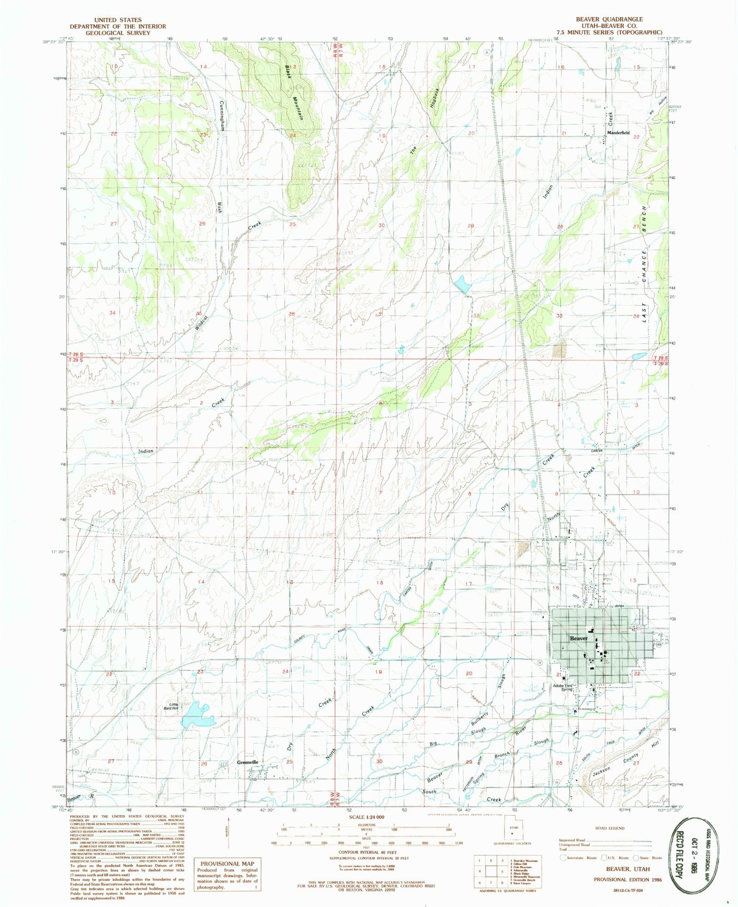
Classic USGS Beaver Utah 7.5'x7.5' Topo Map
Couldn't load pickup availability
Historical USGS topographic quad map of Beaver in the state of Utah. Map scale may vary for some years, but is generally around 1:24,000. Print size is approximately 24" x 27"
This quadrangle is in the following counties: Beaver.
The map contains contour lines, roads, rivers, towns, and lakes. Printed on high-quality waterproof paper with UV fade-resistant inks, and shipped rolled.
Contains the following named places: 2D Northwest Ditch, 84713, Adobe Yard Spring, Assembly of God Church, Beaver, Beaver City Cemetery, Beaver County Ambulance - Beaver, Beaver County Fire District - Beaver, Beaver County Fire District 1, Beaver Fish Hatchery, Beaver High School, Beaver Post Office, Beaver Valley Hospital, Belknap Elementary School, Belknap School, Big Hollow, Big Slough, Black Mountain, Bullberry Slough, Carter Ditch, City Ditch, City of Beaver, County Road Drain, Cunningham Wash, Delano Trailer Park, Dry Creek, First Baptist Church, Greenville, Greenville Cemetery, Greenwood Slough, Jackson County Hill, KBBD-FM (Beaver), Little Bald Hill, Manderfield, Milford Police Department Beaver, Mountain View Cemetery, North Creek, Patterson Ditch, Robinson-Tanner Dam, Robinson-Tanner Reservoir, South Creek, South Field Ditch, Spring Branch Slough, The Church of Jesus Christ of Latter Day Saints, The Hogback, United States Forest Service Fire Station Beaver Ranger District