
MyTopo
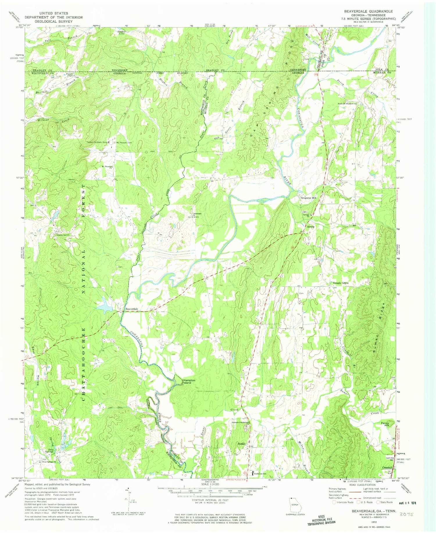
Classic USGS Beaverdale Georgia 7.5'x7.5' Topo Map
Couldn't load pickup availability
Historical USGS topographic quad map of Beaverdale in the states of Georgia, Tennessee. Map scale may vary for some years, but is generally around 1:24,000. Print size is approximately 24" x 27"
This quadrangle is in the following counties: Bradley, Murray, Polk, Whitfield.
The map contains contour lines, roads, rivers, towns, and lakes. Printed on high-quality waterproof paper with UV fade-resistant inks, and shipped rolled.
Contains the following named places: Beaverdale, Beaverdale Elementary School, Beaverdale School, Blue Bird Field, Calvary Church, Campbell Branch, Cave Hollow, Colvard School, Conasauga Church, Dalton Childrens Home, Deep Spring School, Deep Springs, Deep Springs Church, Dry Prong, Dunn Store, Fancy Hill, Fraziers Chapel, Gap Spring Ridge, Gregory, Gregorys Mill, Halls Chapel School, Hampton Island, Holiness Church, Hughes Branch, Hughes Lake, Liberty Bell Church, McIntire Branch, Mill Creek, Mount Pleasant Cemetery, Mount Pleasant Church, Mount Pleasant School, Murray County Fire Department Station 4, North Mount Pleasant Church, Northwest Elementary School, Oak Grove Branch, Oak Grove Church, Oak Grove School, Perry Creek, Petty Farms Airport, Prospect Church, Ridley Cemetery, Ridley Lake, Ridley Lake Dam, Ruralvale, Shields - Harris Cemetery, Sugar Creek, Sumac, Sumac Creek, Sumach-cumberland Church, Temple Grove, Upper Kings Bridge, Whitfield County Fire Department Station 10, Worthy Lake, Worthy Lake Dam


