MyTopo
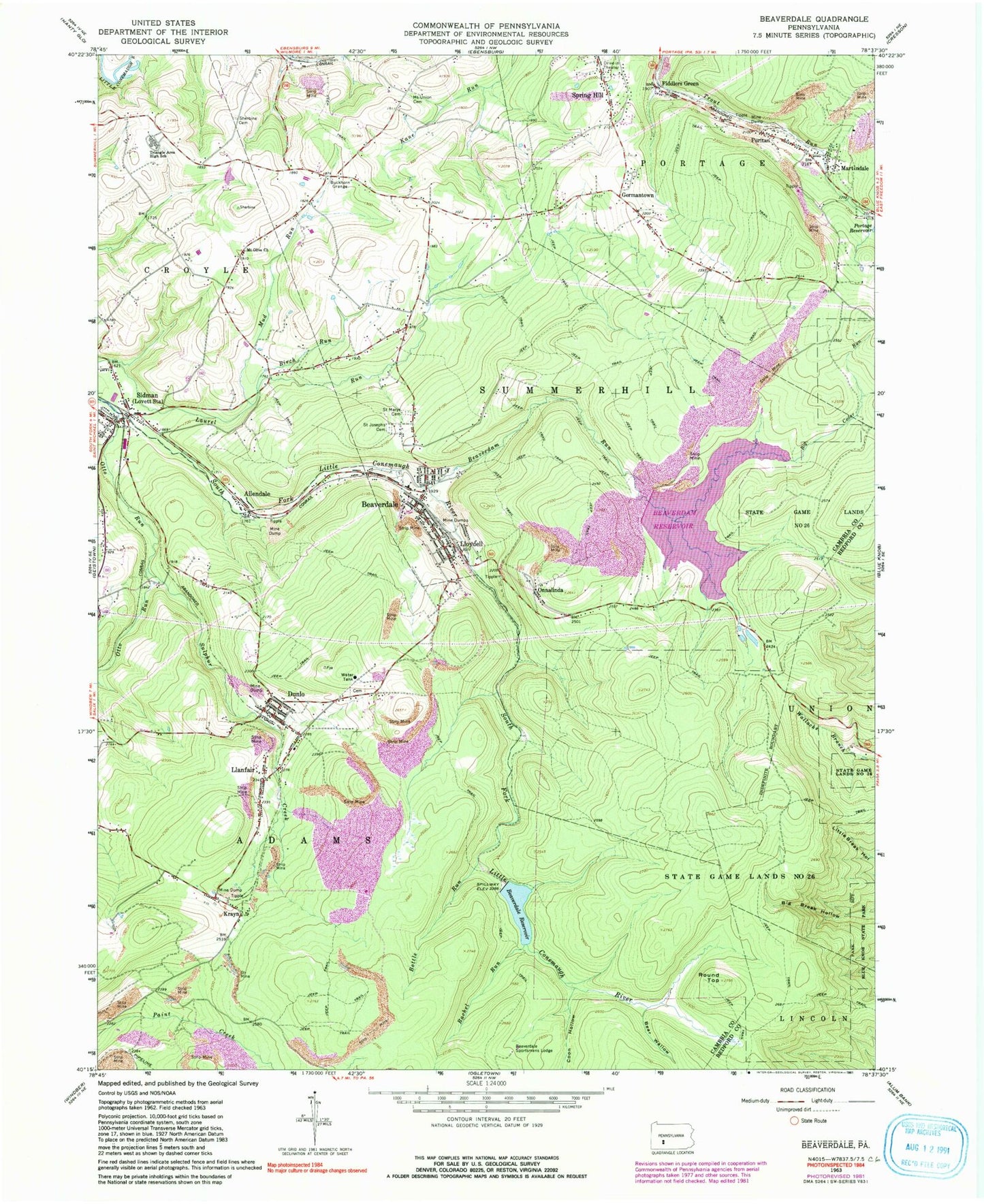
Classic USGS Beaverdale Pennsylvania 7.5'x7.5' Topo Map
Couldn't load pickup availability
Historical USGS topographic quad map of Beaverdale in the state of Pennsylvania. Typical map scale is 1:24,000, but may vary for certain years, if available. Print size: 24" x 27"
This quadrangle is in the following counties: Bedford, Cambria.
The map contains contour lines, roads, rivers, towns, and lakes. Printed on high-quality waterproof paper with UV fade-resistant inks, and shipped rolled.
Contains the following named places: Allendale, Bear Wallow, Beaverdale, Beaverdale Reservoir, Beaverdale Sportsmans Lodge, Beaverdam Run, Big Cedar Run, Birch Run, Bottle Run, Buckhorn Grange, Coon Hollow, Dunlo, Fiddlers Green, Germantown, Krayn, Llanfair, Lloydell, Martindale, Mount Olive Church, Mount Union Cemetery, Onnalinda, Otto Run, Puritan, Rachel Run, Round Top, Saint Joseph's Cemetery, Saint Mary's Byzantine Catholic Cemetery, Sherbine Cemetery, State Game Lands Number 26, Sulphur Creek, Triangle Area High School, Mud Run, Lloydell Dam, Beaverdam Run Dam, Sunflower, Sidman, Township of Adams, Township of Summerhill, Beaverdale Census Designated Place, Spring Hill Census Designated Place, Dunlo Census Designated Place, Adams Township Volunteer Fire Company Dunlo Station 82, Summerhill Township Volunteer Fire Company Station 80, Beaverdale Area Ambulance Service, Onyx Greentree Landfill, Dunlo Post Office, Sidman Post Office, Beaverdale Post Office, Saints Peter and Paul Byzantine Catholic Cemetery, Mount Olive Cemetery, Corpus Christi Cemetery, Dunlo United Methodist Church Cemetery