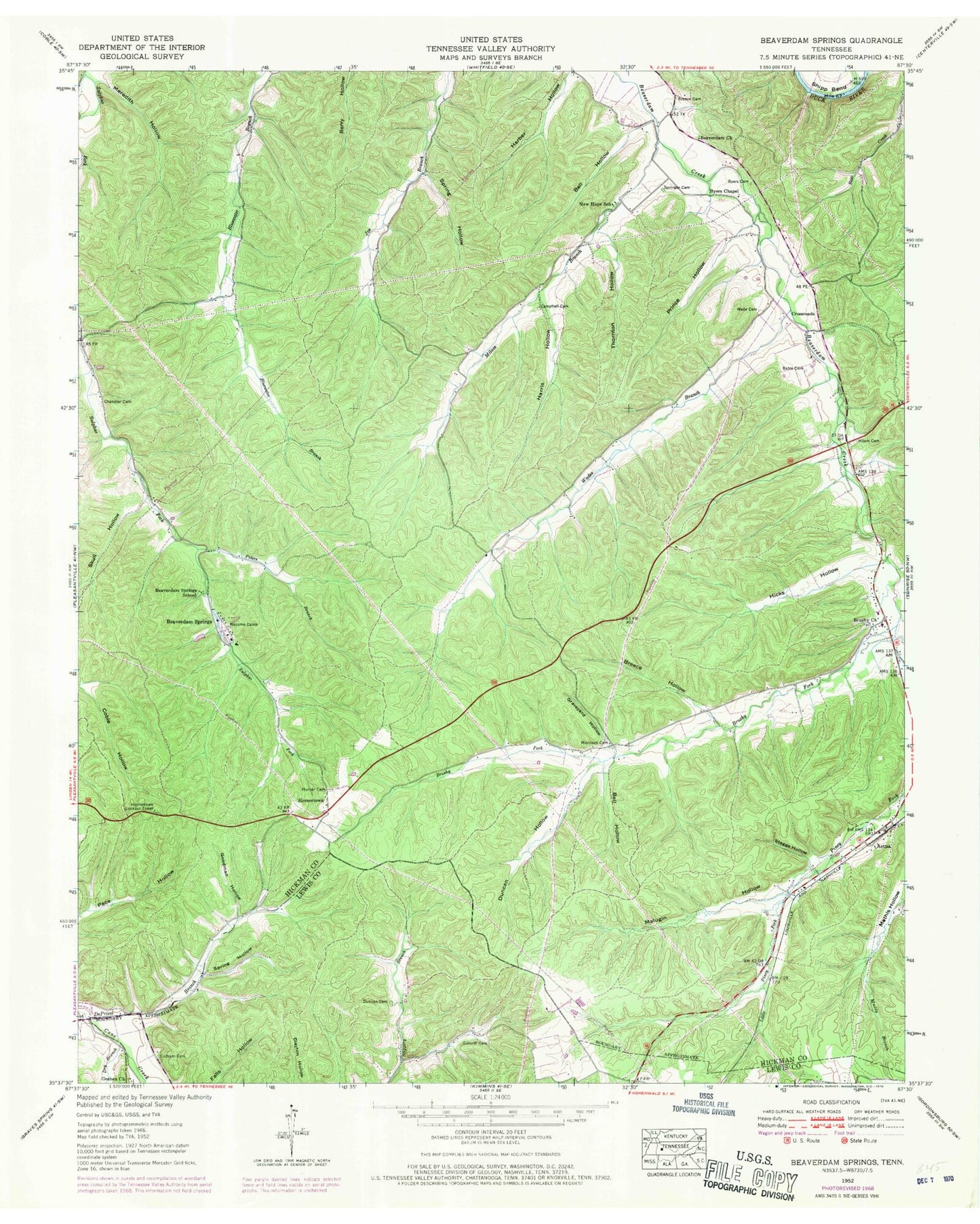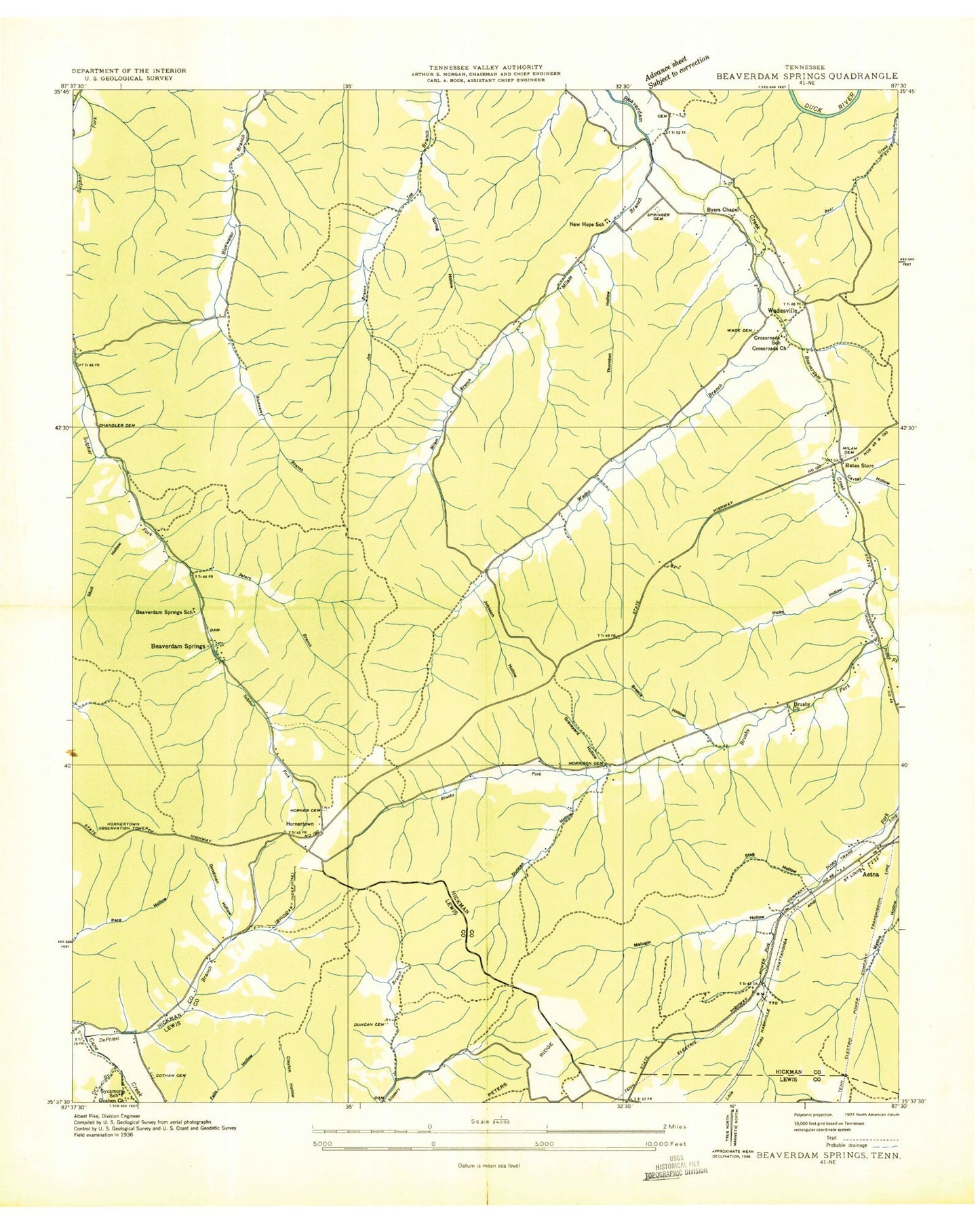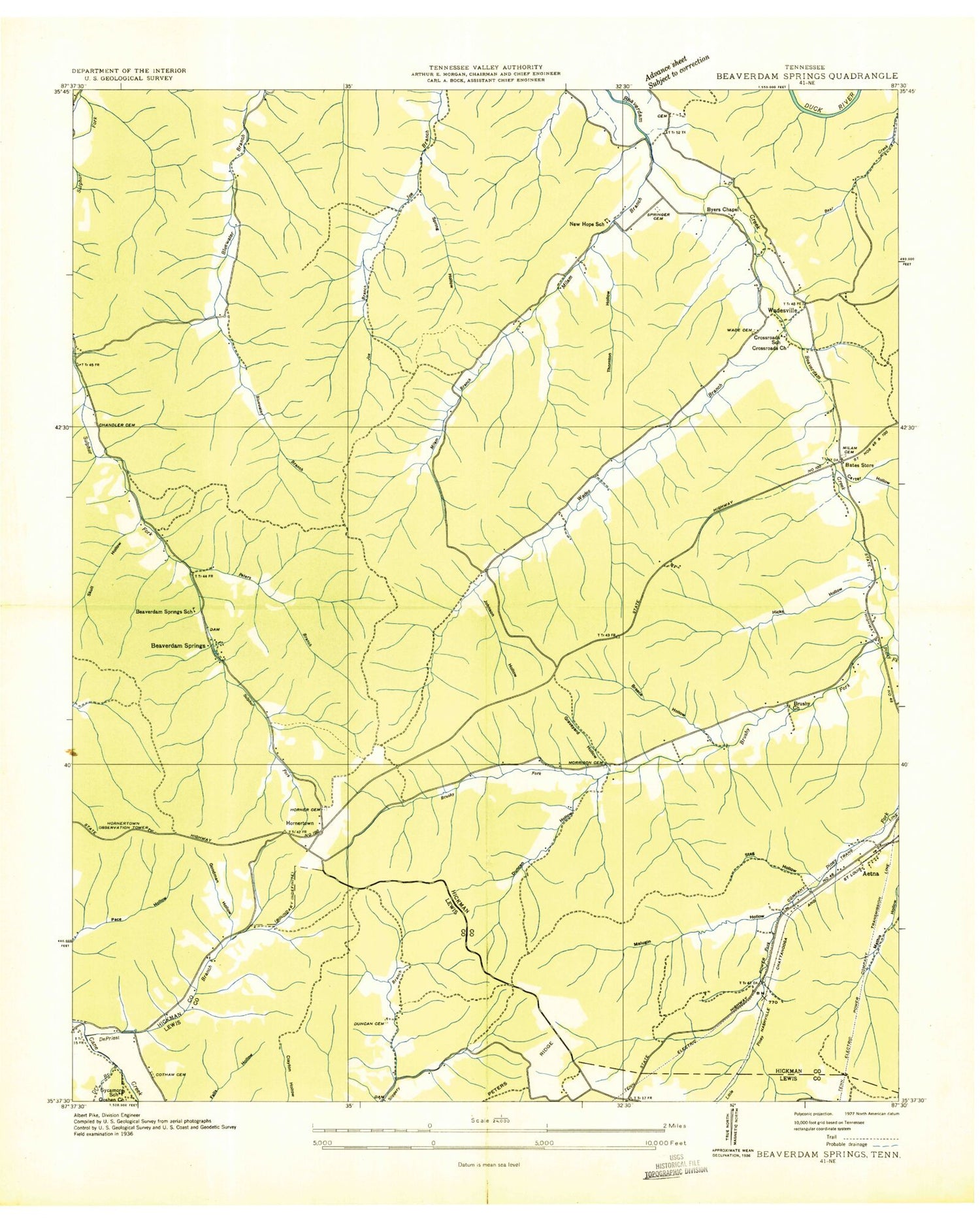
MyTopo
Classic USGS Beaverdam Springs Tennessee 7.5'x7.5' Topo Map
Couldn't load pickup availability
Historical USGS topographic quad map of Beaverdam Springs in the state of Tennessee. Map scale may vary for some years, but is generally around 1:24,000. Print size is approximately 24" x 27"
This quadrangle is in the following counties: Hickman, Lewis.
The map contains contour lines, roads, rivers, towns, and lakes. Printed on high-quality waterproof paper with UV fade-resistant inks, and shipped rolled.
Contains the following named places: Aetna, Aetna Furnace, Aetna Mine, Bates Cemetery, Bates Store, Bear Creek, Beaverdam Church, Beaverdam Springs, Beaverdam Springs School, Bell Hollow, Breece Cemetery, Breece Hollow, Brushy Church, Brushy Fork, Byers Cemetery, Byers Chapel, Campbell Cemetery, Carter Hollow, Chandler Cemetery, Coble Division, Commissioner District 7, Cotham Cemetery, Cross Roads School, Crossroads, Crossroads Church, DePriest Branch, Dry Branch, Duncan Cemetery, Duncan Hollow, Goforth Cemetery, Goodman Hollow, Goshen Church, Graveyard Hollow, Harris Hollow, Hicks Hollow, Horner Cemetery, Hornertown, Hornertown Lookout Tower, Jenkins Hollow Prospects, Johnson Hollow, Little Piney Fork, Malugin Hollow, Meredith Hollow, Metal Landing, Milam Branch, Milam Cemetery, Morrison Cemetery, Nacome Camp, New Hope Baptist Church, New Hope School, Nicholson Prospects, Old Aetna Furnace, Peters Branch, Piney Fork, Piney Fork Prospects, Pleasantville Volunteer Fire and Rescue, Prince Hollow, Skull Hollow, Spring Hollow, Springer Cemetery, Staggs Hollow, Sycamore School, Thornton Hollow, Wade Cemetery, Wades Branch, Washer Hollow Tunnel Mine, West Black Hollow Mine, ZIP Code: 37033