MyTopo
Classic USGS Beaverdam Ohio 7.5'x7.5' Topo Map
Couldn't load pickup availability
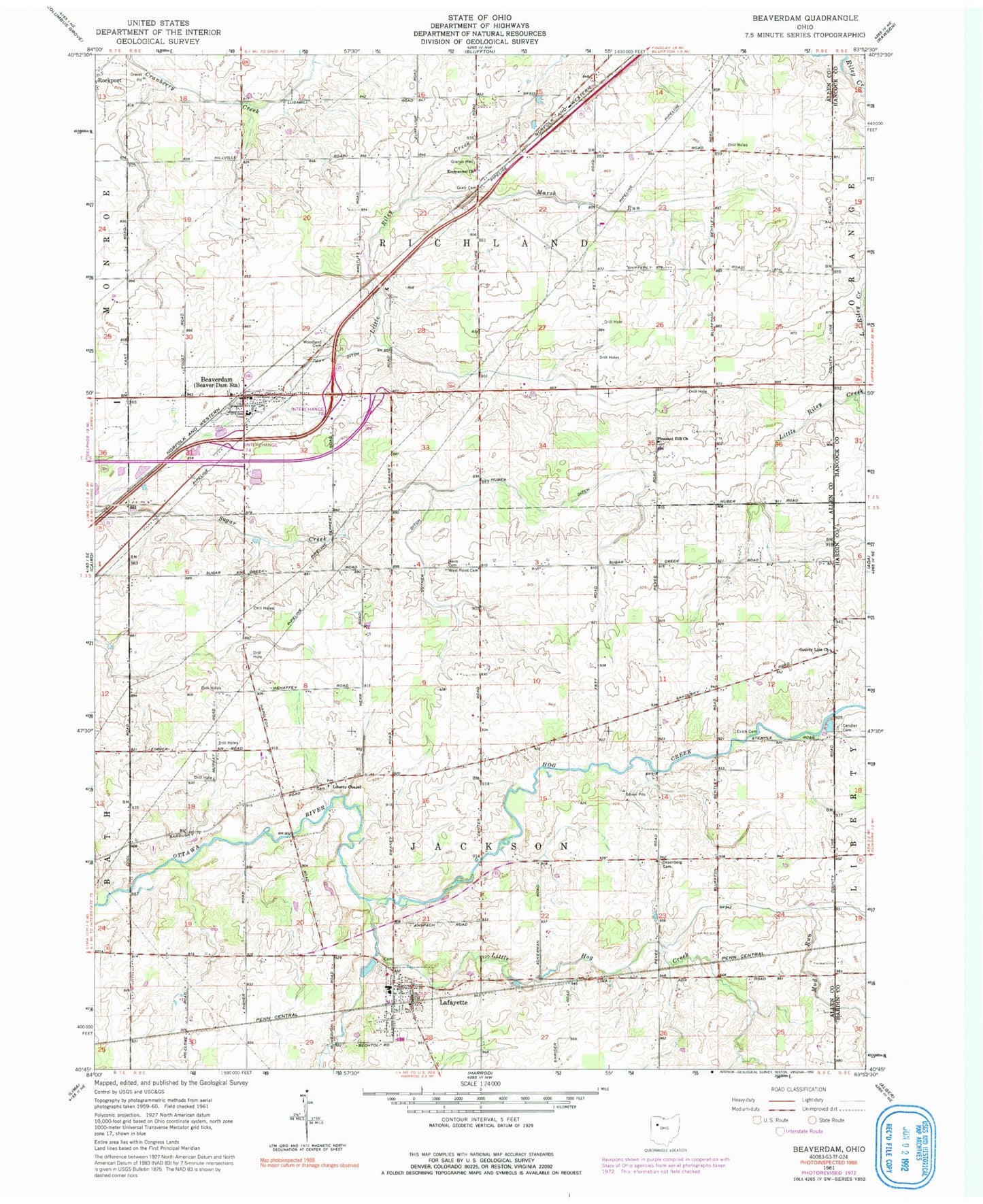
Historical USGS topographic quad map of Beaverdam in the state of Ohio. Map scale may vary for some years, but is generally around 1:24,000. Print size is approximately 24" x 27"
This quadrangle is in the following counties: Allen, Hancock, Hardin.
The map contains contour lines, roads, rivers, towns, and lakes. Printed on high-quality waterproof paper with UV fade-resistant inks, and shipped rolled.
Contains the following named places: Allen East High School, Allen East Primary School, Beaver Dam Station, Beaverdam, Beaverdam - Richland Fire Department, Beaverdam Cemetery, Beaverdam Post Office, Candler Cemetery, Cotner Ditch, County Line Church, Davis Cemetery, Desenberg School, Desenburg Cemetery, Emmanuel Church, Evick Cemetery, Gratz Cemetery, Hall Cemetery, Hog Creek, Huber Ditch, Huber School, Lafayette, Lafayette Cemetery, Lafayette Jackson Township Fire Department, Lafayette Post Office, Liberty Chapel, Liberty Chapel Cemetery, Little Hog Creek, Marsh Run, May Ditch, Mud Run, Pleasant Hill Cemetery, Pleasant Hill Church, Stratton Greenhouses, Township of Jackson, Township of Richland, Village of Beaverdam, Village of Lafayette, West Point Cemetery, Woodland Cemetery, ZIP Codes: 45808, 45854