MyTopo
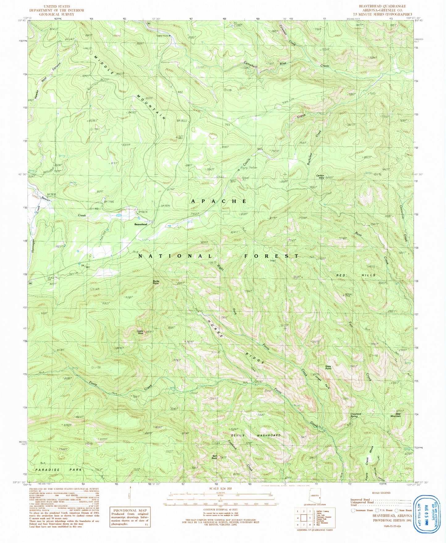
Classic USGS Beaverhead Arizona 7.5'x7.5' Topo Map
Couldn't load pickup availability
Historical USGS topographic quad map of Beaverhead in the state of Arizona. Typical map scale is 1:24,000, but may vary for certain years, if available. Print size: 24" x 27"
This quadrangle is in the following counties: Greenlee.
The map contains contour lines, roads, rivers, towns, and lakes. Printed on high-quality waterproof paper with UV fade-resistant inks, and shipped rolled.
Contains the following named places: Beaverhead, Bell Rock, Burke Point, Horse Ridge, Sissy Point, Buckelew Creek, Carlton Vista, Castle Creek, Castle Rock, Cleveland Spring, Coleman Creek, Deer Mountain, Devils Washboard, Foote Creek Mesa, Hannagan Creek, Jones Park, Red Hills, Right Fork Foote Creek, Soldier Spring, Buckalou Tank, Foote Creek Seventy-six Trail, Log Canyon Tank, Spillway Beaverhead Lodge, Tutt Cienega, Hawkwest Tank, Upper Tank, Section Thirty-six Tank, Duck Corral Tank, Accident Tank, Spur Tank, Campbell Blue Borrow Pit Number One, Pearl Spring, Buckalou Corral, Gravel Pit Tank, Beaverhead Natural Lake, Tutt Tank, Bear Tank, Beaverhead Tank, Hannagan Tank, Snag Tank, Devils Washboard, Burke Point, Campbell Blue Barrow Pit Tank Number Two, Hannagan Gravel Pit, Alpine Ranger District