MyTopo
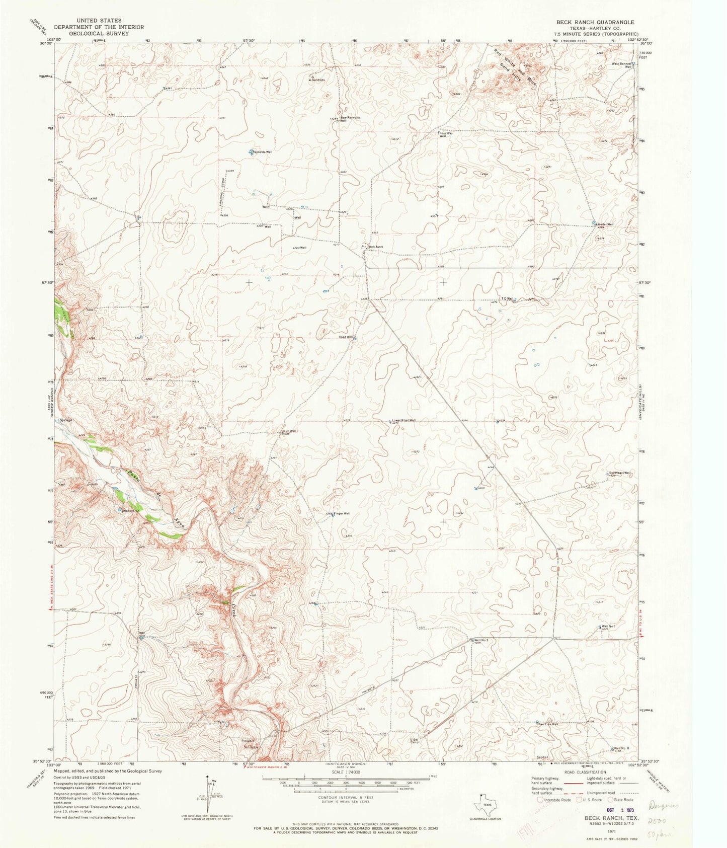
Classic USGS Beck Ranch Texas 7.5'x7.5' Topo Map
Regular price
$16.95
Regular price
Sale price
$16.95
Unit price
per
Couldn't load pickup availability
Historical USGS topographic quad map of Beck Ranch in the state of Texas. Map scale may vary for some years, but is generally around 1:24,000. Print size is approximately 24" x 27"
This quadrangle is in the following counties: Hartley.
The map contains contour lines, roads, rivers, towns, and lakes. Printed on high-quality waterproof paper with UV fade-resistant inks, and shipped rolled.
Contains the following named places: Beck Ranch, Bull Well, Finger Well, Four Way Well, Heifer Well, Lower Road Well, New Reynolds Well, Reynolds Well, Road Well, Southeast Well, T O Well, Two Line Well, U Bar Camp, Well Number Eight, Well Number One, Well Number Seven, Well Number Three, West Bennett Well