MyTopo
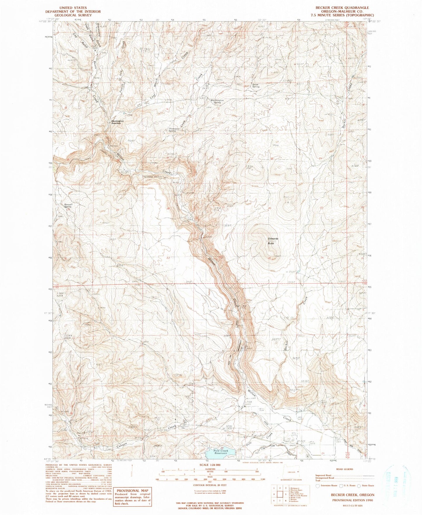
Classic USGS Becker Creek Oregon 7.5'x7.5' Topo Map
Couldn't load pickup availability
Historical USGS topographic quad map of Becker Creek in the state of Oregon. Map scale may vary for some years, but is generally around 1:24,000. Print size is approximately 24" x 27"
This quadrangle is in the following counties: Malheur.
The map contains contour lines, roads, rivers, towns, and lakes. Printed on high-quality waterproof paper with UV fade-resistant inks, and shipped rolled.
Contains the following named places: Basin Creek, Becker Creek, Boswell Spring, Canyon Creek, Cash Gulch, City Gulch, Cole Ditch, Crow Creek, Davis Reservoir Three, Discovery Gulch, East Side Ditch, Edwards Butte, Fourth of July Creek, Glasscock Creek, Huntington Junction, Lost Watch Creek, Pole Creek, Pole Creek Dam, Pole Creek Reservoir, Stove Spring, Thompson Spring, Worthington Spring