MyTopo
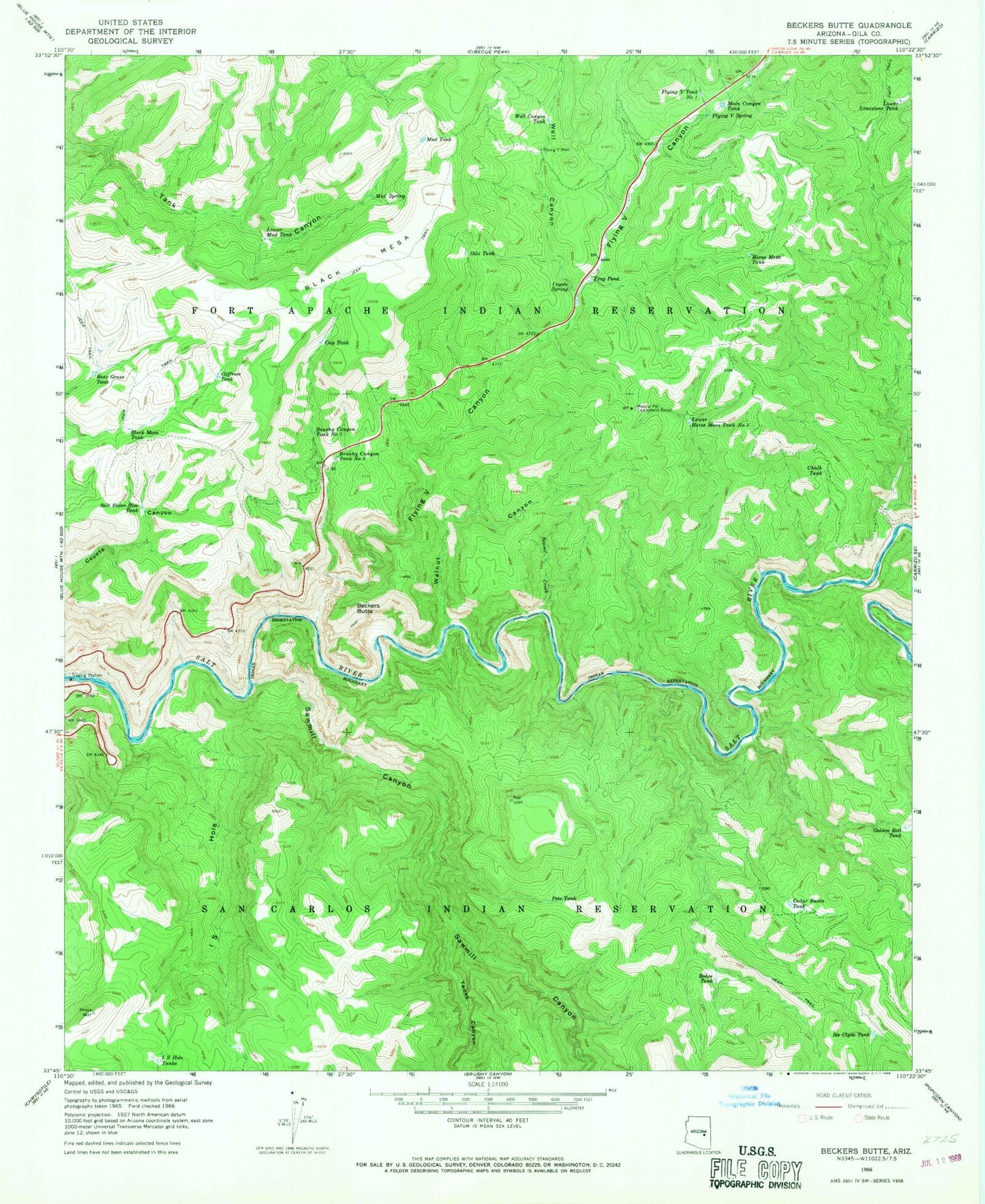
Classic USGS Beckers Butte Arizona 7.5'x7.5' Topo Map
Couldn't load pickup availability
Historical USGS topographic quad map of Beckers Butte in the state of Arizona. Map scale may vary for some years, but is generally around 1:24,000. Print size is approximately 24" x 27"
This quadrangle is in the following counties: Gila.
The map contains contour lines, roads, rivers, towns, and lakes. Printed on high-quality waterproof paper with UV fade-resistant inks, and shipped rolled.
Contains the following named places: Bear Grass Tank, Beaver Creek, Beckers Butte, Beckers Butte Roadside Table, Black Mesa, Black Mesa Tank, Bohee Tank, Brushy Canyon Tank Number One, Brushy Canyon Tank Number Two, Cedar Basin Dam, Cedar Basin Tank, Chalk Tank, Cliffrose Tank, Coyote Spring, Cup Tank, Flying V Canyon, Flying V Spring, Flying V Tank Number One, Flying V Well, Frog Pond, Gila Tank, Golden Roll Dam, Golden Roll Tank, Horse Mesa Tank, I S Hole, I S Hole Tanks, Ike Clyde Tank, Lower Horse Mesa Tank Number Two, Lower Limestone Tank, Lower Mud Tank, Main Canyon Tank, Mescal Pit Catchment Basin, Mud Spring, Mud Tank, Pete Tank, Salt River Rim Tank, Sawmill Canyon, Sawmill Creek, Tanks Canyon, Walnut Canyon, Well Canyon, Well Canyon Tank