MyTopo
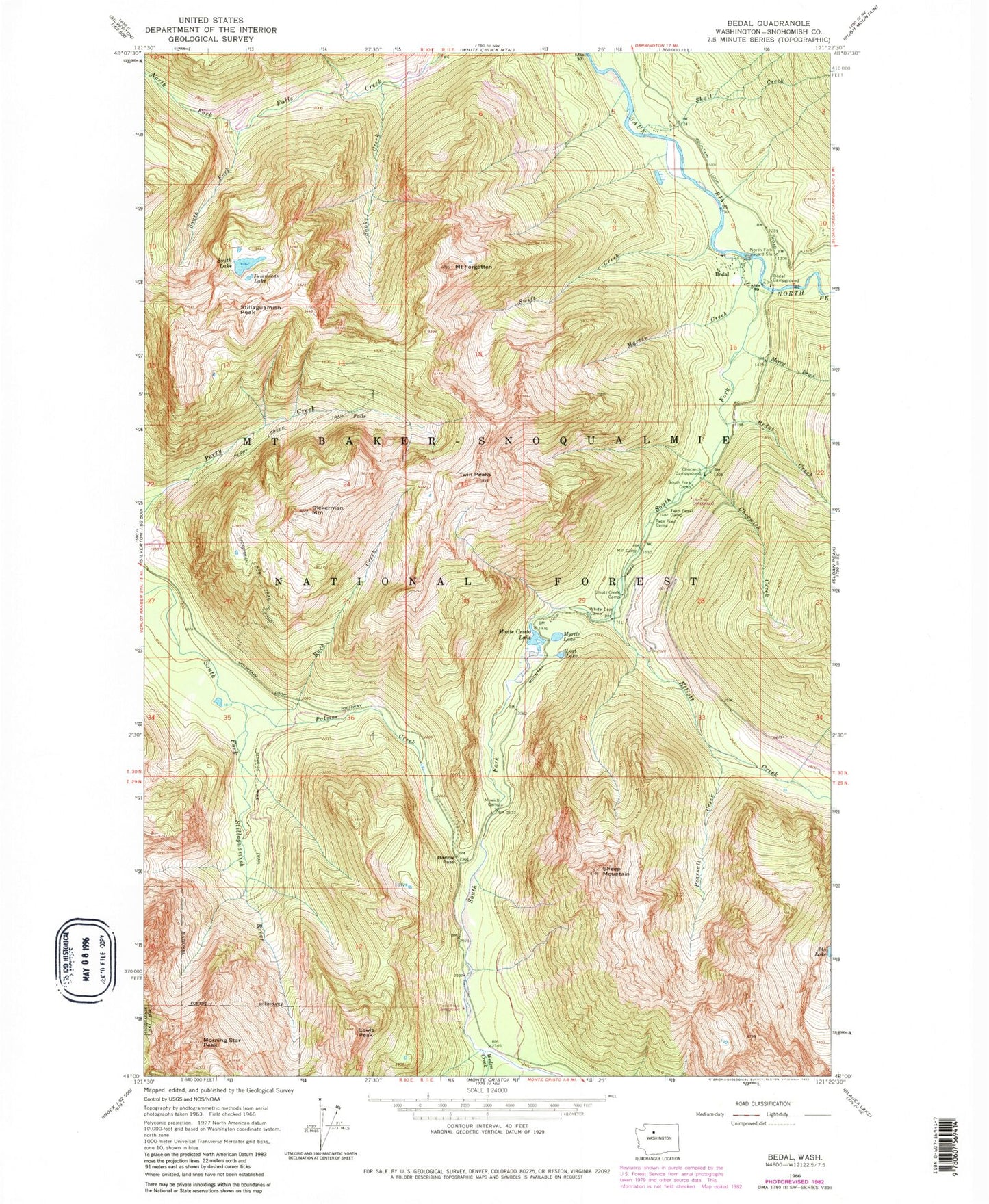
Classic USGS Bedal Washington 7.5'x7.5' Topo Map
Couldn't load pickup availability
Historical USGS topographic quad map of Bedal in the state of Washington. Typical map scale is 1:24,000, but may vary for certain years, if available. Print size: 24" x 27"
This quadrangle is in the following counties: Snohomish.
The map contains contour lines, roads, rivers, towns, and lakes. Printed on high-quality waterproof paper with UV fade-resistant inks, and shipped rolled.
Contains the following named places: Barlow Pass, Bedal, Bedal Campground, Bedal Creek, Buck Creek, Chocwich Campground, Chocwich Creek, Mount Dickerman, Elliott Creek, Elliott Creek Camp, Mount Forgotten, Headlee Pass, Ida Lake, Lewis Peak, Lost Lake, Martin Creek, Merry Brook, Mill Camp, Monte Cristo Lake, Morning Star Peak, Myrtle Lake, North Fork Falls Creek, North Fork Guard Station, North Fork Sauk River, Palmer Creek, Pearsall Creek, Pemmican Lake, Sheep Mountain, Skull Creek, South Fork Camp, South Fork Falls Creek, South Fork Sauk River, South Lake, Stillaguamish Peak, Swift Creek, Twin Peaks, Twin Peaks Camp, Tyee Pool Camp, Weeden Creek, White Deer Camp, Barlow Point, Orient, Shake Creek