MyTopo
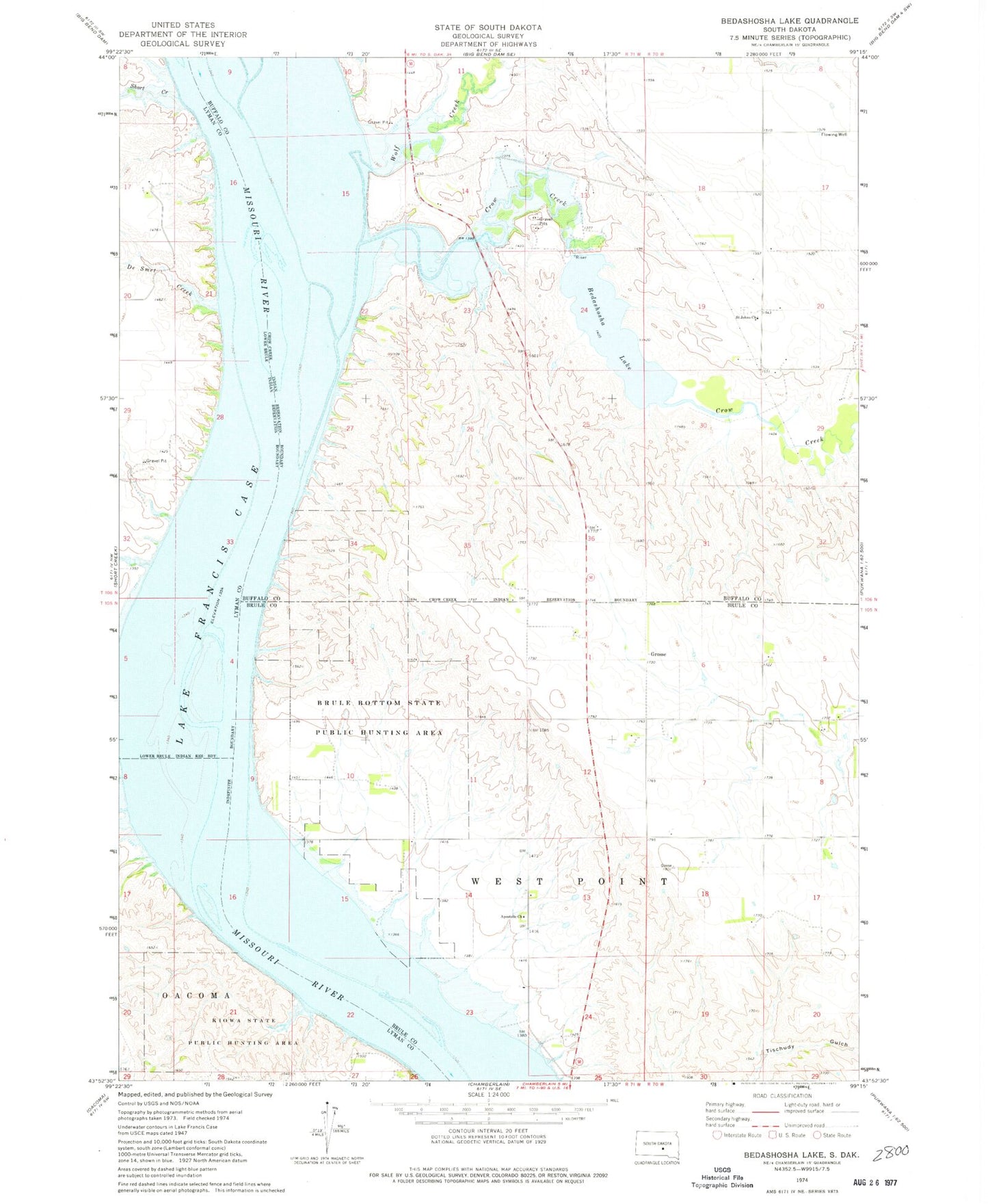
Classic USGS Bedashosha Lake South Dakota 7.5'x7.5' Topo Map
Couldn't load pickup availability
Historical USGS topographic quad map of Bedashosha Lake in the state of South Dakota. Map scale may vary for some years, but is generally around 1:24,000. Print size is approximately 24" x 27"
This quadrangle is in the following counties: Brule, Buffalo, Lyman.
The map contains contour lines, roads, rivers, towns, and lakes. Printed on high-quality waterproof paper with UV fade-resistant inks, and shipped rolled.
Contains the following named places: Bailey Dam, Bedashosha Lake, Brule Bottom State Public Hunting Area, Crow Creek, Crow Creek Dam, De Smet Creek, Des Lauriens Island, Fort Hale, Grace Howard Mission, Grosse, Kiowa State Public Hunting Area, Saint John The Baptist Episcopal Cemetery, Saint Johns Church, Short Creek, Tischudy Gulch, Township of West Point, Wolf Creek