MyTopo
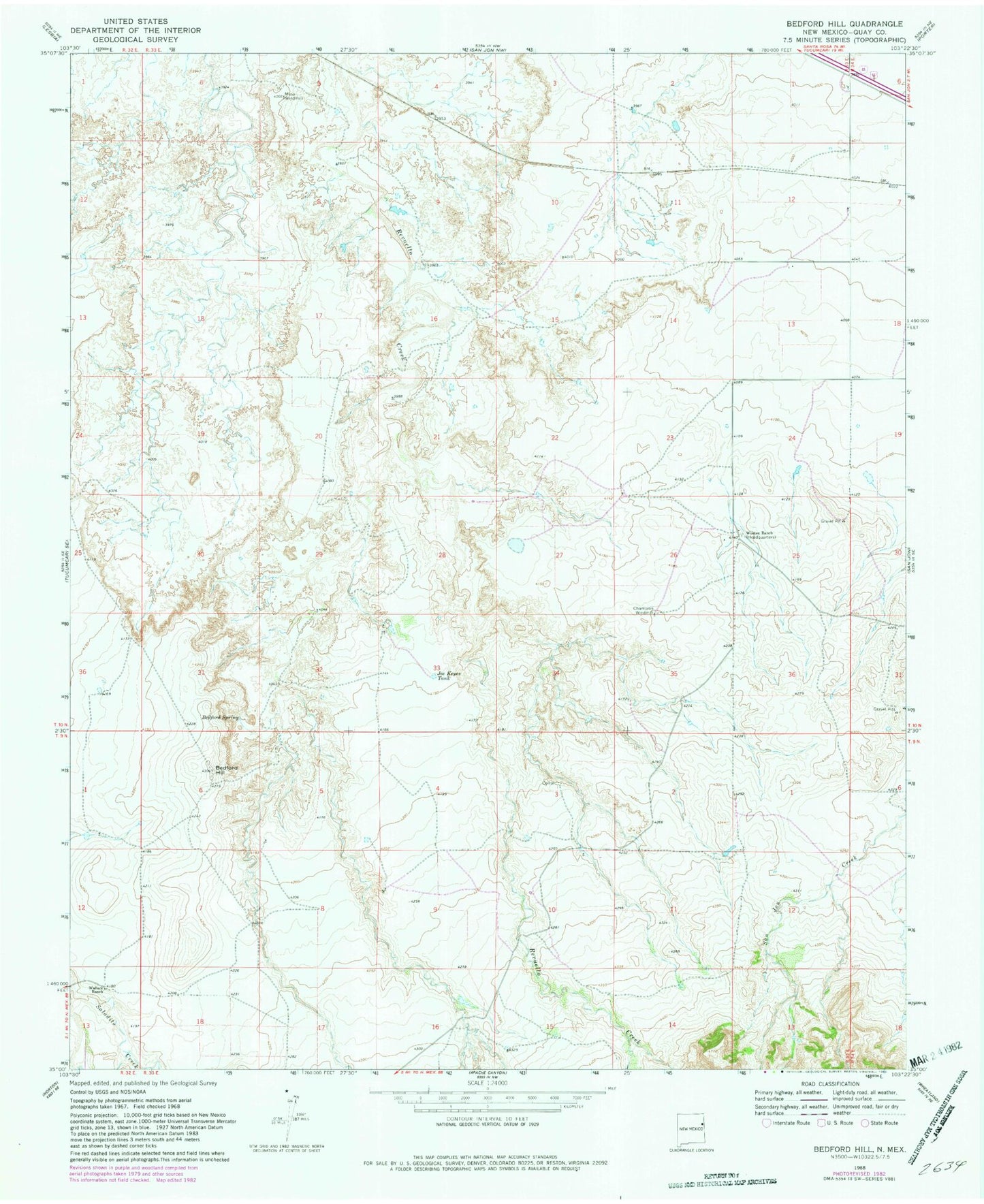
Classic USGS Bedford Hill New Mexico 7.5'x7.5' Topo Map
Regular price
$16.95
Regular price
Sale price
$16.95
Unit price
per
Couldn't load pickup availability
Historical USGS topographic quad map of Bedford Hill in the state of New Mexico. Map scale may vary for some years, but is generally around 1:24,000. Print size is approximately 24" x 27"
This quadrangle is in the following counties: Quay.
The map contains contour lines, roads, rivers, towns, and lakes. Printed on high-quality waterproof paper with UV fade-resistant inks, and shipped rolled.
Contains the following named places: 05166 Water Well, 05173 Water Well, 05174 Water Well, 05175 Water Well, 05176 Water Well, 05177 Water Well, 05178 Water Well, 05180 Water Well, 05194 Water Well, Bedford Hill, Bedford Spring, Champion Windmill, Joe Keyes Tank, Mesa Windmill, Wallace, Wallace Ranch, Wooten Ranch