MyTopo
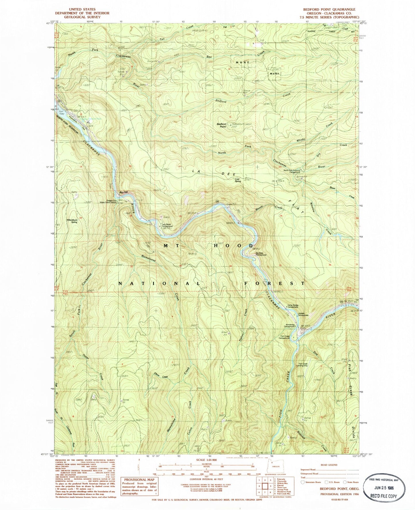
Classic USGS Bedford Point Oregon 7.5'x7.5' Topo Map
Couldn't load pickup availability
Historical USGS topographic quad map of Bedford Point in the state of Oregon. Typical map scale is 1:24,000, but may vary for certain years, if available. Print size: 24" x 27"
This quadrangle is in the following counties: Clackamas.
The map contains contour lines, roads, rivers, towns, and lakes. Printed on high-quality waterproof paper with UV fade-resistant inks, and shipped rolled.
Contains the following named places: Helion Creek, Rimrock Creek, Dog Creek, Lockaby Recreation Site, Bedford Point Lookout, South Fork Water Board Intake, Oscar Creek, Cultus Creek, La Dee Flat, Bedford Creek, Bedford Point, Bee Creek, Big Cliff, Big Eddy Recreation Site, Boyer Creek, Cold Spring, Dry Creek, Fall Creek, Fish Creek Recreation Site, Hillockburn Spring, Lazy Bend Recreation Site, Memaloose Creek, Memaloose Trail, Moore Creek, North Fork Guard Station (historical), South Fork Clackamas River, Wanderers Peak Trail, Whisky Creek, Winslow Creek, Murphy Creek, Small Fry Lake, Clackamas County, Memaloose, Armstrong Recreation Site, Carter Bridge Recreation Site, Fish Creek, North Fork Crossing Forest Camp, Oregon City Water Patrol Station, Hesperin Camp, Bowyer Quarry, Portland General Electric Promontory Park Marina, Portland General Electric Promontory Park Boat Ramp, Lazy Bend Quarry, Carter Bridge Gravel Pit, Oz Pit, Torch Quarry, Helion Quarry, Pup Creek Pit, Mongrel Ridge Quarry, South Fork Clackamas Wild and Scenic River