MyTopo
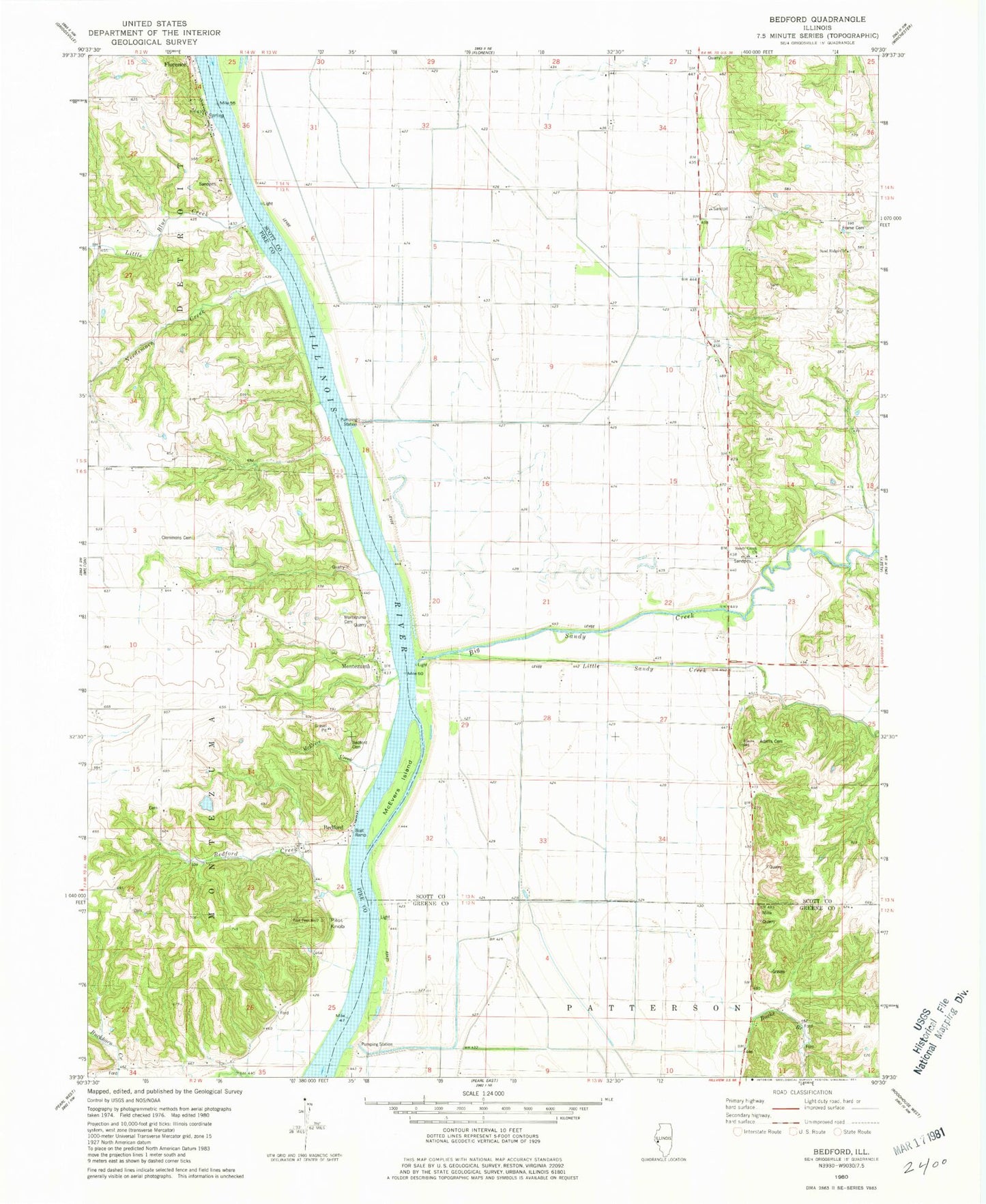
Classic USGS Bedford Illinois 7.5'x7.5' Topo Map
Couldn't load pickup availability
Historical USGS topographic quad map of Bedford in the state of Illinois. Map scale may vary for some years, but is generally around 1:24,000. Print size is approximately 24" x 27"
This quadrangle is in the following counties: Greene, Pike, Scott.
The map contains contour lines, roads, rivers, towns, and lakes. Printed on high-quality waterproof paper with UV fade-resistant inks, and shipped rolled.
Contains the following named places: Adams Family Cemetery, Bedford, Bedford Cemetery, Bedford Creek, Big Island, Big Sandy Creek, Big Swan Pumping Station, Big Swan School, Bridgeport, Brown School, Buckhorn School, Bucks Branch, Clemmons Cemetery, Coon Island School, Douglas School, Frame Cemetery, Freedom Field, Frost Airport, Glasgow Election Precinct, Hillview Pumping Station, Little Blue Creek, Little Sandy Creek, McEvers Creek, Montezuma, Montezuma Cemetery, Morgan Slough, Needsmore Creek, Pilot Knob, Sand Ridge School, Sandy Creek Church, Sugar Grove School, Thomas Quarry, Trimley Creek, Zion Neck School