
MyTopo
Classic USGS Bedford Louisiana 7.5'x7.5' Topo Map
Couldn't load pickup availability
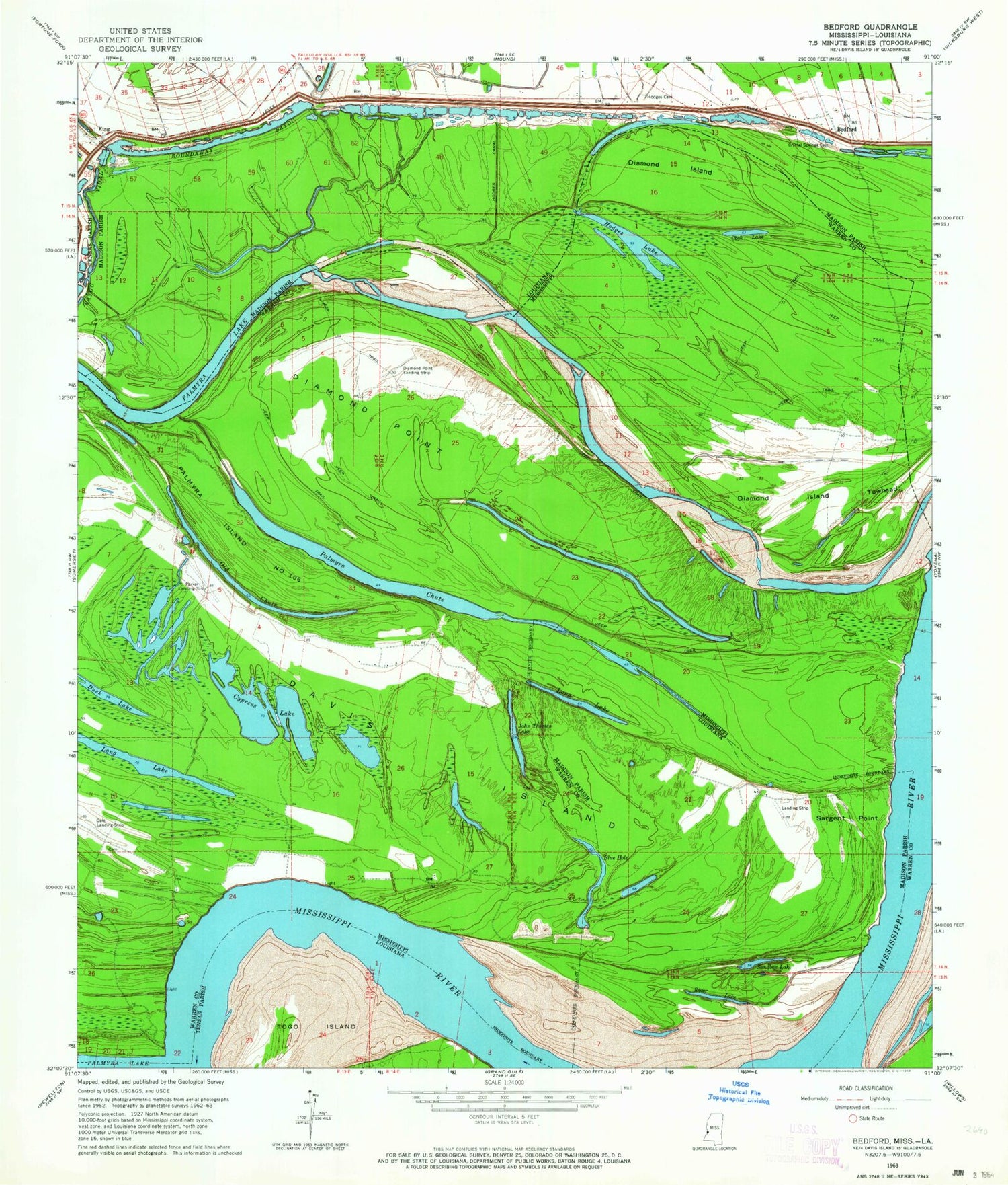
Historical USGS topographic quad map of Bedford in the states of Louisiana, Mississippi. Map scale may vary for some years, but is generally around 1:24,000. Print size is approximately 24" x 27"
This quadrangle is in the following counties: Madison, Tensas, Warren.
The map contains contour lines, roads, rivers, towns, and lakes. Printed on high-quality waterproof paper with UV fade-resistant inks, and shipped rolled.
Contains the following named places: Bayou Vidal, Bedford, BHLLC Airport, Blue Hole, Blue Lake, Brierfield, Brierfield Cemetery, Cook Lake, Coxs Towing Company Lake Dam, Crystal Springs Cemetery, Cypress Lake, Davis Island, Davis Island Bend, Diamond Island, Diamond Island Towhead, Diamond Point, Diamond Point Landing Strip, Diamond Revetment, Duck Lake, Hodge Landing, Hodges Canal, Hodges Cemetery, Hodges Lake, John Thomas Lake, Kellogg Landing, Killikrankia Cutoff, Killikrankia Plantation, King, Long Lake, Newton Bend Bar, Newtown Bend, Oak Bend, Old Chute, Palmyra, Palmyra Chute, Palmyra Island Number One Hundred Six, Palmyra Lake, Parker Landing Strip, Pilgrim Rest Church, Pilgrim Rest School, River Lake, Sandbar Lake, Sargent Point, Ursino, Ursino Bar, Ursino Landing


