MyTopo
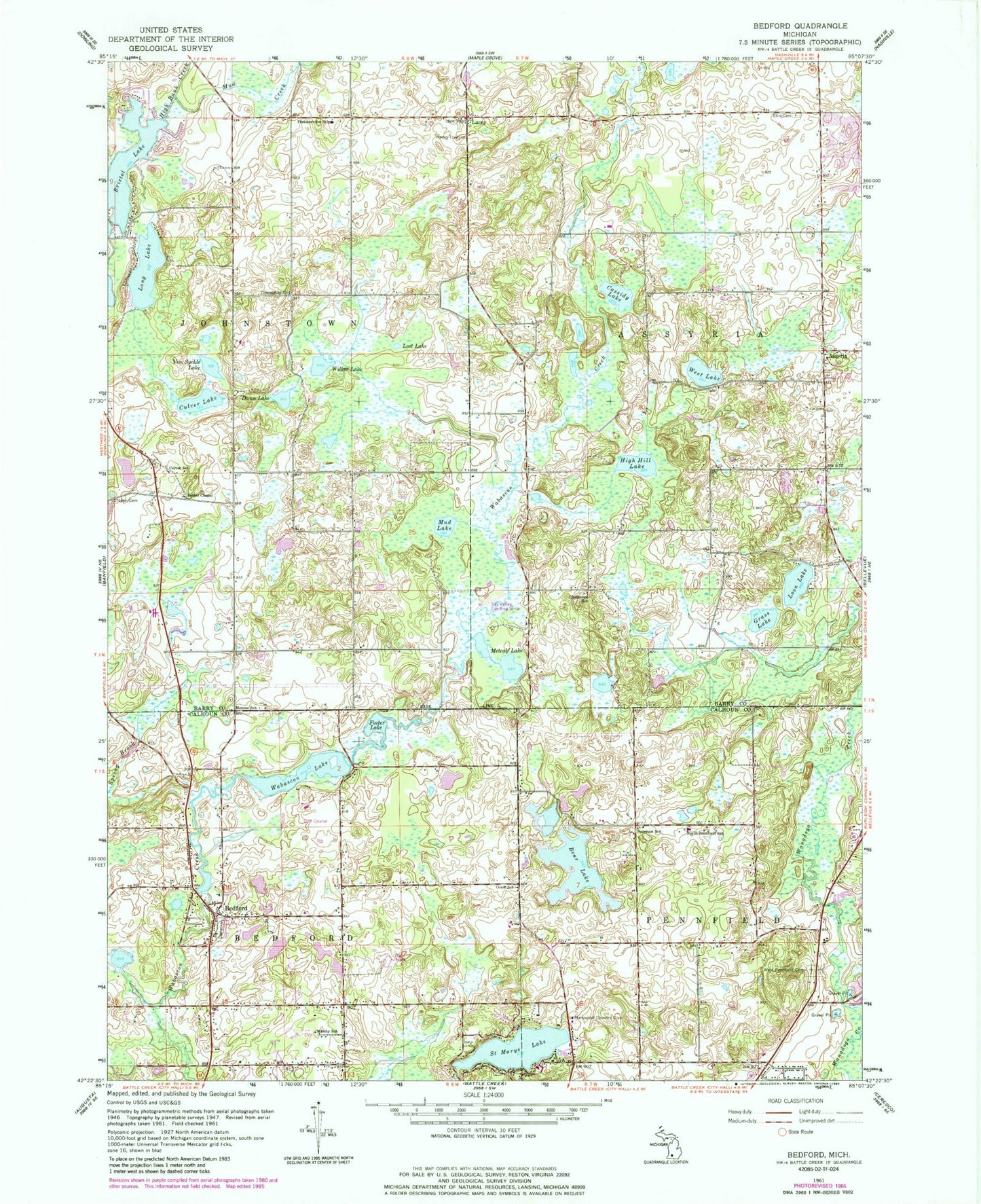
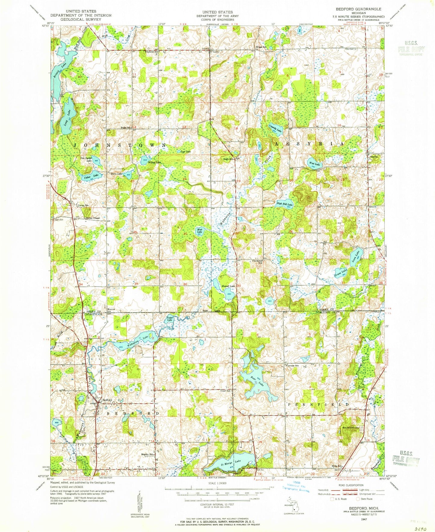
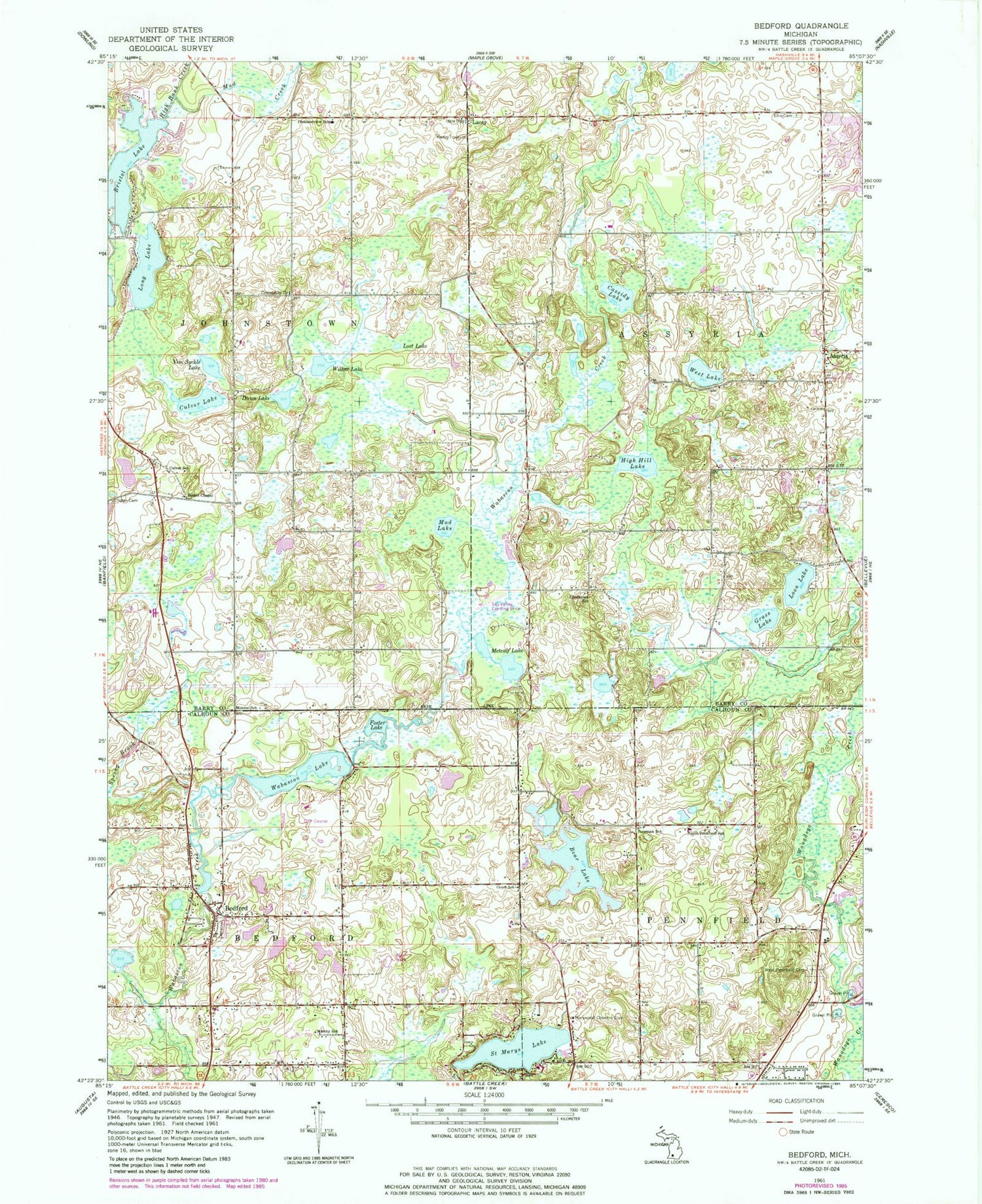
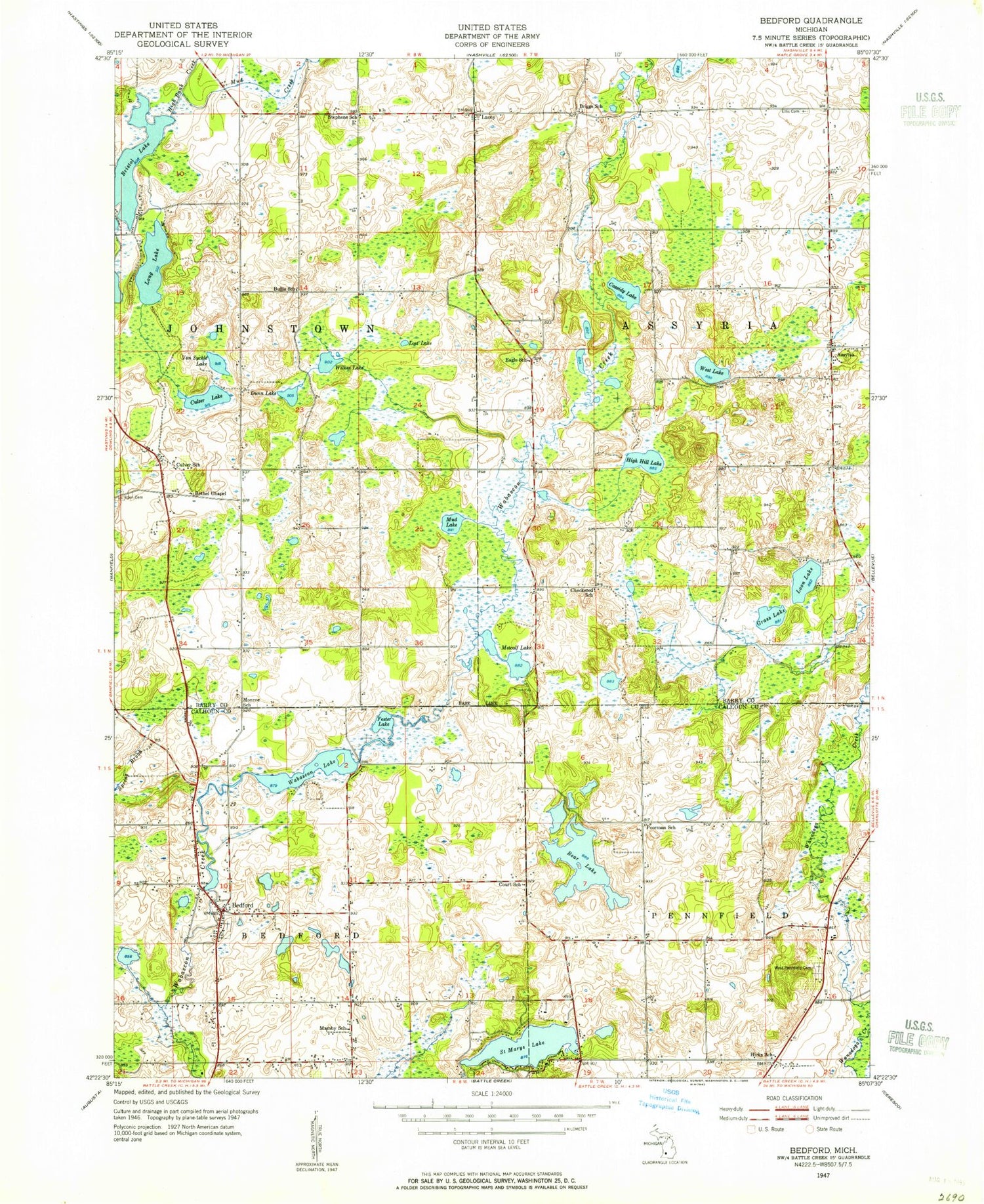
Classic USGS Bedford Michigan 7.5'x7.5' Topo Map
Couldn't load pickup availability
Historical USGS topographic quad map of Bedford in the state of Michigan. Map scale may vary for some years, but is generally around 1:24,000. Print size is approximately 24" x 27"
This quadrangle is in the following counties: Barry, Calhoun.
The map contains contour lines, roads, rivers, towns, and lakes. Printed on high-quality waterproof paper with UV fade-resistant inks, and shipped rolled.
Contains the following named places: Assyria, Assyria Cemetery, Assyria Post Office, Bear Lake, Bedford, Bedford Cemetery, Bedford Charter Township Fire Department Station 1, Bedford Post Office, Bedford Valley Golf Course, Bethel Chapel, Bristol Lake, Cassidy Lake, Charter Township of Bedford, Checkered Cemetery, Checkered School, Community Church, Culver Lake, Culver School, Dunn Lake, Ellis Cemetery, Foster Lake, Grass Lake, Hicks Cemetery, High Hill Lake, Iden Cemetery, Johnstown Township Fire Department, Lacey, Lacey Cemetery, Lacey Post Office, Long Lake, Loon Lake, Lost Lake, Mamby School, Marywood Country Club, Metcalf Lake, Monroe School, Mud Creek, Mud Lake, North Pennfield School, Pleasantview School, Pleasantville Family Church, Poorman School, Saint Marys Lake, Township of Assyria, Township of Johnstown, Von Syckle Lake, Wabascon Lake, West Lake, Wilkes Lake, ZIP Code: 49017