MyTopo
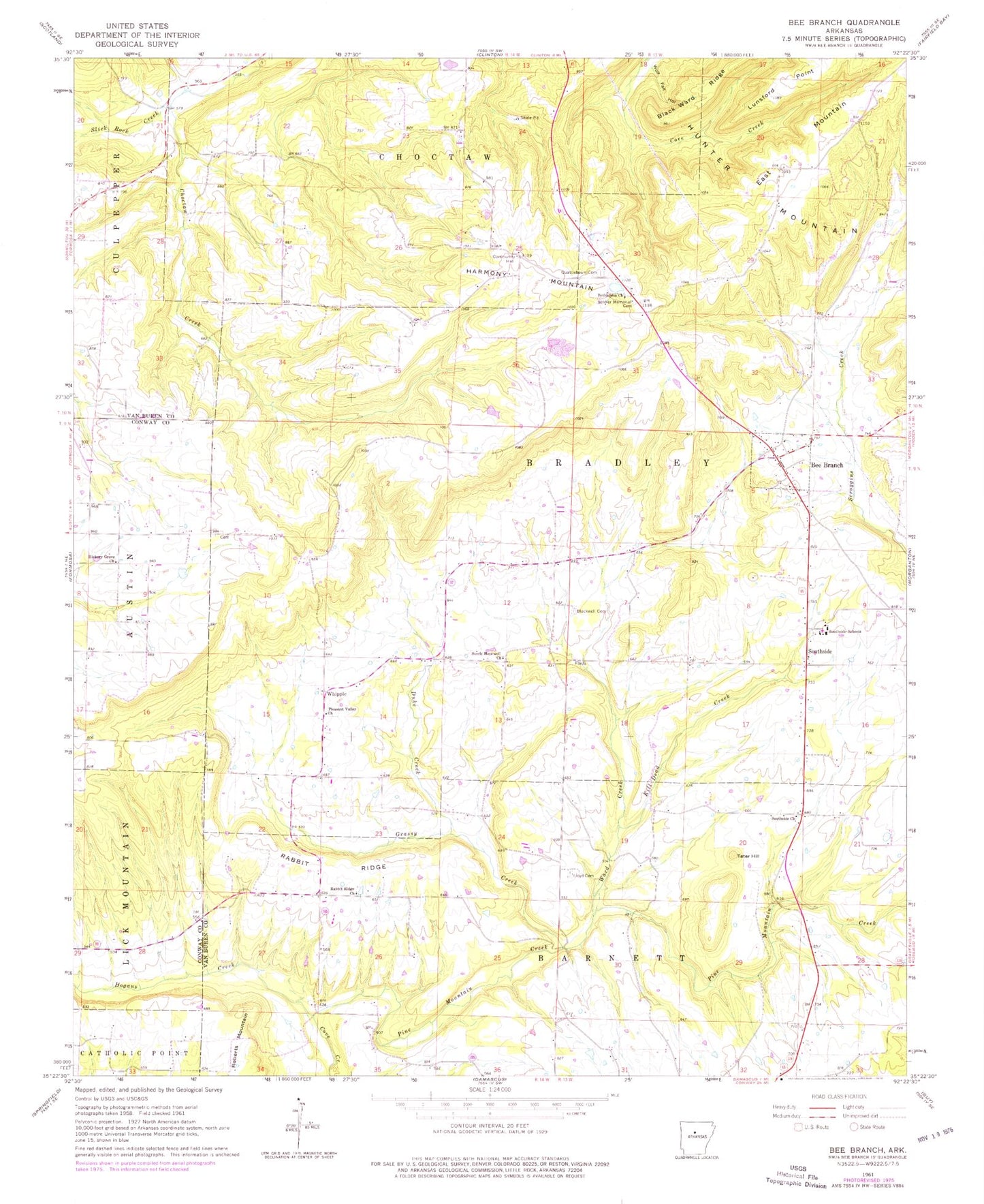
Classic USGS Bee Branch Arkansas 7.5'x7.5' Topo Map
Couldn't load pickup availability
Historical USGS topographic quad map of Bee Branch in the state of Arkansas. Map scale may vary for some years, but is generally around 1:24,000. Print size is approximately 24" x 27"
This quadrangle is in the following counties: Conway, Van Buren.
The map contains contour lines, roads, rivers, towns, and lakes. Printed on high-quality waterproof paper with UV fade-resistant inks, and shipped rolled.
Contains the following named places: B B Ranch Lake, B B Ranch Lake Dam, Bee Branch, Bee Branch Baptist Church, Bee Branch Cemetery, Bee Branch Census Designated Place, Bee Branch Post Office, Bee Branch Volunteer Fire Department, Bethlehem Church, Black Ward Ridge, Blackwell Cemetery, Duke Creek, East Mountain, Grassy Creek, Harmony Mountain, Hickory Grove Church, Hopewell Church, Johnson Branch, Kill Dead Creek, Lloyd Cemetery, Lunsford Point, Pine Mountain Creek, Pleasant Valley Church, Quattlebaum Cemetery, Rabbit Ridge, Rabbit Ridge Church, Roberts Mountain, Slick Rock Creek, South Side Elementary School, South Side High School, Southside, Southside Church, Southside Schools, Steele Hopewell United Methodist Church, Tater Hill, Township of Barnett, Township of Bradley, Ward Creek, Whipple, Wolf Fall Hollow