MyTopo
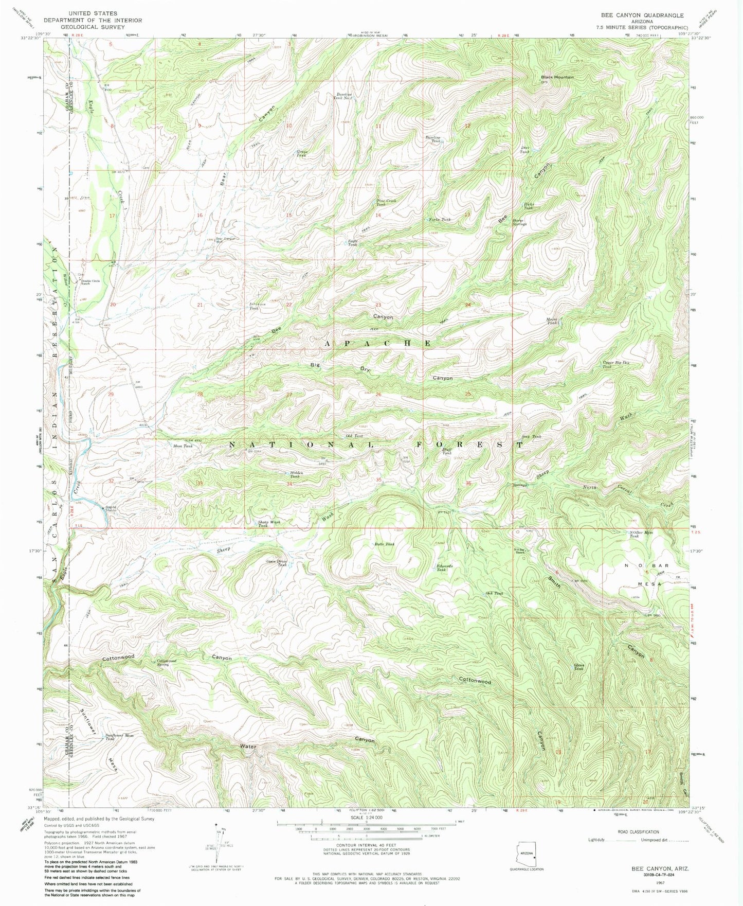
Classic USGS Bee Canyon Arizona 7.5'x7.5' Topo Map
Couldn't load pickup availability
Historical USGS topographic quad map of Bee Canyon in the state of Arizona. Map scale may vary for some years, but is generally around 1:24,000. Print size is approximately 24" x 27"
This quadrangle is in the following counties: Graham, Greenlee.
The map contains contour lines, roads, rivers, towns, and lakes. Printed on high-quality waterproof paper with UV fade-resistant inks, and shipped rolled.
Contains the following named places: Bar F Canyon, Baseline Tank, Baseline Tank Number 2, Bear Canyon, Bear Canyon Well, Bear Tank, Bee Canyon, Bee Canyon Tank, Bee Springs Tank, Big Dry Canyon, Black Mountain, Black Mountain Tank, Black Tank, Bluff Tank, Butte Tank, Butte Tank Number Two, CC Tank, Corner Tank, Cottonwood Corral, Cottonwood Spring Number 2, Cottonwood Spring Number 3, Cottonwood Tank, Coyote Tank, Deer Tank, Division Tank, Double Circle Ranch, Double Circle Ranch Airport, Eagle Elementary School, Edwards Tank, Forks Tank, Gibson Tank, Glenn Tank, Grass Tank, Greenwade Ranch, Hicks Ranch, Hicks Tank, Hidden Tank, Horse Springs, Lee Tank, Line Tank, Mesa Tank, Middle Prong Tank, Moore Ranch, Moore Tank, Mud Springs Canyon, N O Bar Mesa Tank, N O Bar Ranch, New Tank, North Corral Creek, Oak Tank, Old Tank, Open Draw Tank, Pine Creek Tank, Pine Spring Tank, Rough Ridge Tank, Sandstone Tank, Secondary Tank, Seep Tank, Sheep Springs, Sheep Wash, Sheep Wash Tank, Simmons Spring, Smith Canyon, Split Tank, ST Well, Summit Corral, Summit Spring, Sunflower Mesa, Sunflower Mesa Tank, Upper Big Dry Tank, Water Canyon, Willow Creek, Woolaroc, ZIP Code: 85533