MyTopo
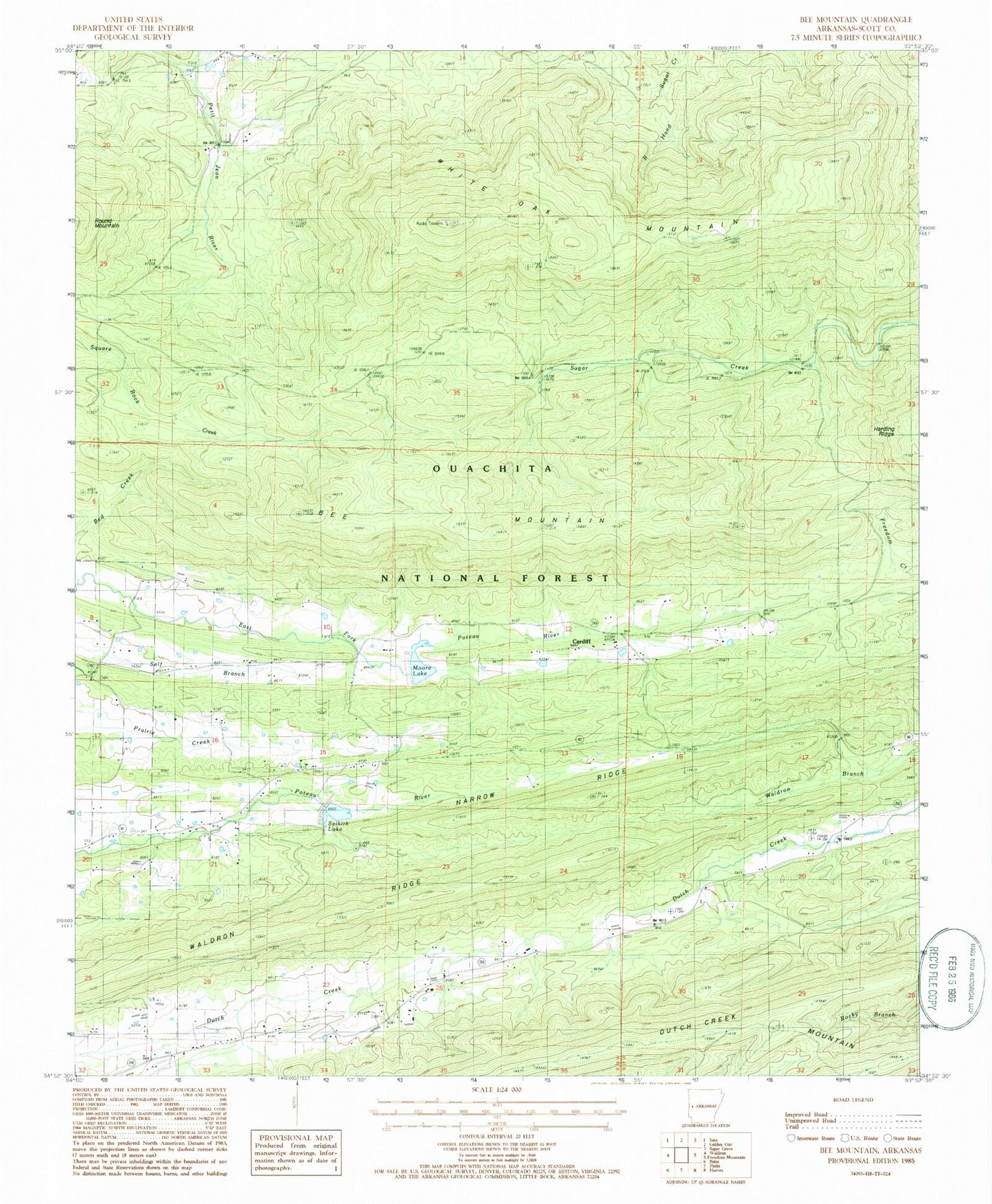
Classic USGS Bee Mountain Arkansas 7.5'x7.5' Topo Map
Couldn't load pickup availability
Historical USGS topographic quad map of Bee Mountain in the state of Arkansas. Map scale may vary for some years, but is generally around 1:24,000. Print size is approximately 24" x 27"
This quadrangle is in the following counties: Scott.
The map contains contour lines, roads, rivers, towns, and lakes. Printed on high-quality waterproof paper with UV fade-resistant inks, and shipped rolled.
Contains the following named places: Bed Creek, Bee Mountain, Cardiff, Friendship Cemetery, Friendship Church, Harding Ridge, Highway 250 Rural Volunteer Fire Department, Moore Lake, Mount Pleasant Cemetery, Mount Pleasant Church, Narrow Ridge, Poteau River Watershed Site One Dam, Poteau River Watershed Site Two Dam, Selkirk Lake, Township of Mount Pleasant, Township of Tate, Waldron Ridge, White Oak Lookout Tower, White Oak Mountain