MyTopo
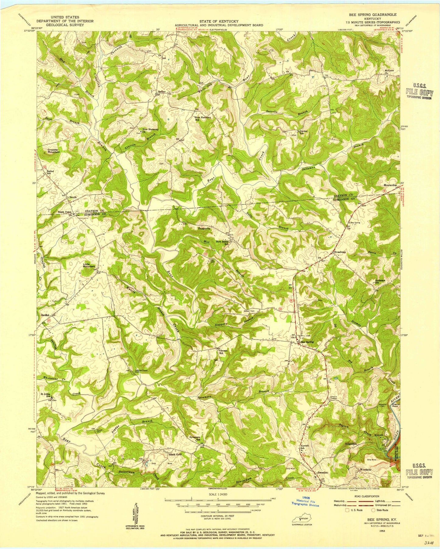
Classic USGS Bee Spring Kentucky 7.5'x7.5' Topo Map
Couldn't load pickup availability
Historical USGS topographic quad map of Bee Spring in the state of Kentucky. Map scale may vary for some years, but is generally around 1:24,000. Print size is approximately 24" x 27"
This quadrangle is in the following counties: Edmonson, Grayson.
The map contains contour lines, roads, rivers, towns, and lakes. Printed on high-quality waterproof paper with UV fade-resistant inks, and shipped rolled.
Contains the following named places: Beaverdam Creek, Bee Spring, Bee Spring Post Office, Big Branch, Black Gold, Broadway, Buck Branch, Cedar Grove Church, Chenneth Branch, Claylick Branch, Coppers Branch, Crowder Mountain, Decker School, Dismal Creek, Jock Church, Kyrock, Kyrock Church, Kyrock Elementary School, Lincoln Branch, Little Mountain, McGrew Church, Mill Branch, Mud Branch, Nappers Branch, Nells Branch, New Harmony Church, New Salem Church, Peggys Branch, Pigeon Creek, Prosperity, Ridgedale, Sadler, Saint Johns School, Salt Well Branch, Saltsman Branch, Shady Lake, Sorrells Branch, South, South Union Church, Sunfish, Sunfish Creek, Sweeden, Sweeden Post Office, Sycamore Branch, Vincent Church, Watery Branch, West Point, Whetstone Creek, White Oak Branch, Woodside, ZIP Codes: 42207, 42285