MyTopo
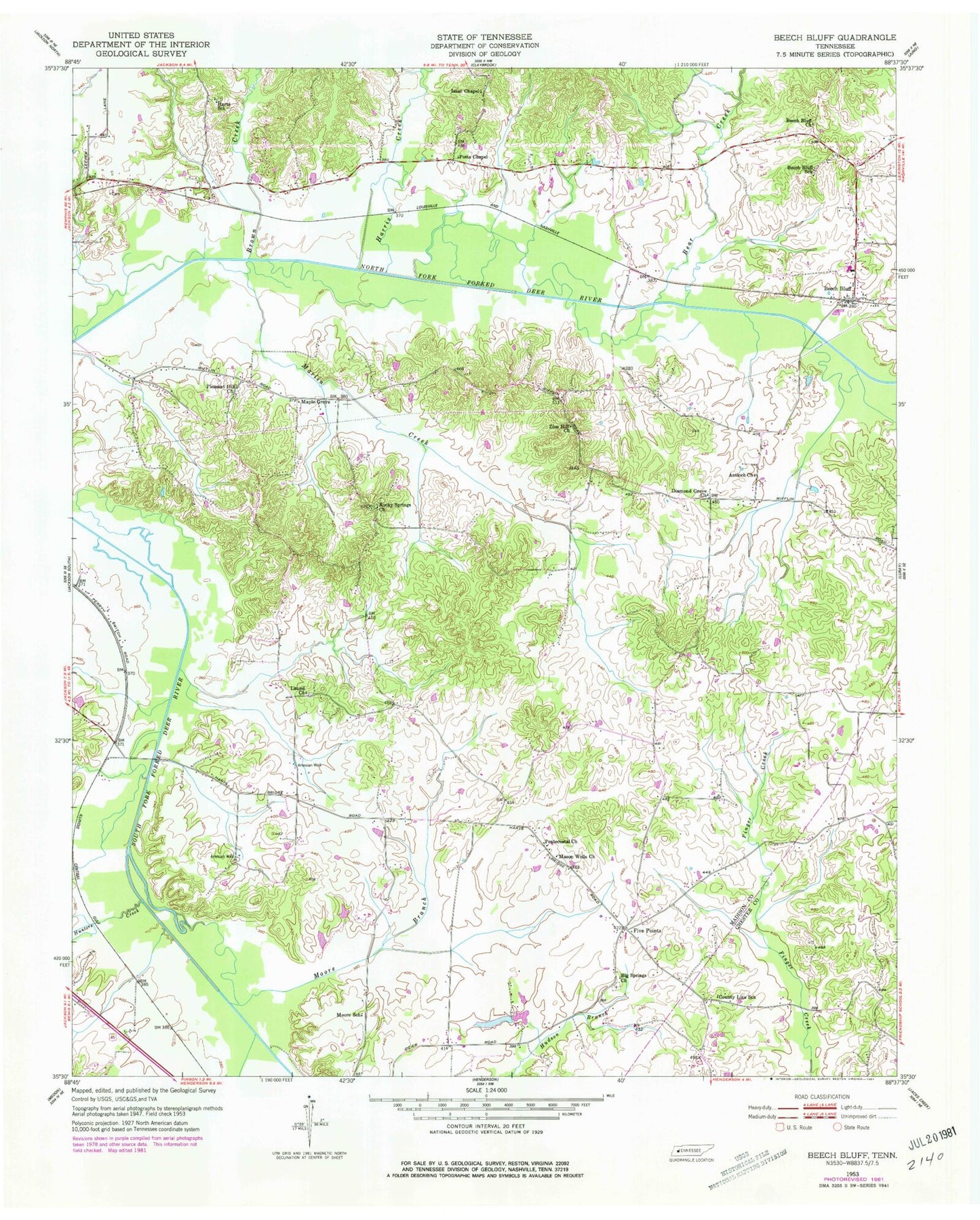
Classic USGS Beech Bluff Tennessee 7.5'x7.5' Topo Map
Couldn't load pickup availability
Historical USGS topographic quad map of Beech Bluff in the state of Tennessee. Map scale may vary for some years, but is generally around 1:24,000. Print size is approximately 24" x 27"
This quadrangle is in the following counties: Chester, Madison.
The map contains contour lines, roads, rivers, towns, and lakes. Printed on high-quality waterproof paper with UV fade-resistant inks, and shipped rolled.
Contains the following named places: Antioch Church, Bear Creek, Beech Bluff, Beech Bluff Census Designated Place, Beech Bluff Church, Beech Bluff Elementary School, Beech Bluff Post Office, Beech Bluff School, Big Springs Church, Brown Creek, Commissioner District 8, County Line School, Diamond Grove Church, Five Points, Harris Creek, Hunters Creek, Hurts Chapel Christian Methodist Episcopal Church, Hurts School, Isaac Chapel, Laurel Church, Madison County Fire Department Station 15, Madison County Fire Department Station 4, Maple Grove, Marlin Creek, Mason Wells Church, Moore Branch, Moore School, Pleasant Hill Church, Potts Chapel, Rocky Springs Church, Southfork Airport, Zion Hill Church