MyTopo
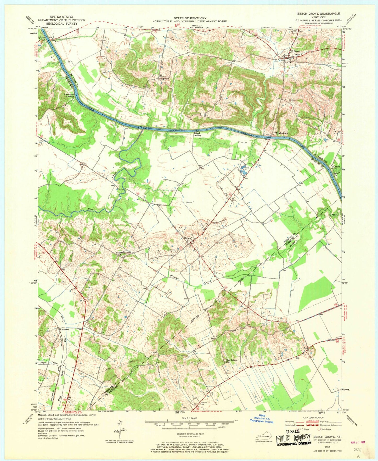
Classic USGS Beech Grove Kentucky 7.5'x7.5' Topo Map
Couldn't load pickup availability
Historical USGS topographic quad map of Beech Grove in the state of Kentucky. Map scale may vary for some years, but is generally around 1:24,000. Print size is approximately 24" x 27"
This quadrangle is in the following counties: Hopkins, McLean, Webster.
The map contains contour lines, roads, rivers, towns, and lakes. Printed on high-quality waterproof paper with UV fade-resistant inks, and shipped rolled.
Contains the following named places: Beech Grove, Beech Grove Census Designated Place, Beech Grove Chapel, Beech Grove Post Office, Beech Grove Volunteer Fire Department, Chelsea, Coltharpe Hills, Congleton, Deer Creek, Elmwood, James Bethel Gresham Memorial Bridge, Lemon, Mason Creek, Mount Zion Cemetery, New Salem, New Salem Church, Old Onton Cemetery, Onton, Onton Cemetery, Onton Census Designated Place, Onton Fire Department, Roland Landing, Samuels Cemetery, Sassafras Grove Cemetery, Sassafras Grove Methodist Church, Steamport Landing, Sugar Camp Creek, Wrightsburg, Wrightsburg Hill, Yellow Creek, ZIP Codes: 42322, 42456