MyTopo
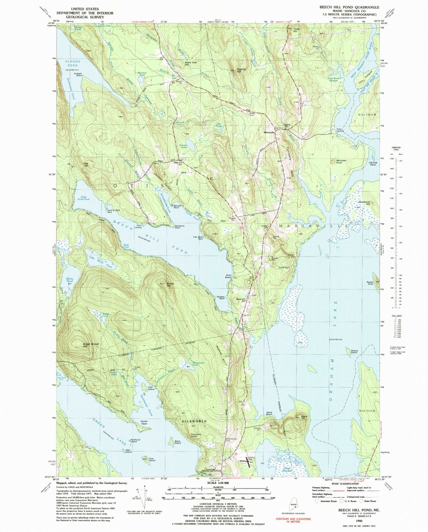
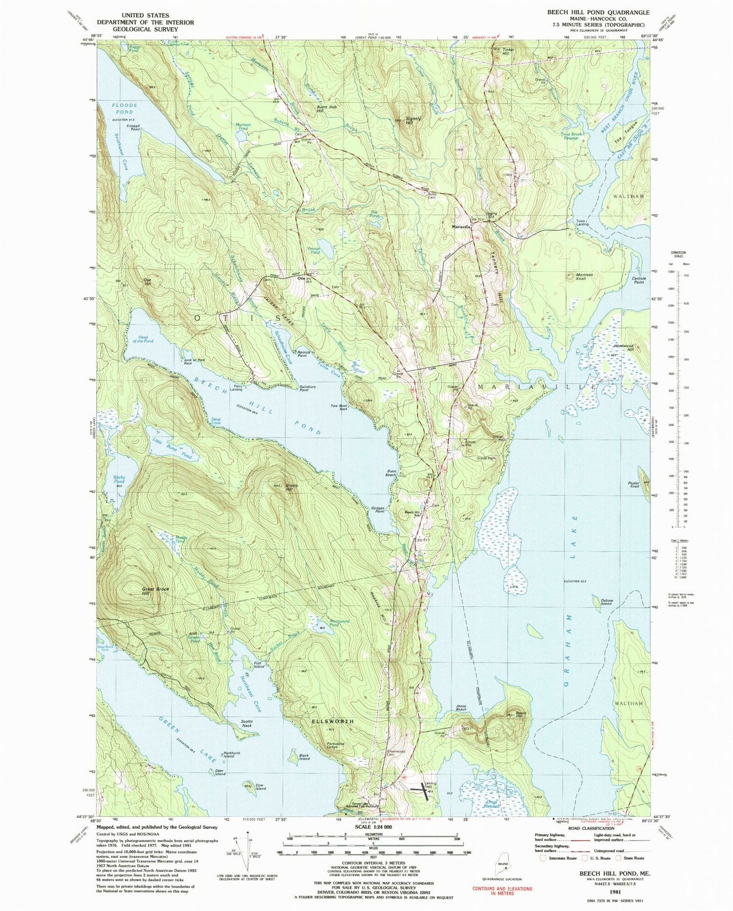
Classic USGS Beech Hill Pond Maine 7.5'x7.5' Topo Map
Couldn't load pickup availability
Historical USGS topographic quad map of Beech Hill Pond in the state of Maine. Typical map scale is 1:24,000, but may vary for certain years, if available. Print size: 24" x 27"
This quadrangle is in the following counties: Hancock.
The map contains contour lines, roads, rivers, towns, and lakes. Printed on high-quality waterproof paper with UV fade-resistant inks, and shipped rolled.
Contains the following named places: Beech Hill, Beech Hill Pond, Black Island, Boggy Brook, Buggy Pond, Burnt Hub Hill, Little Burnt Pond, Cow Island, Dumb Brook, East Branch Union River, Fish Island, Floods Pond, Graham Lake, Great Brook Hill, Greenwood Cemetery, Grotto Hill, Hardwood Hill, Harvey Brook, Hopkins Hill, Jordan Ledge, Kimball Point, Lincoln School, Little Dumb Brook, Morrison Knoll, Morrison Pond, Mosquito Brook, Muddy Pond, Northeast Cove, Oak Hill, Porcupine Ledge, Remick Point, Rile Pond, Rocky Pond, Salisbury Point, Schoolhouse Brook, Schoolhouse Cove, Scotts Neck, Sightly Hill, Southwest Cove, Tannery Brook, Tannery Hill, Tinker Hill, West Branch Union River, Wormwood Pond, Youngs Pond, Lakewood, Mariaville, Otis, Green Lake, Town of Mariaville, Town of Otis, Green Lake Dam, Beech Hill Cemetery, Beech Hill School, Carlisle Point, Deep Cove, Deer Island, Dodges Point, Dunn Beach, Green Lake National Fish Hatchery, Head of the Pond, Jesse Beach, Junk of Pork Rock, Keisers Pond, Mink Brook, Otis Baptist Church, Parkhurst Island, Perry Landing, Pyles Cemetery, Sucker Brook, The Tongue, Town Landing, Trout Brook Flowage, Turtle Brook, Turtle Cove, Two Bush Rock, Mariaville Volunteer Fire Department, Peasley Field, Tannery Hill Cemetery, Otis Public Library