
MyTopo
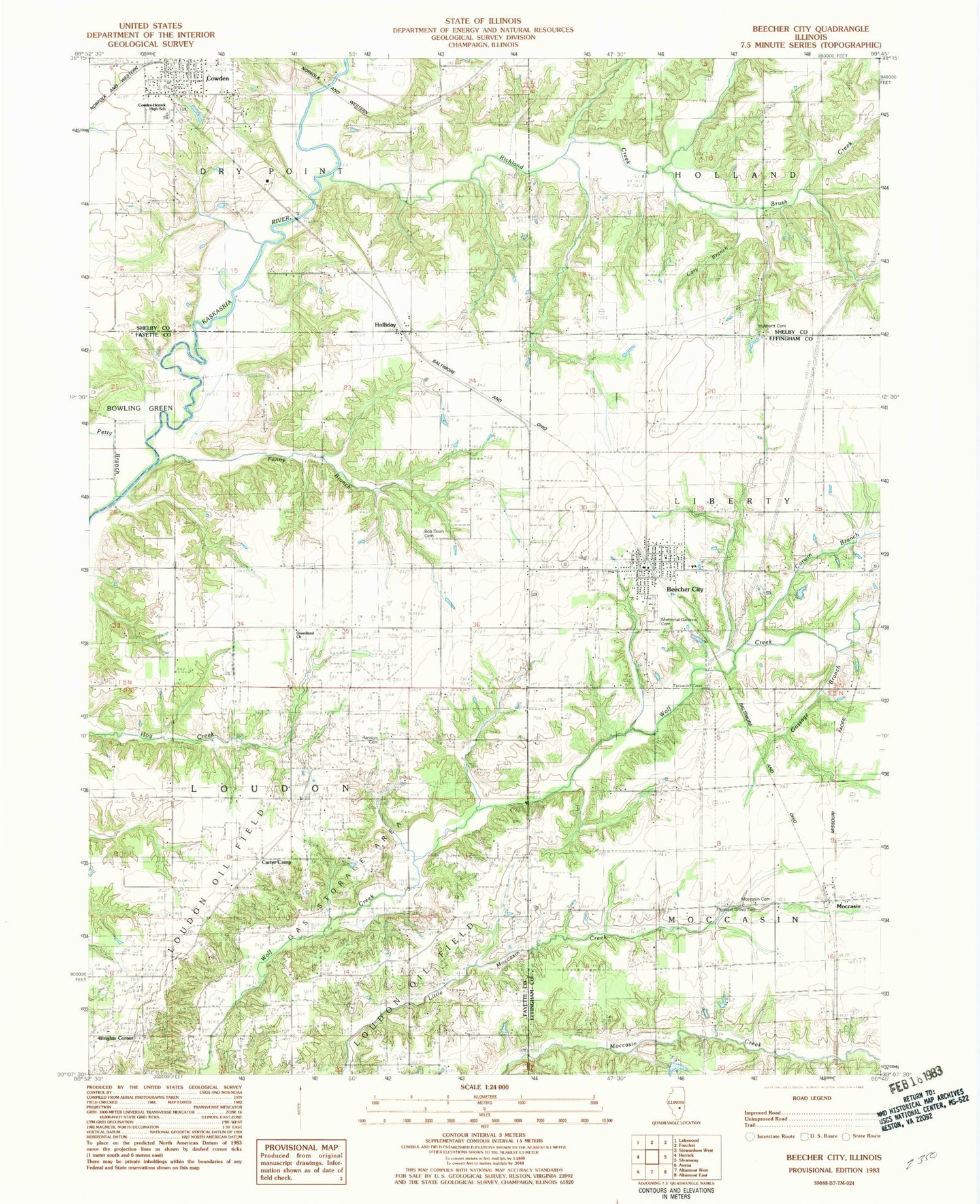
Classic USGS Beecher City Illinois 7.5'x7.5' Topo Map
Couldn't load pickup availability
Historical USGS topographic quad map of Beecher City in the state of Illinois. Map scale may vary for some years, but is generally around 1:24,000. Print size is approximately 24" x 27"
This quadrangle is in the following counties: Effingham, Fayette, Shelby.
The map contains contour lines, roads, rivers, towns, and lakes. Printed on high-quality waterproof paper with UV fade-resistant inks, and shipped rolled.
Contains the following named places: Beecher Cemetery, Beecher City, Beecher City Grade School, Beecher City Junior-Senior High School, Beecher City Post Office, Bob Doan Cemetery, Brush Creek, Buzzard School, Carter Camp, Carter Refinery, Cary Branch, Corwin Branch, Cowden, Cowden Bridge, Cowden Elementary School, Cowden-Herrick High School, Fanny Branch, Gossage Branch, Greenland, Greenland Church, Greenland School, Holliday, Hubbartt Cemetery, Hubbartt Church, Logue School, Loudon Oil Field, Memorial Gardens Cemetery, Miller School, Moccasin, Moccasin Cemetery, Oakland School, Petty Branch, Pleasant Grove Cemetery, Pleasant Hill School, Prairie Union School, Ransom Cemetery, Ransom Church, Richland Creek, Tipsword Cemetery, Township of Dry Point, Tri - County Fire Station of Beecher City, Village of Beecher City, Village of Cowden, Wrights Corner, ZIP Code: 62414


