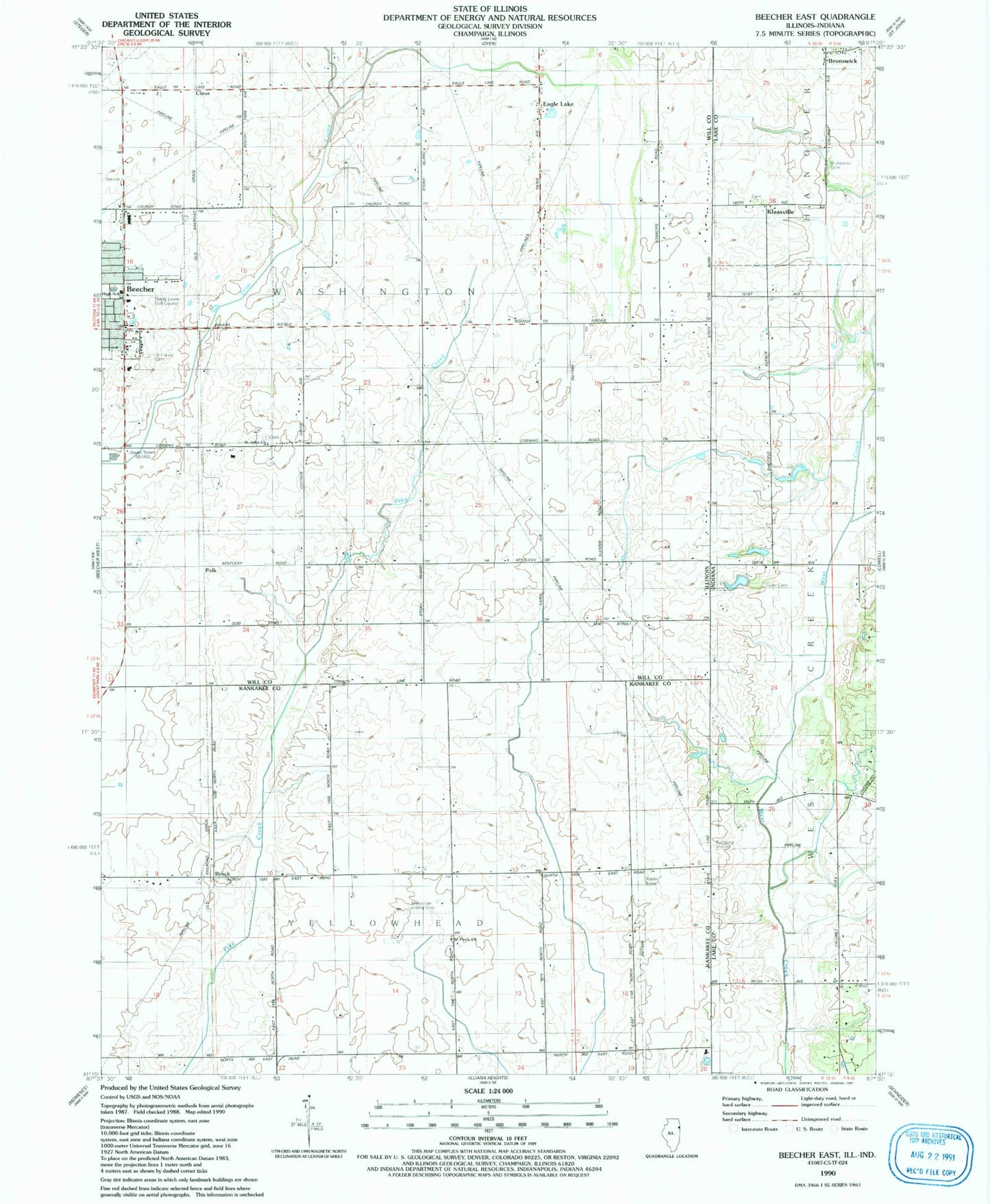
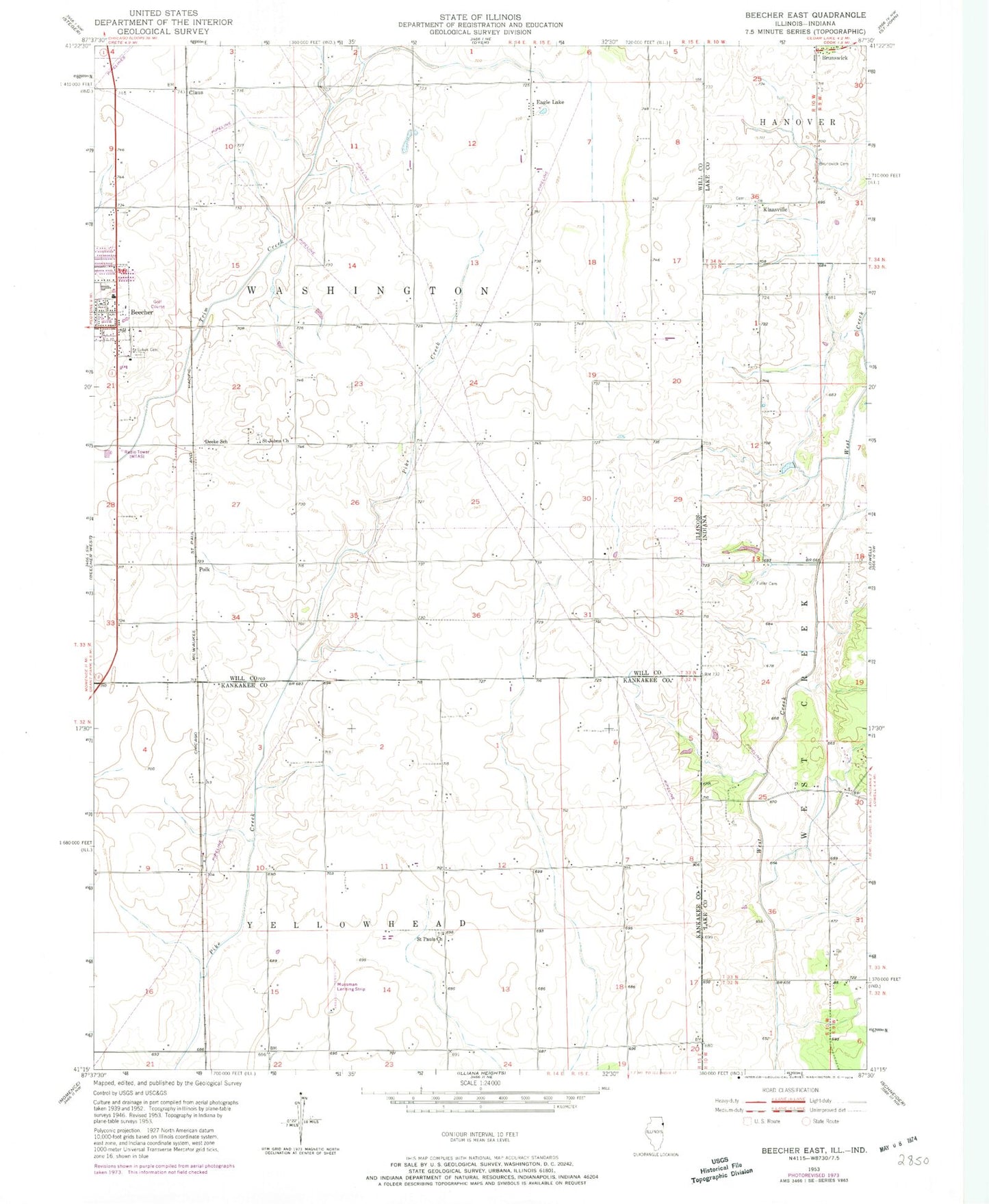
MyTopo
Classic USGS Beecher East Illinois 7.5'x7.5' Topo Map
Couldn't load pickup availability
Historical USGS topographic quad map of Beecher East in the states of Illinois, Indiana. Map scale may vary for some years, but is generally around 1:24,000. Print size is approximately 24" x 27"
This quadrangle is in the following counties: Kankakee, Lake, Will.
The map contains contour lines, roads, rivers, towns, and lakes. Printed on high-quality waterproof paper with UV fade-resistant inks, and shipped rolled.
Contains the following named places: Beecher, Beecher High School, Brock, Brunswick Cemetery, Bulterna Farms and Greenhouses, Camp Area Number Five, Claus, Deeke School, Eagle Lake, Eagle Lake Census Designated Place, Fuller Cemetery, Goose Pond Swamp, Klaasville, Mussman Airport, Polk, Saint John United Church of Christ, Saint Johns United Church of Christ Cemetery, Saint Lukes Cemetery, Saint Paul Lutheran Cemetery, Saint Pauls Lutheran Church, Shady Lawn Golf Course, Township of Washington, Township of Yellowhead, Village of Beecher, Washington Township Center Shopping Center, WTAS-FM (Crete), ZIP Code: 60401