
MyTopo
Classic USGS Beechey Point B-3 SE Alaska 7.5'x7.5' Topo Map
Regular price
$16.95
Regular price
Sale price
$16.95
Unit price
per
Couldn't load pickup availability
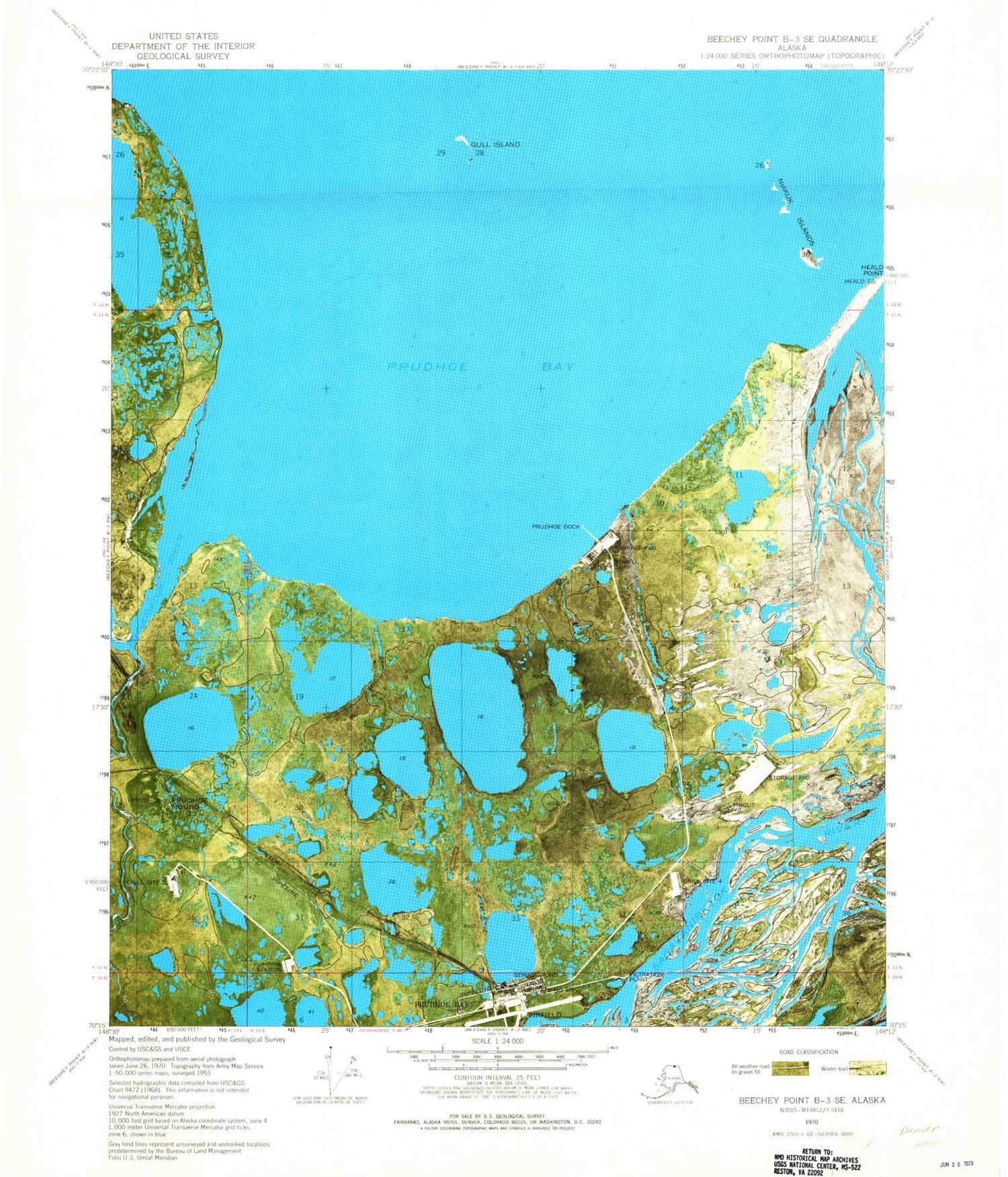
Historical USGS topographic quad map of Beechey Point B-3 SE in the state of Alaska. Map scale may vary for some years, but is generally around 1:24,000. Print size is approximately 24" x 27"
This quadrangle is in the following counties: North Slope.
The map contains contour lines, roads, rivers, towns, and lakes. Printed on high-quality waterproof paper with UV fade-resistant inks, and shipped rolled.
Contains the following named places: Dowell Camp, Drill Site 2, Greater Prudhoe Bay Fire Department Station 2, Gull Island, Niako Island, Niakuk Islands, Point Chandos, Prudhoe Bay, Prudhoe Bay Airport, Prudhoe Dock, Prudhoe Mound, Put River Number 1, Putuligayuk River, Yarborough Inlet


