MyTopo
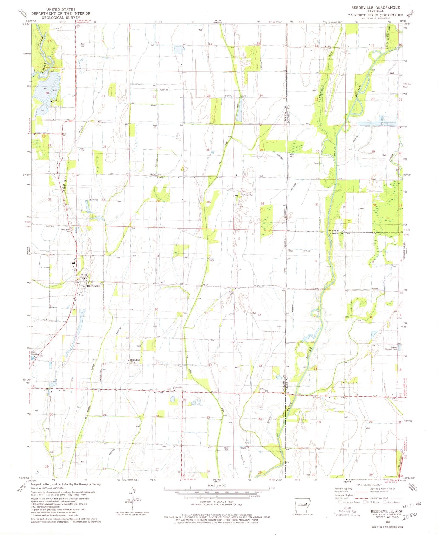
Classic USGS Beedeville Arkansas 7.5'x7.5' Topo Map
Couldn't load pickup availability
Historical USGS topographic quad map of Beedeville in the state of Arkansas. Map scale may vary for some years, but is generally around 1:24,000. Print size is approximately 24" x 27"
This quadrangle is in the following counties: Cross, Jackson, Poinsett.
The map contains contour lines, roads, rivers, towns, and lakes. Printed on high-quality waterproof paper with UV fade-resistant inks, and shipped rolled.
Contains the following named places: Beedeville, Beedeville Church, Beedeville Post Office, Citizenship Church, Citizenship School, Cow Lake, Cow Lake Church, Cow Lake Ditch, Dale Cemetery, Eight Mile Cemetery, Eight Mile Fire Department Station, Eight Mile Fire Department Station - Storage Garage, Eightmile, Givens Cemetery, Jones Cemetery, Love Chapel, May Branch Lateral, McFadden, Old Forked Slough, Proctor School, Threemile Creek, Town of Beedeville, Township of Cow Lake, Walker Cemetery, ZIP Codes: 72014, 72347