MyTopo
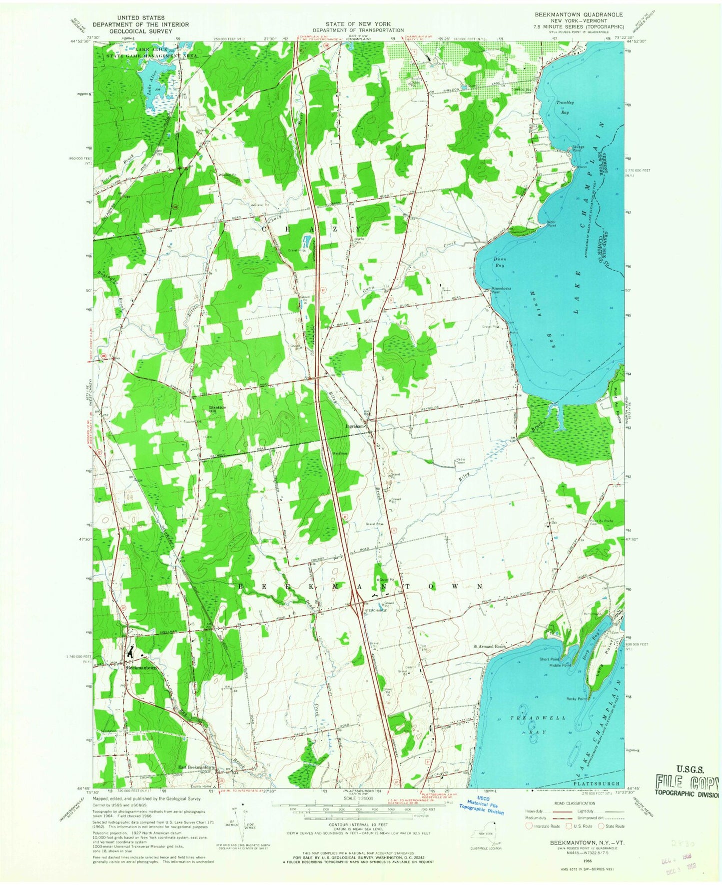
Classic USGS Beekmantown New York 7.5'x7.5' Topo Map
Couldn't load pickup availability
Historical USGS topographic quad map of Beekmantown in the state of New York. Map scale may vary for some years, but is generally around 1:24,000. Print size is approximately 24" x 27"
This quadrangle is in the following counties: Clinton, Grand Isle.
The map contains contour lines, roads, rivers, towns, and lakes. Printed on high-quality waterproof paper with UV fade-resistant inks, and shipped rolled.
Contains the following named places: Allen School, Barnes School, Beekman Lane Farms, Beekmantown, Beekmantown Northbound Rest Area, Beekmantown Southbound Rest Area, Boyington Brook, Bubbins Farm, Clearfield Farm, Deep Bay, Doane Cemetery, Dunn Bay, East Beekmantown, Giroux's Poultry Farm, Gregware Dairy Farm, Guay Creek, Hays School, Ingraham, Lake Alice, Long Point, Mar-lyn Farms, Middle Bay, Middle Point, Minnetoska Point, Monty Bay, Monty's Bay Campsites, Point Au Roche, Point Au Roche Cemetery, Point au Roche Church, Point Comfort, Riley Brook, Rocky Point, Saint Armand Beach, Savage Point, Short Point, Stratton Hill, Stratton Hill School, Town of Beekmantown, Town of Chazy, Treadwell Bay, Trombley Bay, Trombley Bay Cemetery, Wool Point