MyTopo
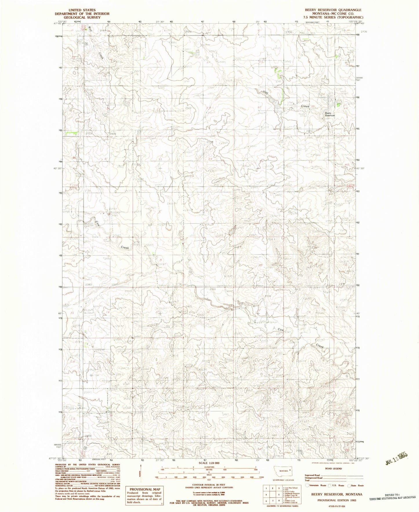
Classic USGS Beery Reservoir Montana 7.5'x7.5' Topo Map
Couldn't load pickup availability
Historical USGS topographic quad map of Beery Reservoir in the state of Montana. Map scale may vary for some years, but is generally around 1:24,000. Print size is approximately 24" x 27"
This quadrangle is in the following counties: McCone.
The map contains contour lines, roads, rivers, towns, and lakes. Printed on high-quality waterproof paper with UV fade-resistant inks, and shipped rolled.
Contains the following named places: 22N49E06CABA01 Well, 22N49E08ADDC01 Well, 22N49E08BDDD01 Well, 22N49E18BCCB01 Well, 22N49E20AACC01 Well, 22N49E21CABD01 Well, 22N49E28BCCB01 Well, 22N49E29CCDC01 Well, 22N49E30ACCC01 Well, 23N49E14CDCC01 Well, 23N49E25BC__01 Well, 23N49E28ABAB01 Well, Beery Reservoir, Berrys Land Dam, Berrys Land Number 4 Dam, Immanuel Lutheran Cemetery, Immanuel Lutheran Church, Tillman Number 3 Dam, Voegele Number 1 Dam