
MyTopo
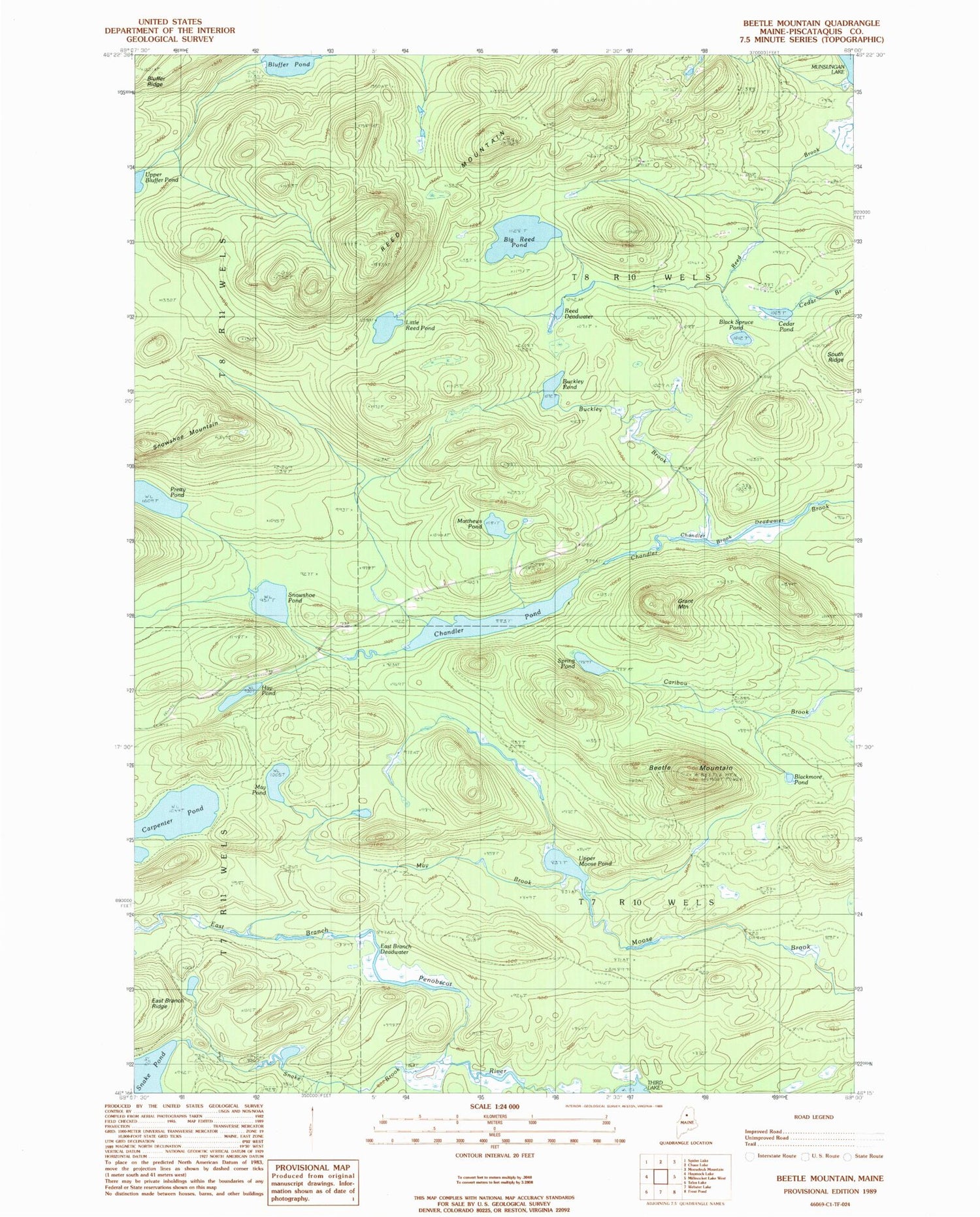
Classic USGS Beetle Mountain Maine 7.5'x7.5' Topo Map
Couldn't load pickup availability
Historical USGS topographic quad map of Beetle Mountain in the state of Maine. Typical map scale is 1:24,000, but may vary for certain years, if available. Print size: 24" x 27"
This quadrangle is in the following counties: Piscataquis.
The map contains contour lines, roads, rivers, towns, and lakes. Printed on high-quality waterproof paper with UV fade-resistant inks, and shipped rolled.
Contains the following named places: Beetle Mountain, Big Reed Pond, Black Spruce Pond, Blackmore Pond, Bluffer Pond, Buckley Brook, Buckley Pond, Carpenter Pond, Cedar Pond, Chandler Brook Deadwater, Chandler Pond, East Branch Deadwater, Grant Mountain, Hay Pond, Little Reed Pond, Matthews Pond, May Brook, May Pond, Pretty Pond, Reed Brook, Reed Deadwater, Reed Mountain, Snake Brook, Snowshoe Mountain, Snowshoe Pond, Spring Pond, Upper Bluffer Pond, Upper Moose Pond, T7 R10 WELS, T8 R10 WELS


