MyTopo
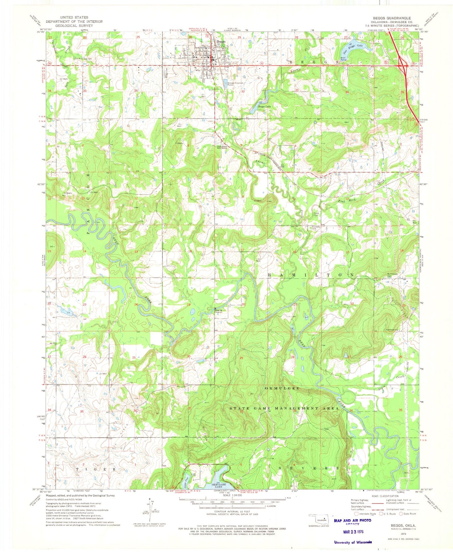
Classic USGS Beggs Oklahoma 7.5'x7.5' Topo Map
Couldn't load pickup availability
Historical USGS topographic quad map of Beggs in the state of Oklahoma. Typical map scale is 1:24,000, but may vary for certain years, if available. Print size: 24" x 27"
This quadrangle is in the following counties: Okmulgee.
The map contains contour lines, roads, rivers, towns, and lakes. Printed on high-quality waterproof paper with UV fade-resistant inks, and shipped rolled.
Contains the following named places: Adams Creek, Beggs, Beggs Cemetery, Beggs Lake, Checkerboard Creek, Faith Manna Bible Mission, Flat Rock Creek, Huckaby - Perryman Cemetery, Lions Cove, Negro Creek, New Beggs Lake, Northwest Cemetery, Northwest Church, Okmulgee State Game Management Area, Old Post Oak Cemetery, Stake Cemetery, Oknoname 111008 Dam, Oknoname 111008 Reservoir, Beggs Dam, New Beggs Lake Dam, New Beggs Lake, Oknoname 111087 Dam, Oknoname 111087 Reservoir, Laden, Baptist Church, Beggs High School, Beggs Post Office, Township of Hamilton, Creek Oklahoma Tribal Statistical Area, Okmulgee Division, City of Beggs, Beggs Volunteer Fire Department, Beggs City Police Department