MyTopo
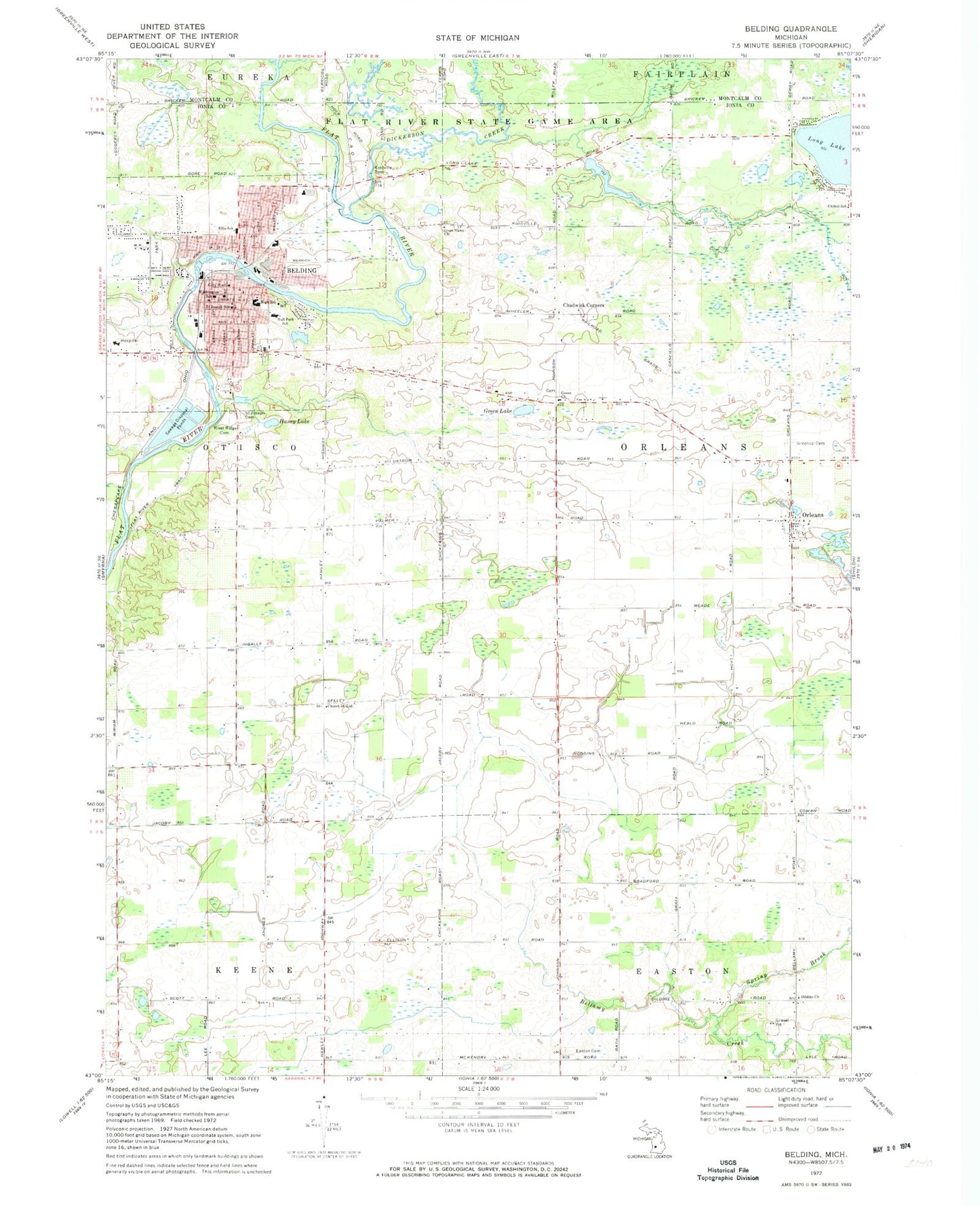
Classic USGS Belding Michigan 7.5'x7.5' Topo Map
Couldn't load pickup availability
Historical USGS topographic quad map of Belding in the state of Michigan. Map scale may vary for some years, but is generally around 1:24,000. Print size is approximately 24" x 27"
This quadrangle is in the following counties: Ionia, Montcalm.
The map contains contour lines, roads, rivers, towns, and lakes. Printed on high-quality waterproof paper with UV fade-resistant inks, and shipped rolled.
Contains the following named places: Alvah N Belding Library Historical Marker, Alvah N Belding Public Library, Belding, Belding Assembly of God Church, Belding Bible Church, Belding Fire Department, Belding Free Methodist Church, Belding High School, Belding Life Emergency Medical Services, Belding Middle School, Belding Police Department, Belding Post Office, Belding Station, Belding Wesleyan Methodist Church, Belrockton Dormitory Historical Marker, Chadwick Corners, Chadwick Post Office, Chadwick Station, Chandler Woods Charter Academy, Chittel School, Church of Jesus Christ of Latter Day Saints, City of Belding, Congregational Church, Dickerson Creek, Dildine Church, Easton Cemetery, Ellis School, First Baptist Church, Green Church, Green Lake, Greene Cemetery, Greenop Cemetery, Haney Lake, Holy Cross Lutheran Church, Jesus Name Church, Kiddville Dam, Kiddville Post Office, Lake Ranney, Miriam Post Office, Old Belding Cemetery, Orleans, Orleans Bible Church, Orleans Post Office, Orleans Station, Orleans Township Volunteer Fire Department, Pere Marquette Railway Depot Historical Marker, River Ridge Cemetery, Saint Joseph Cemetery, Saint Joseph School, Snell Post Office, Spring Brook, Township of Orleans, United Methodist Church, Wabasis Creek, Washington School