MyTopo
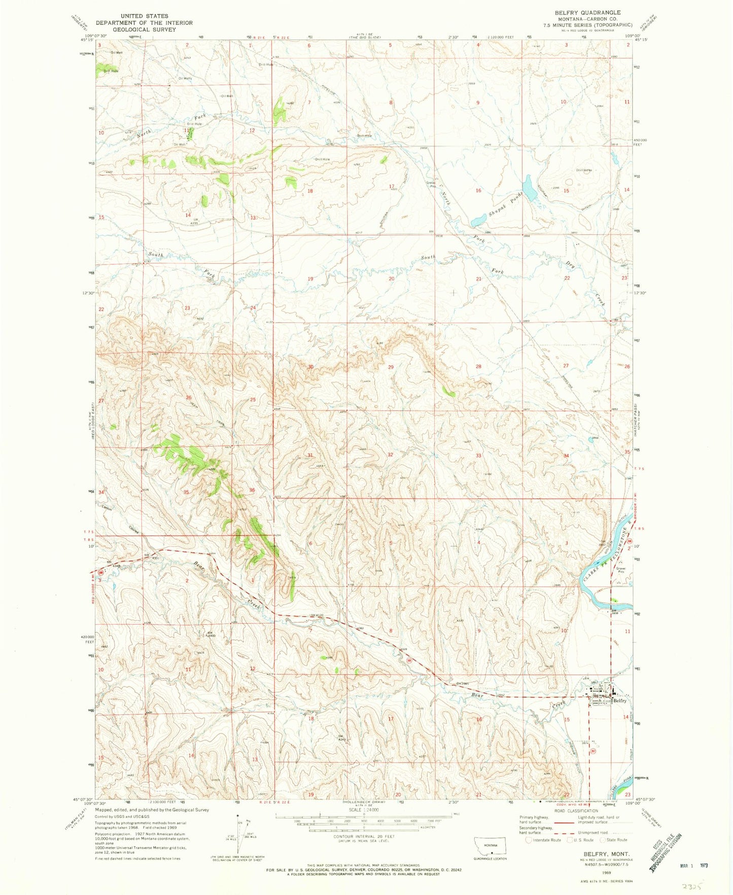
Classic USGS Belfry Montana 7.5'x7.5' Topo Map
Couldn't load pickup availability
Historical USGS topographic quad map of Belfry in the state of Montana. Map scale may vary for some years, but is generally around 1:24,000. Print size is approximately 24" x 27"
This quadrangle is in the following counties: Carbon.
The map contains contour lines, roads, rivers, towns, and lakes. Printed on high-quality waterproof paper with UV fade-resistant inks, and shipped rolled.
Contains the following named places: 08S22E15ADBC01 Well, 59007, Belfry, Belfry Post Office, Belfry Rural Fire District 9, Belfry School, Belfry United Methodist Church, Carbon County, Clarks Fork of the Yellowstone River Bridge, Higham Ditch, Larkin Coulee, North Fork Dry Creek, Olivers, Saint Johns Lutheran Church, Shupak Ditch, Shupak Number 1 Dam, Shupak Number 2 Dam, Shupak Ponds, South Fork Dry Creek, Sunnyside School, The Church of Jesus Christ of Latter Day Saints, Youst Ditch