MyTopo
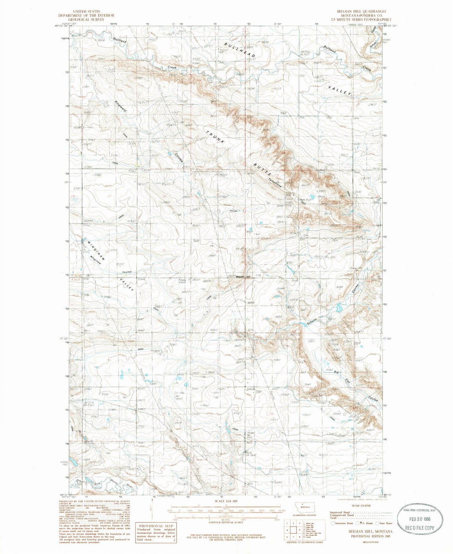
Classic USGS Belgian Hill Montana 7.5'x7.5' Topo Map
Regular price
$16.95
Regular price
Sale price
$16.95
Unit price
per
Couldn't load pickup availability
Historical USGS topographic quad map of Belgian Hill in the state of Montana. Map scale may vary for some years, but is generally around 1:24,000. Print size is approximately 24" x 27"
This quadrangle is in the following counties: Pondera.
The map contains contour lines, roads, rivers, towns, and lakes. Printed on high-quality waterproof paper with UV fade-resistant inks, and shipped rolled.
Contains the following named places: Barber Coulee, Belgian Church, Belgian Colony, Belgian Hill, Belgian School, Bullhead Valley, KZIN-FM (Shelby), L 2 Canal, L 9 Canal, L Canal, Munyon School, Ringwald Coulee, Sacred Heart Cemetery, Telephone Hill, Trunk Butte, Wingina, Winginaw Valley School