
MyTopo
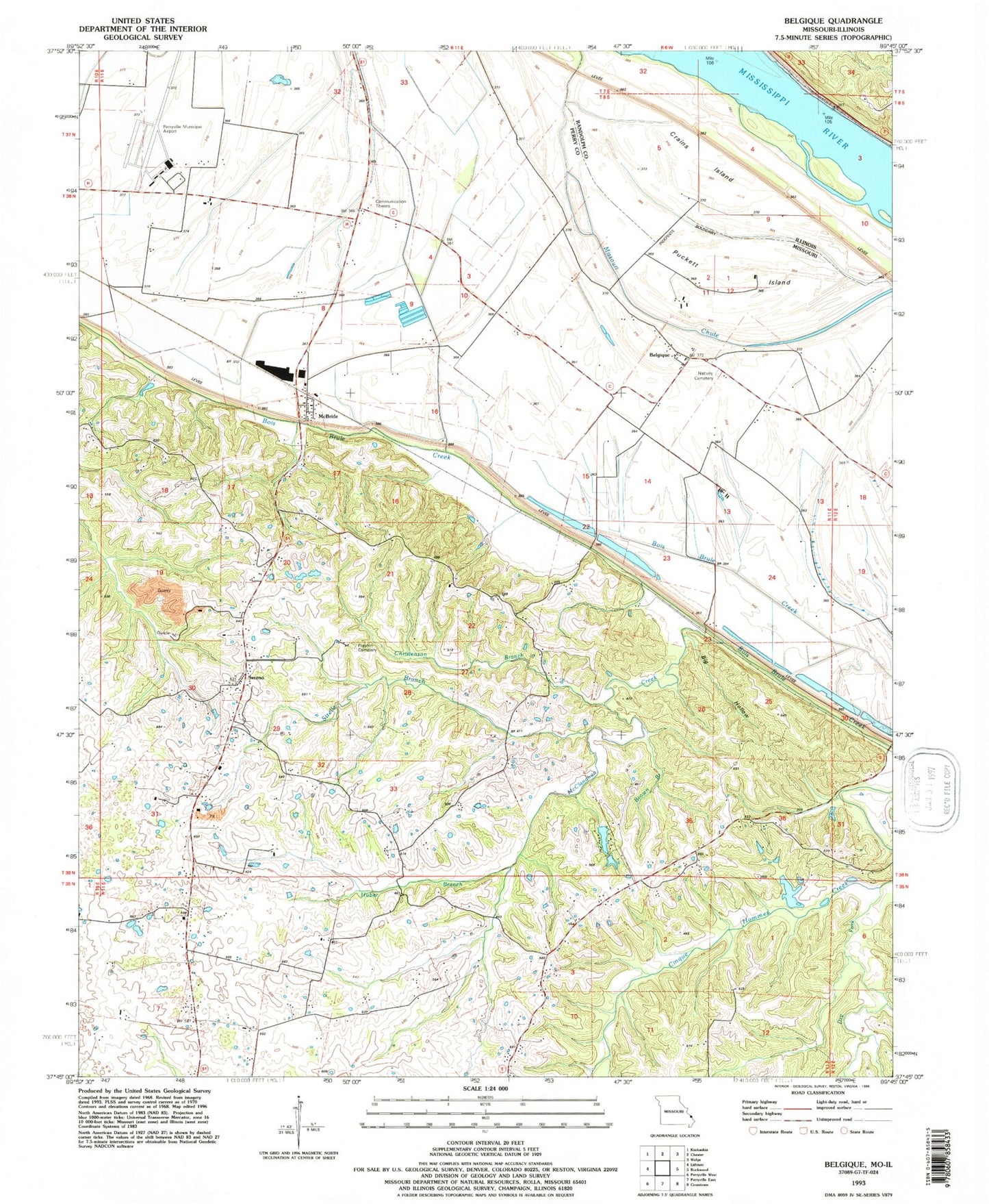
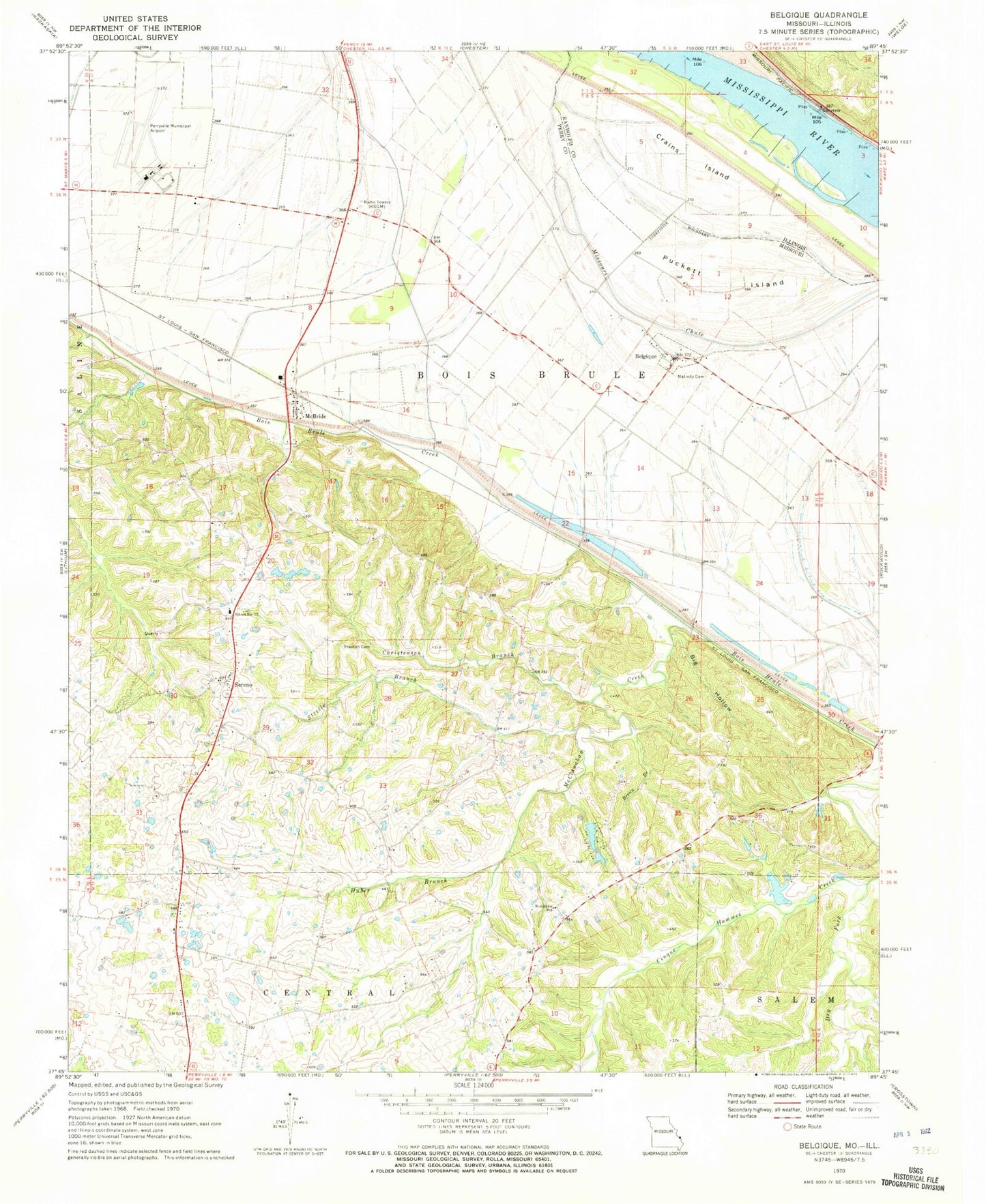
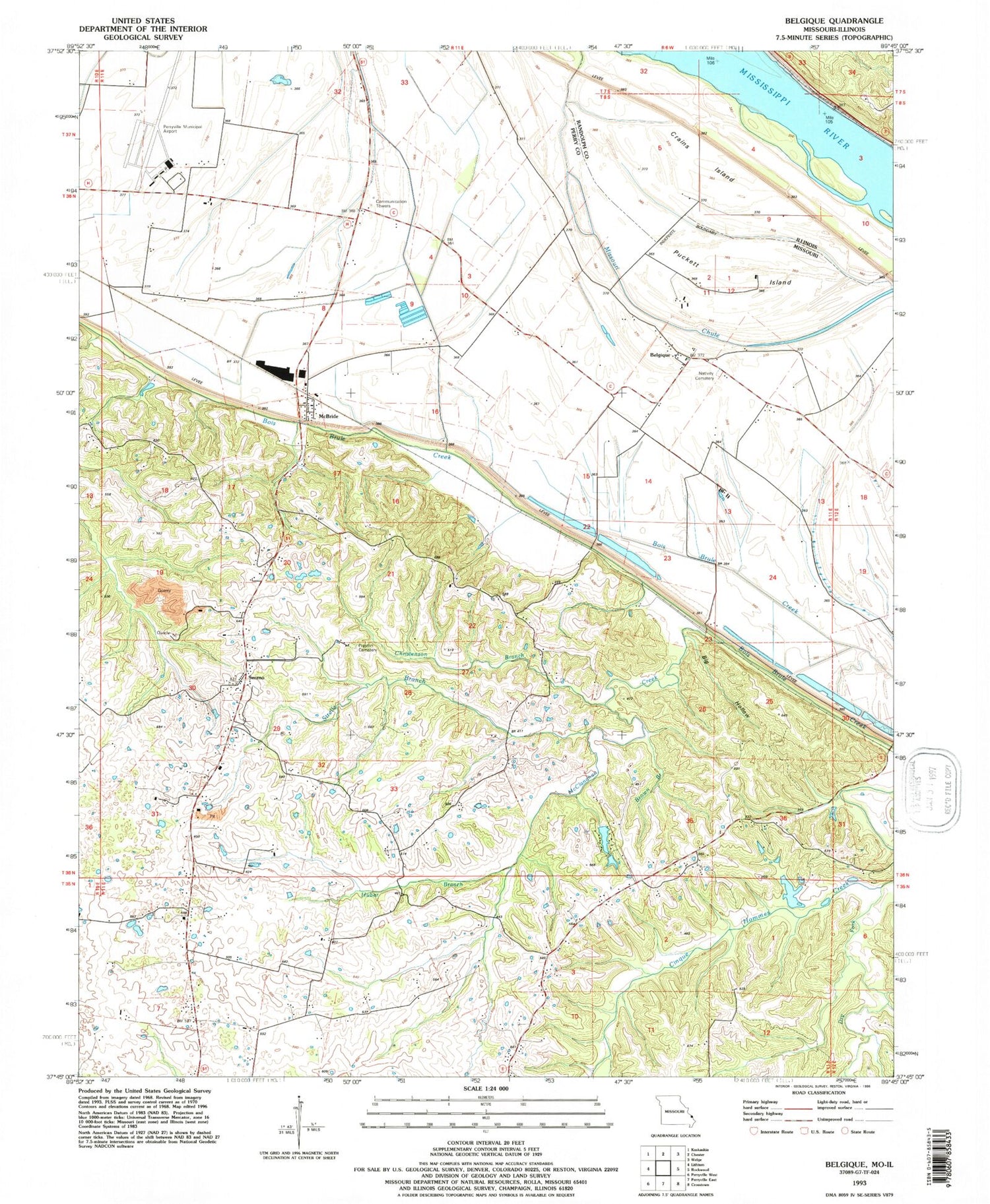
Classic USGS Belgique Missouri 7.5'x7.5' Topo Map
Couldn't load pickup availability
Historical USGS topographic quad map of Belgique in the states of Missouri, Illinois. Map scale may vary for some years, but is generally around 1:24,000. Print size is approximately 24" x 27"
This quadrangle is in the following counties: Perry, Randolph.
The map contains contour lines, roads, rivers, towns, and lakes. Printed on high-quality waterproof paper with UV fade-resistant inks, and shipped rolled.
Contains the following named places: Belgique, Big Hollow, Boxdorfer School, Brown Branch, Christisen Branch, Crains Island, Dry Fork, Hoff School, Huber Branch, Lady of Victory Church, McBride, McClanahan Creek, McClannahan Mill, Miles School, Morey School, Nativity Of The Blessed Virgin Cemetery, Perryville Regional Airport, Preston Cemetery, Puckett Island, School Number 73, Sereno, Sereno School, Streiler Branch, Township of Bois Brule, Turkey Toe Canyon Lake Dam, Twin Lakes, Twin Lakes Lower Dam