MyTopo
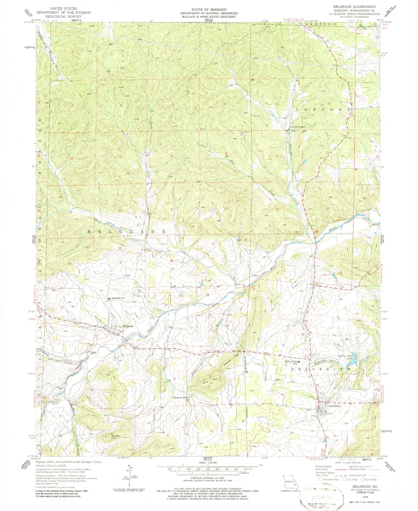
Classic USGS Belgrade Missouri 7.5'x7.5' Topo Map
Couldn't load pickup availability
Historical USGS topographic quad map of Belgrade in the state of Missouri. Map scale may vary for some years, but is generally around 1:24,000. Print size is approximately 24" x 27"
This quadrangle is in the following counties: Washington.
The map contains contour lines, roads, rivers, towns, and lakes. Printed on high-quality waterproof paper with UV fade-resistant inks, and shipped rolled.
Contains the following named places: Aker Hill, Belgrade, Belgrade Dam, Belgrade Methodist Cemetery, Belgrade Post Office, Belgrade School, Belgrade Volunteer Fire Department, Belleview Collegiate Institution, Belleview Presbyterian Church, Bellevue Presbyterian Cemetery, Bennett Bryan Cemetery, Breckenridge School, Bressie Lake Dam, Brock Creek, Bryan Gristmill, Caledonia, Caledonia Fire Protection District, Caledonia Methodist Cemetery, Caledonia Post Office, Carson Cemetery, Church of God, Clear Creek, Davis Cemetery, Dent Branch, Deslodge Land, Dry Bone Shaft, Farquaher Lead Diggings, Flat Creek, Furnace Creek, Furnace Creek Cemetery, Furnace Creek School, Hunters Mill, Hunters Mill Bridge, Jane Bryan Cemetery, Janes Creek, Jumbo Shaft, Kitchell Hill, Lake Loomis Dam, Nicholson Iron Bank, North Fork Clear Creek, Number 267 Dam, Pleasant Grove Church, Pleasant Grove School, Podorski Lake Dam, Reynolds Branch, Rieffer Lake Dam, Short-N-Ruff Airport, Sloan School, Spring Glen Lake, Spring Glen Lake Dam, Turner Hill, Valley High School, Village of Caledonia, ZIP Code: 63631