
MyTopo
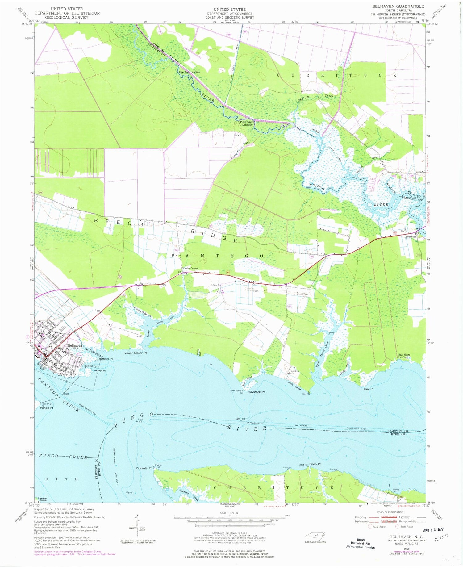
Classic USGS Belhaven North Carolina 7.5'x7.5' Topo Map
Couldn't load pickup availability
Historical USGS topographic quad map of Belhaven in the state of North Carolina. Map scale is 1:24000. Print size is approximately 24" x 27"
This quadrangle is in the following counties: Beaufort, Hyde.
The map contains contour lines, roads, rivers, towns, and lakes. Printed on high-quality waterproof paper with UV fade-resistant inks, and shipped rolled.
Contains the following named places: Arnolds Ridge, Battalina Creek, Battalina Point, Bay Point, Bay Shore Landing, Beech Ridge, Beech Ridge Pork Farm, Belhaven, Belhaven Elementary School, Belhaven Fire and Rescue Station 84, Belhaven Police Department, Bible Shore, Chinquapir Ridge, Clark Mill Creek, Cow Gut, Crooked Creek, Cutting Sedge Creek, Deep Point, Dowry Creek Marina, Durants Point, Fishing Creek, Flax Pond, Gaylords Island, Haslin Corner, Haslir School (historical), Haystack Point, Herring Run, Hoggard Temple Church of God, Hoophole Landing, J A Wilkerson High School, Knights Creek, Lawson Shore, Leechville, Lower Dowry Creek, Lower Dowry Point, Lowes Ditch, Mount Olive Church of Christ, Mount Olive Pentecostal Church, Pantego Creek, Pantego Swamp, Piney Grove Landing, Piney Grove Run, Pungo Creek, Pungo District Hospital Airport, Pungo Point, Riverside Campground Airport (historical), Saint Miller Church, Sandy Gut, Sawyers Landing, Shallop Creek, Shallop Creek School, Tooleys Creek, Tooleys Point, Town of Belhaven, Trinity United Methodist Church, Upper Dowry Creek, Vidant Pungo Hospital, Whiteplain Free Will Baptist Church


