MyTopo
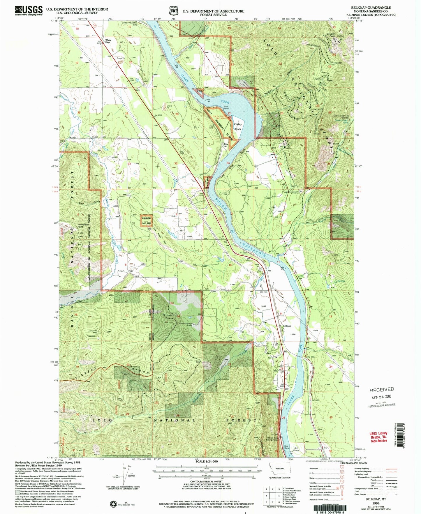
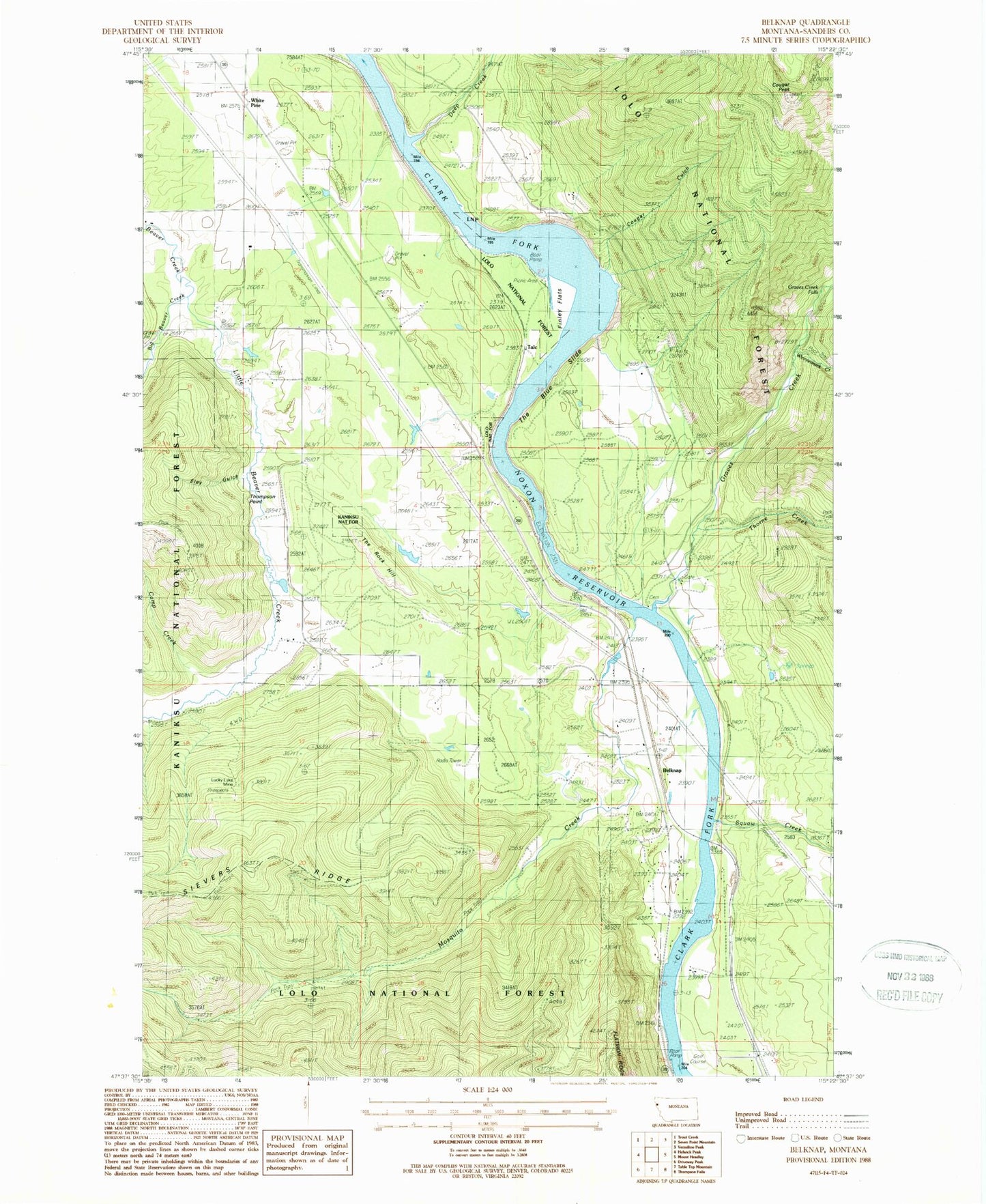
Classic USGS Belknap Montana 7.5'x7.5' Topo Map
Couldn't load pickup availability
Historical USGS topographic quad map of Belknap in the state of Montana. Map scale may vary for some years, but is generally around 1:24,000. Print size is approximately 24" x 27"
This quadrangle is in the following counties: Sanders.
The map contains contour lines, roads, rivers, towns, and lakes. Printed on high-quality waterproof paper with UV fade-resistant inks, and shipped rolled.
Contains the following named places: 22N30W23BDDA01 Well, 22N30W23DBAB01 Well, 22N30W24CCCC01 Well, 23N30W20DCCC01 Well, 23N30W20DCDC01 Well, 23N30W35DCAB01 Well, Belknap, Belknap Census Designated Place, Belknap Post Office, Belknap School, Big Beaver Creek, Blue Slide Gulch, Borax Creek Mine, Camp Creek, Cougar Gulch, Cougar Peak, Deep Creek, Eley Gulch, Enterprise Post Office, Fantom Creek, Finley Flats, Flatiron Ridge Fishing Access Site, Flatiron Ridge Recreation Site, Graves Creek, Graves Creek Falls, Kildee, Lavell, Little Beaver Creek, Littlebear Airport, Lucky Luke Mine, Marmot, Mosquito Creek, Pinehurst Ranch Airport, Shannonville, Sievers Ridge, Sqaylth-kwum Creek, Talc, The Blue Slide, The Rock Hill, Thompson Falls Golf Club, Thompson Point, Thorne Creek, White Pine, White Pine Station, Whitepine Community Methodist Church, Whitepine Post Office, Whitepine School, Winniemuck Creek